Old Maps of Hanover County, Virginia for Academic Research
Study the evolution of Hanover County with 171 high-resolution historic maps. Whether you're teaching, researching, or modeling changes in land use, these maps provide essential visual documentation of urban, environmental, and geographic change.
- Analyze long-term change: Track patterns in development, transportation, and natural features.
- Ideal for environmental or urban studies: Support academic projects with primary historical map data.
- Use in the classroom or lab: Educators and researchers rely on these maps to bring historical context to life.
These maps are a powerful tool for teaching, research, and visualizing how Hanover County has changed over the decades.
Hanover County, VA maps
(171)- 1887 Map of Spottsylvania
 1887 Spottsylvania1887 Print · USGSCentral Virginia in the late 1880s remains a landscape of river fords and crossroads shops before modern development. Genealogists and historians can trace the locations of the Vaucluse Gold Mine, Wilderness Tavern, and the path of the Narrow Gauge Railroad.
 - 1890 Map of Goochland
 1890 Goochland1890 Print · USGSGoochland and the surrounding Virginia Piedmont are captured here in the late nineteenth century as the river-and-rail economy thrived. Researchers can trace the paths of the Chesapeake and Ohio Railroad and find landmarks like Hopeful Church or the Coal Pits.
 - 1892 Map of Spottsylvania
 1892 Spottsylvania1892 Print · USGSCentral Virginia’s post-war landscape is captured here in the late nineteenth century, showing a rural economy defined by gold mining and river crossings. Genealogists can trace family footprints at Todds Tavern, the Vaucluse Gold Mine, and along the Narrow Gauge Railroad.6 unique versions available
 - 1892 Map of Goochland
 1892 Goochland1892 Print · USGSThe rural heart of central Virginia is captured here in the decade before the turn of the century, showing a landscape shaped by major rivers and early rail lines. Genealogists can trace family names and early settlements like Negro Foot, Mabelton, and the historic Hanover Academy.8 unique versions available
 - 1894 Map of Richmond
 1894 Richmond1894 Print · USGSThe Richmond area at the close of the nineteenth century reveals a city expanding into its rural surroundings via a complex network of turnpikes and railroads. Genealogists and historians can trace family-named sites like Hawes Shop, Hazelgrove's Store, and Gilman's Mill alongside civil war landmarks at Seven Pines and Old Cold Harbor.
 - 1895 Map of Richmond
 1895 Richmond1895 Print · USGSRichmond and Manchester thrive as bustling riverfront hubs in the 1890s, where rail lines and historic turnpikes converge on the James River. Genealogists and historians can trace family locations near Merry Oaks Church or follow the road to Old Cold Harbor and Seven Pines.5 unique versions available
 - 1918 Map of Doswell
 1918 Doswell1918 Print · USGSCentral Virginia during the first World War features a landscape of river-fed mills and vital rail junctions. Genealogists can locate family names at Hanover Courthouse or trace the early paths of segregated schools like Ruther Glen School (Colored) and Penola School (Colored).4 unique versions available
 - 1920 Map of King William
 1920 King William1920 Print · USGSCoastal Virginia during the late teens and early twenties reveals a landscape of river-bend settlements and tidal swamps. Researchers can trace the Pamunkey Indian Reservation, early river crossings like Piping Tree Ferry, and rail depots at Tunstall.4 unique versions available
 - 1934 Map of Seven Pines
 1934 Seven Pines1934 Print · USGSHenrico and Hanover counties are seen here in the mid-1930s, documenting a landscape where historic battlegrounds met the dawn of modern aviation. Researchers can trace the legacy of local conflict through the National Cem or locate community centers like New Bridge Ch and Highland Springs.
 - 1934 Map of Richmond
 1934 Richmond1934 Print · USGSRichmond's urban landscape is captured in the mid-1930s, showing a capital city shaped by its riverfront industry and rail network. Researchers can trace the grounds of the State Capitol, find the Broad Street Sta, and locate the Confederate Soldiers Home.2 unique versions available
 - 1936 Map of Glen Allen
 1936 Glen Allen1936 Print · USGSHenrico and Hanover counties are captured here in the mid-1930s, showing a rural landscape organized around the Chickahominy River. Genealogists and local historians can trace the foundations of Short Pump, find Deep Run Ch, or locate the Richmond Fredericksburg and Potomac Railroad corridor.2 unique versions available
 - 1938 Map of Seven Pines
 1938 Seven Pines1938 Print · USGSEastern Henrico County and Hanover County are seen here in the mid-1930s as suburban growth began to meet rural history. Genealogists and historians can trace family landmarks like the Trent House, find rural schools such as Dry Bridge Sch, and locate the early Richard E Byrd Landing Field.3 unique versions available
 - 1938 Map of Studley
 1938 Studley1938 Print · USGSHanover County's rural character is captured in the mid-1930s before the expansion of the Richmond suburbs. Genealogists can trace family landmarks and community hubs like Bethesda Ch, Studley, and the Pole Green Sch along the historic Pamunkey River corridor.3 unique versions available
 - 1938 Map of Yellow Tavern
 1938 Yellow Tavern1938 Print · USGSHanover and Henrico counties appear in the 1930s as a landscape of rural crossroads and river bottomlands. Genealogists can trace family-named landmarks and institutions like the Henry Clay Birthplace, St Josephs Villa, and the Jeb Stuart Monument.3 unique versions available
 - 1939 Map of Richmond
 1939 Richmond1939 Print · USGSRichmond before the war shows a sophisticated urban landscape defined by river power and a complex rail network. Genealogists and historians can locate numerous burial grounds like Hollywood Cemetery or trace the early streetcar path of the Richmond Ashland Electric Ry.2 unique versions available
 - 1941 Map of Glen Allen
 1941 Glen Allen1941 Print · USGSNorth of Richmond in the mid-1930s, this area shows a landscape of rural crossroads and established family farms before modern suburbanization. Genealogists and researchers can locate historic landmarks like Ground Squirrel Ch, the Coalpit Sch, and the community of Short Pump.2 unique versions available
 - 1942 Map of Partlow
 1942 Partlow1942 Print · USGSSpotsylvania County during the early years of the war remained a landscape of rural general stores and winding river crossings. Genealogists and local historians can trace family locations near Duerson Store, Wallers Church, and Partlow.2 unique versions available
 - 1942 Map of Beaverdam, 1961 Print
 1942 Beaverdam1961 Print · USGSHanover and Louisa counties were largely defined by the rail and river network of the early 1940s. Researchers can trace the layout of small crossroads communities and family-named landmarks such as Greenes Corner, Lazarus Chapel, and the Beaverdam Sch.
 - 1943 Map of Mabelton
 1943 Mabelton1943 Print · USGSHanover County during the early 1940s is shown here as a landscape of rural crossroads and river-bottom milling. Researchers can trace family sites near Helltown Store, locate St Peters Church, or find the old Taylors Creek Mill.2 unique versions available
 - 1943 Map of Hanover Academy
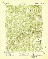 1943 Hanover Academy1943 Print · USGSMid-century Hanover County is shown here during the war years, when the rural economy still revolved around river fords and crossroads mills. Researchers can locate family landmarks like SNEEDS MILL, Hanover Academy, and the curiously named Negro Foot.2 unique versions available
 - 1943 Map of Perkinsville
 1943 Perkinsville1943 Print · USGSGoochland County at the height of the Second World War remains a landscape of rural stores and riverside rail transport. Genealogists and historians can trace the foundations of State Farm, find old community hubs like Gammons Store, or locate country parishes such as Hebron Church.2 unique versions available
 - 1943 Map of Hewlett
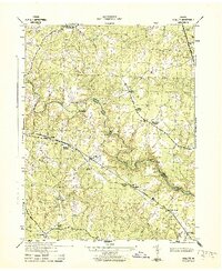 1943 Hewlett1943 Print · USGSCaroline and Hanover counties are captured here in the early 1940s, showing a rural landscape organized around the Chesapeake and Ohio rail line. Researchers can trace the heritage of local crossroads like Chilesburg or find specific landmarks such as Ottley Mill and the Mt Hewlett School.2 unique versions available
 - 1943 Map of Beaverdam
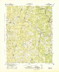 1943 Beaverdam1943 Print · USGSMid-century Hanover and Louisa counties revolve around the railroad and timber trades during the early years of the war. Genealogists and historians can trace the local hubs of Beaverdam and Bumpass, alongside rural anchors like Lazarus Chapel and Harris Store.
 - 1943 Map of Dabneys, 1961 Print
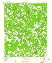 1943 Dabneys1961 Print · USGSInland Louisa County and the surrounding tri-county area are captured here during the 1940s as rural agriculture defined the landscape. Genealogists and local historians can trace scattered communities and numerous small congregations including Fork Ch, Shelfar, and Dabneys.
 - 1943 Map of Johnsons Springs, 1961 Print
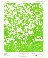 1943 Johnsons Springs1961 Print · USGSGoochland County at the height of the 1940s shows a rural Piedmont landscape of crossroads hamlets and family-named creek branches. Genealogists can trace early homesteads and community hubs like Rockville, Johnsons Springs, and the Centerville Sch.
Showing maps 1-25 of 171
Top cities of Hanover County
Frequently asked questions
- What are the different types of historical maps available for Hanover County?
- What is the oldest map of Hanover County?
- Where can I purchase historical maps of Hanover County for my home or office?
- Where can I download high-res historical maps of Hanover County?
- Are there historical topographic maps available for Hanover County?
- Is there historical aerial imagery available for Hanover County?
- Where are historical maps of Hanover County sourced from?