Old Maps of Nottoway County, Virginia for Hiking & Exploration
Hike through history with 85 historic maps of Nottoway County. Explore old trails, ghost towns, and forgotten backroads — perfect for outdoor adventurers and local explorers.
- Rediscover forgotten places: Map out old mining camps, roads, and footpaths that no longer exist on modern maps.
- Layer with modern tools: Combine with LiDAR or satellite views to plan hikes through historical terrain.
- Made for exploration: Popular among hikers, overlanders, and local history lovers.
Use these maps to find adventure and explore the hidden past of Nottoway County.
Nottoway County, VA maps
(85)- 1891 Map of Farmville
 1891 Farmville1891 Print · USGSSouth-central Virginia's rail and river networks come alive in the 1890s, centered on the bustling hub of Farmville. Genealogists can trace family roots through old courthouse seats like Cumberland C.H. and vanished stops like Jennings Ordinary or Rice Depot.
 - 1893 Map of Farmville
 1893 Farmville1893 Print · USGSThe Virginia Piedmont at the end of the nineteenth century centers on the rail junction at Farmville and the winding Appomattox River. Genealogists can trace family lands near Hampden Sidney, Guinea Mills, and the old tavern site at Joppings Ordinary.8 unique versions available
 - 1897 Map of Amelia
 1897 Amelia1897 Print · USGSThe rural interior of central Virginia comes into focus in the late nineteenth century, as the Appomattox River corridor transitions from a river-based economy to a rail-centered one. Researchers can trace ancestral property lines near Giles Mill, locate the rail hub at Mosley Junction, or find old river crossings like Goode Bridge.5 unique versions available
 - 1918 Map of Lawrenceville, 1963 Print
 1918 Lawrenceville1963 Print · USGSBrunswick and Dinwiddie Counties are shown here during the late days of the First World War, as the region's rail-and-river economy reached its peak. Genealogists can trace family roots through numerous rural landmarks like Sunnyside High School, Wheeler Mill, and Johnston Grove Church.
 - 1920 Map of Lawrenceville
 1920 Lawrenceville1920 Print · USGSBrunswick County at the height of the steam-rail era shows a landscape crisscrossed by three major rail lines and dozens of small rural communities. Genealogists can trace family connections to many churches and schools, such as Little Mount Church (Colored), Masons Mill School, and the County Poor Farm.
 - 1921 Map of Lawrenceville
 1921 Lawrenceville1921 Print · USGSBrunswick County in the years following the Great War shows a landscape defined by its bustling rail junctions and riverside mills. Genealogists and local historians can trace family-named sites like Meredithville P.O., Barrows Store, and the County Poor Farm.2 unique versions available
 - 1942 Map of Lawrenceville
 1942 Lawrenceville1942 Print · USGSBrunswick County at the start of the 1940s is defined by its busy rail junctions and a landscape of small rural schoolhouses. Trace the origins of local families near Lawrenceville or find old community centers like Charlie Hope and Price Mill.
 - 1943 Map of Richmond, 1972 Print
 1943 Richmond1972 Print · USGSCoastal Virginia and the state capital are shown in detail during the mid-century era of infrastructure expansion. Genealogists and historians can trace the grounds of Richmond Nat Battlefield Park, locate the Yorktown Nat Cem, or follow the many rural routes through Amelia Court House and Tappahannock.
 - 1947 Map of Roanoke, 1948 Print
 1947 Roanoke1948 Print · USGSCentral Virginia in the late 1940s reveals a region defined by its great mountain ridges and the powerful river-and-rail economy connecting Roanoke to Lynchburg. Researchers can trace the path of the Virginian RR and locate historic county seats like Charlotte Court House.2 unique versions available
 - 1949 Map of Richmond, 1951 Print
 1949 Richmond1951 Print · USGSCoastal Virginia in the years following World War II remained a landscape of historic river towns and expanding military bases. Genealogists and historians can trace the rail lines of the Southern Ry and locate established landmarks from Camp Lee to the remote reaches of Dragon Swamp.
 - 1950 Map of Wellville
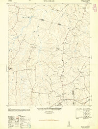 1950 Wellville1950 Print · USGSThe rural intersection of Nottoway, Amelia, and Dinwiddie Counties comes alive in this post-war survey. Genealogists can trace family connections through a network of country stores and churches like Simpsons Store, Rocky Hill Church, and Jerusalem School.2 unique versions available
 - 1950 Map of Hebron
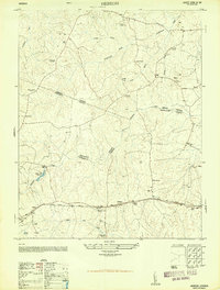 1950 Hebron1950 Print · USGSDinwiddie and Nottoway counties are shown here at mid-century, where rural life revolved around the railroad and community schools. Genealogists can trace family roots at Salem Cemetery or locate landmarks like King David Lodge Hall and the Mission Light School.2 unique versions available
 - 1951 Map of Danieltown, 1952 Print
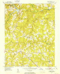 1951 Danieltown1952 Print · USGSMid-century Brunswick County is captured here during a time of rural stability, characterized by the Virginian rail line and family-run crossroads. Researchers can trace ancestral locations through the many named sites like Warrens Store, Rocky Run Church, and Stainback Cem.4 unique versions available
 - 1953 Map of Norfolk, 1954 Print
 1953 Norfolk1954 Print · USGSCoastal Virginia and northeastern North Carolina appear here during the post-war industrial boom, showing the critical rail-and-sea connections of Hampton Roads. Genealogists can trace family roots through rural landmarks like Gethsemane Ch, the Caledonia State Prison Farm, and the vast interior of the Dismal Swamp.4 unique versions available
 - 1958 Map of Jetersville, 1959 Print
 1958 Jetersville1959 Print · USGSAmelia and Cumberland counties in the late 1950s show a landscape of traditional mills and rail-side settlements along the Appomattox River. Genealogists can trace family connections at Clarke Cem or study community hubs like Paineveille Sch and Hobsons Chapel.2 unique versions available
 - 1958 Map of Crewe, 1959 Print
 1958 Crewe1959 Print · USGSNottoway County thrived as a railroad crossroads in the late fifties, centered on the busy rail hubs of Crewe and Burkeville. Researchers can trace old family sites and rural landmarks like the Piedmont Sanatorium, Jennings Ordinary, and Wards Chapel.2 unique versions available
 - 1959 Map of Roanoke
 1959 Roanoke1959 Print · USGSCentral Virginia and the Blue Ridge appear in great detail during the late fifties, showcasing the transition from mountain industry to Piedmont farmland. Trace the path of the Norfolk and Western railroad or find old river towns like Appomattox and Amelia Court House.
 - 1959 Map of Richmond
 1959 Richmond1959 Print · USGSMid-century Virginia is captured here at its most vital rail and river junctions, from the capital city to the Chesapeake Bay. Genealogists and historians can trace the development of colonial settlements like Williamsburg and military landmarks including Fort Monroe and Camp Lee.
 - 1963 Map of Roanoke
 1963 Roanoke1963 Print · USGSCentral Virginia and the Blue Ridge front appear here in the early sixties, caught between their deep railroad roots and new postwar developments. Genealogists and historians can trace the rail lines of the Norfolk and Western through towns like Bedford and Altavista, or locate family landmarks near Smith Mountain Lake.
 - 1964 Map of Richmond
 1964 Richmond1964 Print · USGSCoastal and central Virginia are mapped during the mid-twentieth century, showing the critical intersection of rail, river, and military life. Genealogists can trace family roots through rural county seats like Amelia or find vanished coastal neighborhoods near Phoebus and Hilton Village.
 - 1964 Map of Hebron, 1966 Print
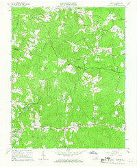 1964 Hebron1966 Print · USGSThe rural borderlands of Dinwiddie, Amelia, and Nottoway counties are shown here in the mid-1960s, centered on the railroad corridor and scattered farming hamlets. Family researchers can locate numerous burial sites and landmarks like Hebron, Hobbs Mill, and the King David Lodge Hall.4 unique versions available
 - 1966 Map of Blackstone East, 1967 Print
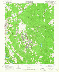 1966 Blackstone East1967 Print · USGSNottoway County during the mid-sixties is captured here, showing the expansion of military training facilities alongside traditional rural life. Genealogists and historians can trace the foundations of Blackstone Army Air Base and locate local landmarks like Spring Hill Ch and the Nottoway Reservoir.5 unique versions available
 - 1966 Map of Wellville, 1967 Print
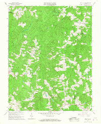 1966 Wellville1967 Print · USGSNottoway County in the mid-sixties remained a landscape of rural commerce and deep-rooted congregations. Researchers can find traditional family-named crossroads like Simonsons Store and trace the Norfolk and Western line through Wellville.3 unique versions available
 - 1968 Map of Deatonville, 1971 Print
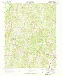 1968 Deatonville1971 Print · USGSAmelia and Prince Edward counties are captured here in the late sixties, showing a landscape defined by the Appomattox River. You can trace the grounds of Saylers Creek Battlefield State Park and locate historic community centers like Deatonville and Gravel Hill Ch.2 unique versions available
 - 1968 Map of Blackstone West, 1972 Print
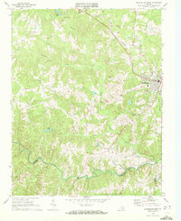 1968 Blackstone West1972 Print · USGSBlackstone and the Southside Virginia countryside appear here in the late sixties, a period of transition for the rail-and-river landscape. Genealogists and historians can trace old community landmarks like Vaster High Sch, Lakeview Cemetery, and the Norfolk and Western rail line.3 unique versions available
Showing maps 1-25 of 85
Top cities of Nottoway County
Frequently asked questions
- What are the different types of historical maps available for Nottoway County?
- What is the oldest map of Nottoway County?
- Where can I purchase historical maps of Nottoway County for my home or office?
- Where can I download high-res historical maps of Nottoway County?
- Are there historical topographic maps available for Nottoway County?
- Is there historical aerial imagery available for Nottoway County?
- Where are historical maps of Nottoway County sourced from?