Old Maps of Kibler, Virginia for Metal Detecting
Plan your next treasure hunt with 12 historic maps of Kibler. Find old homesites, ghost towns, trails, and gathering spots that may be lost to time — perfect for identifying promising metal detecting locations.
- Locate forgotten sites: Uncover places like long-lost settlements, abandoned rail lines, or gathering spots.
- Plan better hunts: Use map overlays combined with LiDAR or satellite views to narrow in on historically rich areas.
- Made for detectorists: Thousands of hobbyists use these maps to discover relics, coins, and hidden history.
Use these historic maps to boost your research and find new opportunities beneath the surface of Kibler.
Kibler, VA maps
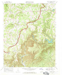
(12)- 1928 Map of Stuart
 1928 Stuart1928 Print · USGSThe Blue Ridge foothills of the late twenties are captured here as a network of mountain settlements and river-powered industry. Genealogists can trace family roots through numerous country landmarks like Greaseys Chapel, Stonewall Jackson School, and Carters Mill.2 unique versions available
 - 1931 Map of Stuart
 1931 Stuart1931 Print · USGSThe Blue Ridge plateau meets the Piedmont in the late 1920s, showing a landscape of mountain farming and river-driven milling. Genealogists can trace family roots through numerous local landmarks like Meadows of Dan, Stonewall Jackson Sch, and Three Forks Mill.3 unique versions available
 - 1953 Map of Winston-Salem, 1974 Print
 1953 Winston-Salem1974 Print · USGSThe North Carolina Piedmont and Virginia highlands meet in the mid-1950s, a landscape defined by the tobacco and textile hubs of the Blue Ridge foothills. Researchers can trace the rail-and-river geography connecting Winston-Salem to mountain towns like Mount Airy and Galax.2 unique versions available
 - 1955 Map of Winston-Salem
 1955 Winston-Salem1955 Print · USGSThe Central Blue Ridge and Piedmont transition are captured here in the mid-fifties, from the industrial hub of Winston-Salem to the high peaks of Southwest Virginia. Genealogists can trace family landmarks like Richmond Hill Ch, Siloam Ch, and the old rail stops along the Southern Railway.
 - 1962 Map of Winston-Salem
 1962 Winston-Salem1962 Print · USGSThe North Carolina Piedmont meets the Virginia highlands in the early sixties, showing the rail corridors and mountain gaps of the southern Appalachians. Researchers can trace the Blue Ridge Parkway or locate family sites near Winston-Salem, Mount Airy, and Hanging Rock Mountain.
 - 1968 Map of Meadows of Dan, 1971 Print
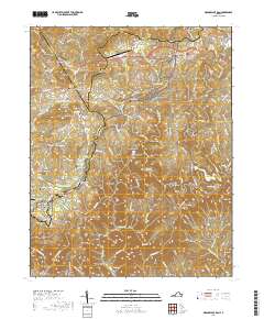
 1968 Meadows of Dan1971 Print · USGSThe Blue Ridge highlands at the end of the 1960s reveal a mix of early industry and modern infrastructure. Genealogists and historians can trace family roots through sites like Mabry Mill, New Bell Spur Ch, and the high-elevation Meadows of Dan.3 unique versions available
 - 1986 Map of Galax
 1986 Galax1986 Print · USGSThe Virginia and North Carolina borderlands are captured here in the mid-1980s as the region balanced mountain agriculture with new recreational tourism. Researchers can locate remote family landmarks and rural institutions, from Ferrum Jr College and Siloam Ch to the Pinnacles Powerplant and Archies Mill.2 unique versions available
 - 2011 Map of Meadows of Dan, 2011 Print
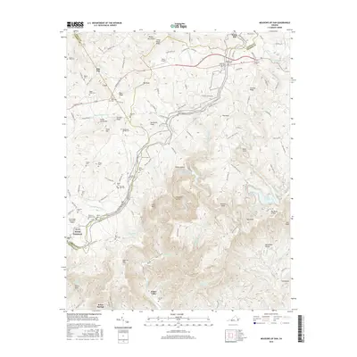
 2011 Meadows of Dan2011 Print · USGSCovers Kibler, including Pike City, Meadows of Dan, and other nearby areas
 - 2013 Map of Meadows of Dan, 2013 Print
 2013 Meadows of Dan2013 Print · USGSCovers Kibler, including Pike City, Meadows of Dan, and other nearby areas
 - 2016 Map of Meadows of Dan, 2016 Print
 2016 Meadows of Dan2016 Print · USGSCovers Kibler, including Pike City, Meadows of Dan, and other nearby areas
 - 2019 Map of Meadows of Dan, 2019 Print
 2019 Meadows of Dan2019 Print · USGSCovers Kibler, including Pike City, Meadows of Dan, and other nearby areas
 - 2022 Map of Meadows of Dan, 2022 Print
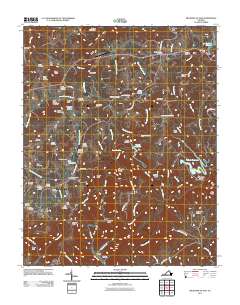
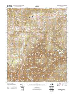
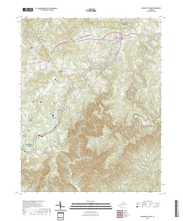 2022 Meadows of Dan2022 Print · USGSHigh atop the Blue Ridge in the early 2020s, this area maintains its character as a landscape of small family homesteads and mountain churches. Genealogists can trace family lines through the James Bowman Cem, Stanley Cem, and Mayberry Presbyterian Church Cem.
End of results
Showing maps 1-12 of 12
Top cities near Kibler
Frequently asked questions
- What are the different types of historical maps available for Kibler?
- What is the oldest map of Kibler?
- Where can I purchase historical maps of Kibler for my home or office?
- Where can I download high-res historical maps of Kibler?
- Are there historical topographic maps available for Kibler?
- Is there historical aerial imagery available for Kibler?
- Where are historical maps of Kibler sourced from?