1960s Maps of Rockbridge County, Virginia
Explore 20 historic maps of Rockbridge County from the 1960s. These maps offer a rare glimpse into what life looked like during the 1960s — showing old roads, neighborhoods, homes, and landmarks that have changed or disappeared over time.
Whether you're researching your family's past, planning a metal detecting trip, or studying how Rockbridge County's landscape evolved across the 1960s, these high-resolution maps are a powerful tool for exploring the history of this region.
- Focus on a specific era: All maps on this page are from the 1960s, giving you a focused view of this time period.
- See what’s changed: Compare century-old streets, trails, and buildings to today's modern landscape using overlays and satellite layers.
- Research with precision: Use these maps for genealogy, historical research, land use analysis, or educational projects.
- View, download, or print: Maps are fully viewable online in high resolution, and can be downloaded or printed for your own records.
Start exploring Rockbridge County's history through authentic maps from the 1960s. This is your window into the past.
Rockbridge County, VA maps
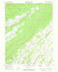
(20)- 1961 Map of Arnold Valley, 1963 Print
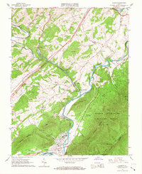
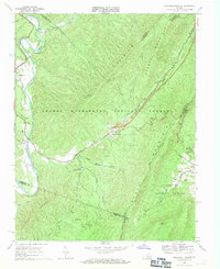
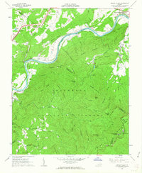 1961 Arnold Valley1963 Print · USGSBotetourt and Rockbridge counties are shown here in the early sixties as industrial rail lines follow the bends of the James River. Genealogists and historians can locate old landmarks like the Glenwood Furnace (Ruins), Bedford Air Force Station, and High Bridge Cem.3 unique versions available
 - 1961 Map of Natural Bridge, 1963 Print
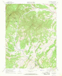
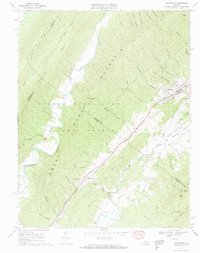
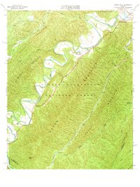
 1961 Natural Bridge1963 Print · USGSRockbridge County's agricultural and forest lands are captured in the early sixties, centered on the Natural Bridge area. Genealogists can locate family landmarks like Miller Cem, Oakdale Ch, and the small settlement at Fancy Hill.2 unique versions available
 - 1962 Map of Sugarloaf Mtn, 1963 Print
 1962 Sugarloaf Mtn1963 Print · USGSThe Botetourt and Rockbridge county line was a landscape of iron furnaces and mountain chapels in the early 1960s. Genealogists and historians can locate Jane Furnace (Ruins), Rapps Mill, and family burial sites like Deacons Cem.4 unique versions available
 - 1963 Map of Roanoke
 1963 Roanoke1963 Print · USGSCentral Virginia and the Blue Ridge front appear here in the early sixties, caught between their deep railroad roots and new postwar developments. Genealogists and historians can trace the rail lines of the Norfolk and Western through towns like Bedford and Altavista, or locate family landmarks near Smith Mountain Lake.
 - 1965 Map of Buena Vista, 1967 Print
 1965 Buena Vista1967 Print · USGSThe industrial river valley and the high Blue Ridge meet in the mid-sixties around Buena Vista. Researchers can trace the Appalachian Trail across Humphreys Gap or locate family roots near Oronoco and the Southern Seminary Jr College campus.7 unique versions available
 - 1965 Map of Glasgow, 1967 Print
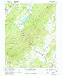
 1965 Glasgow1967 Print · USGSThe confluence of the Maury and James Rivers comes alive in the mid-1960s, showing a landscape defined by heavy rail and mountain wilderness. Genealogists and historians can trace family sites like Mt Lidia Cem and Poplar Hill Ch, or locate the industrial works at Buffalo Forge Station.2 unique versions available
 - 1965 Map of Montebello, 1967 Print
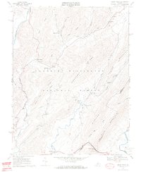
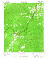 1965 Montebello1967 Print · USGSThe high ridges of Rockbridge and Nelson counties come alive in the mid-sixties as the winding Blue Ridge Parkway meets the Appalachian Trail. Genealogists can locate family landmarks like Grant Cem and the Irish Creek settlement, or trace the remote Wiggins Spring Shelter and Fish Hatchery.4 unique versions available
 - 1965 Map of Vesuvius, 1967 Print
 1965 Vesuvius1967 Print · USGSThe Shenandoah Valley meets the Blue Ridge in the mid-sixties, showing a landscape defined by rail-side settlements and mountain gaps. Genealogists can locate family landmarks like Old Providence Ch, Spottswood Sch, and the State Prison Camp No 10.3 unique versions available
 - 1966 Map of Snowden, 1979 Print
 1966 Snowden1979 Print · USGSThe James River gap and the Blue Ridge heights dominate this Virginia survey as they appeared in the 1960s. Researchers can trace the path of the Appalachian Trail, locate country churches like Sharon Ch, or study the rail corridor through Natural Bridge Station.2 unique versions available
 - 1967 Map of Augusta Springs, 1968 Print
 1967 Augusta Springs1968 Print · USGSAugusta County’s valley floor and mountain ridges are documented here in the late sixties, showing the vital link of the Chesapeake and Ohio railroad. Trace local industry and community life through the Estaline Furnace (Ruins), Miller Memorial Ch, and the settlement at Augusta Springs.3 unique versions available
 - 1967 Map of Collierstown, 1969 Print
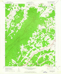
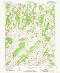
 1967 Collierstown1969 Print · USGSRockbridge County's rural valleys and ridges appear in detail during the late sixties, as agricultural patterns remained visible across the terrain. Trace local family roots at the Hartbarger Cem or explore established communities like Collierstown and Denmark.3 unique versions available
 - 1967 Map of Cornwall, 1969 Print
 1967 Cornwall1969 Print · USGSRockbridge County's mountain settlements and forest gaps are frozen in time during the late sixties as the South River valley develops. Genealogists can locate family landmarks like Paxton Hill, Riverside Ch, and the high Clarks Mountain Cem.3 unique versions available
 - 1967 Map of Brownsburg, 1969 Print
 1967 Brownsburg1969 Print · USGSRockbridge County and the southern edge of Augusta County are shown here in the late 1960s, centered on the historic mill towns of the Shenandoah Valley. Genealogists and historians can trace the foundations of Brownsburg, locate family-named sites like Lunsford Hill, and identify early landmarks such as Wades Mill or the McElwee Chapel Cem.2 unique versions available
 - 1967 Map of Craigsville, 1969 Print
 1967 Craigsville1969 Print · USGSAugusta and Rockbridge counties are shown in the late sixties, where the Chesapeake and Ohio railway follows the narrow valley floors. Genealogists and historians can locate the Drive-in Theater, several Quarry sites, and country churches like Lebanon Ch and Little River Ch.2 unique versions available
 - 1967 Map of Lexington, 1969 Print
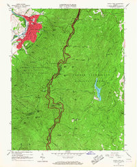
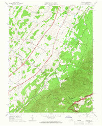
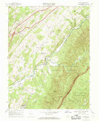
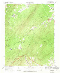
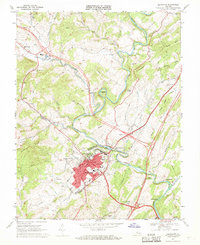 1967 Lexington1969 Print · USGSLexington and its collegiate campuses are captured in detail during the late sixties, showing the city's growth alongside its deep-rooted history. Researchers can trace local landmarks like Stonewall Jackson Hospital, the C & O rail lines, and Highland Belle Sch.4 unique versions available
 - 1967 Map of Goshen, 1979 Print
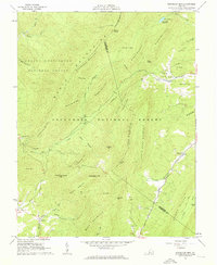
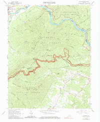
 1967 Goshen1979 Print · USGSRockbridge County's mountain passes and river valleys are captured here in the late sixties, just as recreational camps expanded around Lake Merriweather. Researchers can locate historic rural centers like Rockbridge Baths, Cedar Grove, and Bethesda Ch.3 unique versions available
 - 1969 Map of Green Valley, 1970 Print
 1969 Green Valley1970 Print · USGSBath County's mountain gaps and river valleys are shown here in the late sixties as the region maintained its rural character. Genealogists can locate family landmarks like McCowan Spring, Cloverdale Ch, and the small settlement of Armstrong.5 unique versions available
 - 1969 Map of Longdale Furnace, 1971 Print
 1969 Longdale Furnace1971 Print · USGSAlleghany County in the late sixties reveals a landscape shaped by mountain industry and the winding Cowpasture River. Genealogists can locate family landmarks like Lone Star Ch, Sharon Sch, and the historical site of Longdale Furnace.3 unique versions available
 - 1969 Map of Nimrod Hall, 1971 Print
 1969 Nimrod Hall1971 Print · USGSBath County's rugged ridge-and-valley landscape is documented here during the late 1960s as the river-and-rail economy shaped local life. Researchers can trace the path of the Chesapeake and Ohio through the Mason Tunnel or locate ancestral sites like Indian Hill Ch and Nimrod Hall.2 unique versions available
 - 1969 Map of Millboro, 1971 Print
 1969 Millboro1971 Print · USGSVirginia's mountain gaps and railroad corridors are captured here in the late sixties, showing the rugged divide between Bath and Rockbridge counties. Researchers can trace historic sites like Rockbridge Alum Springs, the Millboro Tunnel, and the remote community of California.3 unique versions available
End of results
Showing maps 1-20 of 20
Top cities of Rockbridge County
Frequently asked questions
- What are the different types of historical maps available for Rockbridge County?
- What is the oldest map of Rockbridge County?
- Where can I purchase historical maps of Rockbridge County for my home or office?
- Where can I download high-res historical maps of Rockbridge County?
- Are there historical topographic maps available for Rockbridge County?
- Is there historical aerial imagery available for Rockbridge County?
- Where are historical maps of Rockbridge County sourced from?