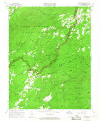
1965 Map of Montebello
USGS Topo · Published 1967About this map
Montebello and the surrounding high country of the George Washington National Forest define this 1965 survey, where the borders of Rockbridge, Nelson, and Amherst counties converge. The high-elevation landscape is bisected by the Blue Ridge Parkway, which winds along the crest through Irish Gap and past the Yankee Horse Ridge overlooks. Local history is anchored by the settlement of Irish Creek, featuring the Irish Creek Cem and a nearby mine, reflecting a period when small mountain communities remained largely intact alongside federally managed lands.
Find a feature on this map
64 named features on this map. Tap any name to fly to it.
Don’t see what you’re looking for? This feature index may not catch every label — zoom into the map to look around manually.
Map Details
Editions of this 1965 Montebello Map
4 editions found
Other maps of this area

1894 · Lexington
USGS Topo · 1:125,000

1932 · Lexington
USGS Topo · 1:48,000

1935 · Buena Vista
USGS Topo · 1:48,000

1935 · Amherst
USGS Topo · 1:48,000

1936 · Vesuvius
USGS Topo · 1:48,000

1937 · Lexington
USGS Topo · 1:62,500

1939 · Amherst
USGS Topo · 1:62,500

1939 · Buena Vista
USGS Topo · 1:62,500

1940 · Buena Vista
USGS Topo · 1:62,500

1941 · Vesuvius
USGS Topo · 1:62,500