1960s Maps of Shenandoah County, Virginia
Explore 21 historic maps of Shenandoah County from the 1960s. These maps offer a rare glimpse into what life looked like during the 1960s — showing old roads, neighborhoods, homes, and landmarks that have changed or disappeared over time.
Whether you're researching your family's past, planning a metal detecting trip, or studying how Shenandoah County's landscape evolved across the 1960s, these high-resolution maps are a powerful tool for exploring the history of this region.
- Focus on a specific era: All maps on this page are from the 1960s, giving you a focused view of this time period.
- See what’s changed: Compare century-old streets, trails, and buildings to today's modern landscape using overlays and satellite layers.
- Research with precision: Use these maps for genealogy, historical research, land use analysis, or educational projects.
- View, download, or print: Maps are fully viewable online in high resolution, and can be downloaded or printed for your own records.
Start exploring Shenandoah County's history through authentic maps from the 1960s. This is your window into the past.
Shenandoah County, VA maps
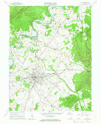
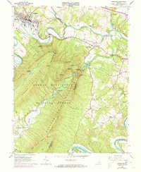
(21)- 1961 Map of Cumberland
 1961 Cumberland1961 Print · USGSThe tri-state highlands of Maryland, West Virginia, and Pennsylvania are shown in the mid-twentieth century as a complex landscape of ridges and river valleys. Researchers can trace the winding Potomac River and find old rail-and-river towns like Cumberland, Keyser, and Morgantown.
 - 1962 Map of Cumberland
 1962 Cumberland1962 Print · USGSThe central Appalachians meet at the height of the mid-century industrial era, showing the rugged topography between Morgantown and Winchester. Genealogists can trace family lands near Fort Necessity or along the vital Baltimore & Ohio RR corridors.
 - 1965 Map of Luray, 1966 Print
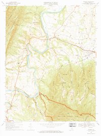
 1965 Luray1966 Print · USGSPage County in the mid-sixties is captured here between the heights of the Blue Ridge and the Massanutten range. Genealogists and local historians can trace the valley's settlement patterns through numerous rural landmarks like Beahms Chapel, Antioch Ch, and the streets of Luray.3 unique versions available
 - 1965 Map of Wardensville, 1967 Print
 1965 Wardensville1967 Print · USGSWardensville and the surrounding mountain ridges come into focus in the mid-sixties, illustrating the deep ties between the valley floor and the high forest. Local historians can trace the sites of the Old Iron Furnace, the Clagett Cem, and Marvin Chapel.3 unique versions available
 - 1965 Map of Mountain Falls, 1968 Print
 1965 Mountain Falls1968 Print · USGSThe Virginia and West Virginia borderlands in the mid-1960s reveal a landscape of mountain ridges and secluded valley settlements. Genealogists and historians can trace family locations through landmarks like Star Tannery, Gravel Springs Cem, and the Mineral Mine.3 unique versions available
 - 1966 Map of Bentonville, 1968 Print
 1966 Bentonville1968 Print · USGSThe Shenandoah River valley at the mid-century reveals a landscape framed by national parks and the river's great loops. Genealogists and hikers can trace the original paths of the Appalachian Trail near Bentonville, find old riverside communities like Overall, and locate rural landmarks such as Mt Carmel Ch.4 unique versions available
 - 1966 Map of Edinburg, 1968 Print
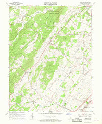
 1966 Edinburg1968 Print · USGSMid-century Shenandoah Valley life is centered here on the winding river and the busy mountain gaps during the 1960s. Genealogists and historians can trace family roots through Cedarwood Cem, Hawkinstown, and local landmarks like Union Forge Ch.3 unique versions available
 - 1966 Map of Toms Brook, 1968 Print
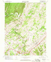
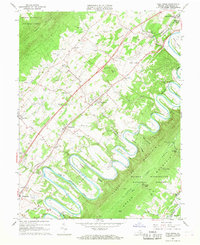 1966 Toms Brook1968 Print · USGSShenandoah Valley life in the mid-sixties is captured here as the river loops around Seven Bends while the new interstate begins to change local transit. Genealogists can locate family landmarks like the Keller Cem, Emmanuel Ch, and the site of the County Home.4 unique versions available
 - 1966 Map of Woodstock, 1968 Print
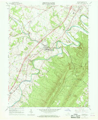
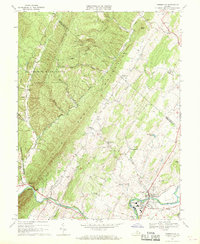
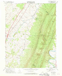
 1966 Woodstock1968 Print · USGSShenandoah County life in the mid-1960s centered on the hub of Woodstock and the industrial vestiges of the valley's iron era. Genealogists and historians can trace the foundations of Columbia Furnace, locate Massanutten Military Academy, and find family landmarks like Coffmantown and Cedar Creek Ch.2 unique versions available
 - 1966 Map of Lost City, 1968 Print
 1966 Lost City1968 Print · USGSThe valleys of Hardy County are shown here in the mid-sixties as the rural communities of Lost City and Mathias remained centered on the river forks. Researchers can trace ancestral locations through several small cemeteries and country churches like Holly Hill Church and New Dale Ch.2 unique versions available
 - 1966 Map of Conicville, 1968 Print
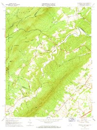
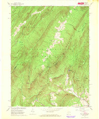
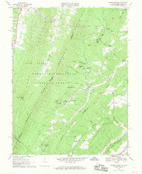
 1966 Conicville1968 Print · USGSShenandoah County in the mid-sixties reveals a landscape of ridge-and-valley settlements and early industrial sites. Genealogists can trace family roots through markers like Otterbein Chapel, the Old Iron Furnace, and the Confederate Unknown Memorial Cem.3 unique versions available
 - 1966 Map of Middletown, 1968 Print
 1966 Middletown1968 Print · USGSMiddletown and the surrounding Shenandoah Valley are captured in the mid-1960s, showing a landscape defined by Civil War history and rural industry. Researchers can trace ancestral sites like Quaker Cem, the ruins of Nieswander's Fort, and landmarks such as Monroe College.3 unique versions available
 - 1966 Map of Wolf Gap, 1968 Print
 1966 Wolf Gap1968 Print · USGSThe borderlands of West Virginia and Virginia are captured here in the mid-sixties, where the legacy of early iron works meets modern forest recreation. Genealogists and historians can trace the foundations of Liberty Furnace, the remote Mt Vernon Ch, and the winding Old Railroad Grade.3 unique versions available
 - 1966 Map of Rileyville, 1968 Print
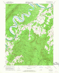
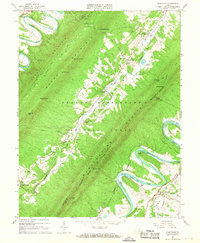 1966 Rileyville1968 Print · USGSThe Shenandoah Valley during the mid-sixties reveals a landscape of ridge-top lookouts and river-bottom agriculture. Researchers can locate family landmarks like Fosters Landing, Saint Davids Church, and the Norfolk and Western rail line.4 unique versions available
 - 1966 Map of Strasburg, 1973 Print
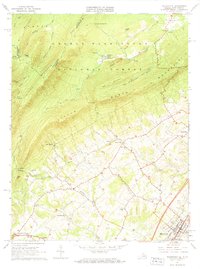
 1966 Strasburg1973 Print · USGSThe Shenandoah Valley during the mid-1960s shows a mix of mountain wilderness and riverside rail hubs. Trace local history through the Elizabeth Furnace Recreational Area ruins, the Otterburn Sch, and established crossroads like Waterlick and Buckton.2 unique versions available
 - 1967 Map of New Market, 1968 Print
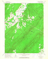
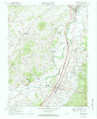 1967 New Market1968 Print · USGSShenandoah Valley life in the mid-1960s centers on the river and rail corridors of Mt Jackson and New Market. Genealogists can trace family roots through numerous landmarks like Triplett Institute, Plains Mill, and Solomons Ch.3 unique versions available
 - 1967 Map of Stanley, 1969 Print
 1967 Stanley1969 Print · USGSPage County is documented in the late sixties as the river-and-rail economy of the Page Valley thrived. Genealogists and local historians can trace family locations near Alma, St Lukes Ch, and the old Grove Hill Landing on the river.2 unique versions available
 - 1967 Map of Timberville, 1969 Print
 1967 Timberville1969 Print · USGSRockingham and Shenandoah counties are captured in the late sixties as traditional valley life met mid-century industrial growth. Researchers can locate family landmarks like Moores Store, Cootes Store, and several rural houses of worship including Bethel Ch.3 unique versions available
 - 1967 Map of Hamburg, 1969 Print
 1967 Hamburg1969 Print · USGSThe river valley and mountain ridges of Page County come into focus during the late sixties. Genealogists and researchers can trace the historic river landings and rural churches including Whitehouse Landing, Woods Chapel, and the Mill Creek Ch.3 unique versions available
 - 1967 Map of Orkney Springs, 1969 Print
 1967 Orkney Springs1969 Print · USGSThe Shenandoah mountains during the late 1960s reveal a landscape of deep-rooted resort history and rural church communities. Researchers can locate remote settlements and mountain chapels like Orkney Springs, Mt Hermon Ch, and Bird Haven.3 unique versions available
 - 1967 Map of Tenth Legion, 1970 Print
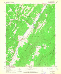
 1967 Tenth Legion1970 Print · USGSThe Shenandoah Valley and the formidable slopes of Massanutten Mountain are frozen in time here during the late sixties. Genealogists and local historians can trace small communities like Arkton and Athlone or locate the Bethlehem Ch and various family cemeteries.2 unique versions available
End of results
Showing maps 1-21 of 21
Top cities of Shenandoah County
- Strasburg historical maps
- Woodstock historical maps
- New Market historical maps
- Mount Jackson historical maps
- Basye historical maps
- Edinburg historical maps
See more
Frequently asked questions
- What are the different types of historical maps available for Shenandoah County?
- What is the oldest map of Shenandoah County?
- Where can I purchase historical maps of Shenandoah County for my home or office?
- Where can I download high-res historical maps of Shenandoah County?
- Are there historical topographic maps available for Shenandoah County?
- Is there historical aerial imagery available for Shenandoah County?
- Where are historical maps of Shenandoah County sourced from?