Old Maps of Shenandoah County, Virginia for Hiking & Exploration
Hike through history with 97 historic maps of Shenandoah County. Explore old trails, ghost towns, and forgotten backroads — perfect for outdoor adventurers and local explorers.
- Rediscover forgotten places: Map out old mining camps, roads, and footpaths that no longer exist on modern maps.
- Layer with modern tools: Combine with LiDAR or satellite views to plan hikes through historical terrain.
- Made for exploration: Popular among hikers, overlanders, and local history lovers.
Use these maps to find adventure and explore the hidden past of Shenandoah County.
Shenandoah County, VA maps
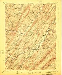
(97)- 1891 Map of Romney, 1897 Print
 1891 Romney1897 Print · USGSHampshire, Hardy, and Mineral counties are captured here in the 1880s as the river valleys were transitioning from frontier outposts to connected industrial hubs. Genealogists and historians can trace family locations near Capon Iron Works, Adams Mill, and the many hamlets along Patterson Creek.5 unique versions available
 - 1892 Map of Woodstock, 1898 Print
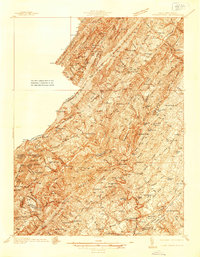
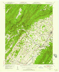
 1892 Woodstock1898 Print · USGSThe Shenandoah Valley in the 1890s is captured here as a landscape of river-driven towns and mountain iron furnaces. Researchers can trace family roots in Woodstock or Edinburg and locate historic industrial sites like Liberty Furnace and Columbia Furnace.5 unique versions available
 - 1893 Map of Luray, 1898 Print
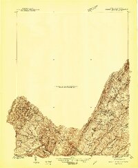
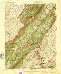
 1893 Luray1898 Print · USGSThe Shenandoah Valley in the 1890s was a land of steep mountain ridges and vital new railways. Genealogists and historians can trace old homesteads and depots along the Shenandoah Valley Railroad or find remote hamlets like Seven Fountains and Browntown.
 - 1894 Map of Winchester, 1899 Print
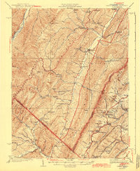
 1894 Winchester1899 Print · USGSThe Virginia and West Virginia borderlands appear here in the late nineteenth century, showing a landscape defined by mountain ridges and bustling rail junctions. Researchers can trace early rural life through family-named sites like Unger Store and Fawcetts Gap or the resort history of Capon Springs.6 unique versions available
 - 1905 Map of Luray, 1910 Print
 1905 Luray1910 Print · USGSThe Blue Ridge and Shenandoah Valley are frozen in time just after the turn of the century, showing the critical rail networks and mountain gaps of the period. Genealogists can trace family names and settlements like Luray, Front Royal, and Strasburg along the Shenandoah Valley Railroad.4 unique versions available
 - 1921 Map of Orkney Springs
 1921 Orkney Springs1921 Print · USGSHardy County life in the early 1920s was centered in the valley between the high ridges of Shenandoah and South Fork mountains. Genealogists can trace family footprints through a dense network of rural schools and churches, including Jenkins Chapel, Mathias, and the Lumber RR.2 unique versions available
 - 1922 Map of Wardensville
 1922 Wardensville1922 Print · USGSThe Hardy County highlands in the early twenties show a landscape of isolated hollows and mountain railroads. Genealogists can locate family homesteads near numerous country schools like Sugar Grove School and tracks of the Winchester and Western.
 - 1923 Map of Middletown
 1923 Middletown1923 Print · USGSThe West Virginia and Virginia borderlands were a patchwork of mountain farms and river crossings in the early 1920s. Genealogists can trace family names through landmarks like Hooks Mills, Capon Springs, and the Christian Church.
 - 1923 Map of Orkney Springs
 1923 Orkney Springs1923 Print · USGSHardy County, West Virginia, is shown in the early twenties as a landscape of rural schoolhouses and mountain churches tucked between high ridges. Genealogists can locate specific family-named landmarks like Halterman School, Jenkins Chapel, and the Lumber RR line.2 unique versions available
 - 1923 Map of Edinburg
 1923 Edinburg1923 Print · USGSThe Virginia and West Virginia borderlands appear in the early twenties as a landscape of isolated mountain schools and forest lookouts. Genealogists can trace family footprints around the Heishman School and Mt Vernon Church or locate early settlements at Rockland and Perry.5 unique versions available
 - 1924 Map of Wardensville
 1924 Wardensville1924 Print · USGSWardensville and the surrounding mountains of Hardy County are shown here during the early twenties. Genealogists can trace family names through landmarks like Heishman School, Rio, and Crest Hill Church along the river valleys.2 unique versions available
 - 1929 Map of Stony Man
 1929 Stony Man1929 Print · USGSBlue Ridge mountain life and the early development of Shenandoah National Park are captured here just as the park boundary was being established. Genealogists and hikers can trace old mountain routes to the President Hoover Community Sch, locate St Luke Episcopal Mission, or find early trail markers at Sexton Shelter.2 unique versions available
 - 1933 Map of Stony Man
 1933 Stony Man1933 Print · USGSThe Blue Ridge highlands and Page Valley are captured here during the early years of the national park era. Genealogists and historians can trace family locations through mountain hollows and riverside crossings like Stricklers Ferry, St George Mission, and Baileys Store.3 unique versions available
 - 1937 Map of Middletown
 1937 Middletown1937 Print · USGSFrederick and Shenandoah Counties are surveyed here in the late 1930s, documenting the valley's ridge-and-hollow terrain and Civil War history. Genealogists can locate family landmarks like Nieswanders Fort, Quaker Hill Cem, and the industry at Star Tannery.2 unique versions available
 - 1940 Map of Orkney Springs
 1940 Orkney Springs1940 Print · USGSThe West Virginia and Virginia borderlands appear in the early 1940s, showing a landscape of mountain resorts and valley farms. Genealogists can trace family landmarks like Halterman Cem and schools such as Mt Hermon Sch.2 unique versions available
 - 1942 Map of Mt Jackson, 1959 Print
 1942 Mt Jackson1959 Print · USGSThe Shenandoah Valley during the early forties reveals a landscape defined by the towering Massanutten Mountain and the winding river forks. Researchers can trace historic industrial sites like Catherine Furnace, old schools such as Soliloquy Sch, and the grounds of Shenandoah Academy.2 unique versions available
 - 1943 Map of Orkney Springs
 1943 Orkney Springs1943 Print · USGSThe mountain valleys of the West Virginia-Virginia border come alive in the 1940s, showing a landscape defined by ridges and rural hamlets. Family researchers can trace ancestry through numerous schools and churches like Jenkins Chapel, Halterman School, and Tusing Cem.2 unique versions available
 - 1943 Map of Middletown
 1943 Middletown1943 Print · USGSThe Virginia and West Virginia borderlands are revealed in this wartime-era survey of Frederick County and the surrounding ridges. Genealogists and historians can trace family locations near Star Tannery, the Cedar Creek Battlefield, or old schoolhouses like Mountain View Sch.2 unique versions available
 - 1944 Map of Orkney Springs
 1944 Orkney Springs1944 Print · USGSDeep in the mountains of Hardy County during the 1940s, this area was defined by its tight-knit valley settlements and small mountain schools. Genealogists can locate family landmarks like Fravel Run Sch, Jenkins Chapel, and the community of Lost City.
 - 1946 Map of Mt Jackson
 1946 Mt Jackson1946 Print · USGSThe Shenandoah Valley during the mid-1940s reveals a landscape defined by the parallel forks of its famous river and the rising wall of Massanutten Mountain. Genealogists can trace family lines through sites like Riedlers Sch, Catherine Furnace, and Long Cem.2 unique versions available
 - 1947 Map of Mt Jackson
 1947 Mt Jackson1947 Print · USGSThe Shenandoah Valley during the 1940s is captured here, showing the dramatic ridges between the river forks. Genealogists and historians can trace community roots through sites like Woods Chapel, Plains Mill, and Shenandoah Academy near New Market.2 unique versions available
 - 1947 Map of Strasburg, 1955 Print
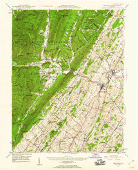
 1947 Strasburg1955 Print · USGSThe Shenandoah Valley during the late 1940s reveals a landscape defined by the winding North and South Forks of the river and the steep ridges of Massanutten. Genealogists can locate rural landmarks like Saint Davids Church, Bentonville, and the Mt Hebron Ch Cem.7 unique versions available
 - 1947 Map of Edinburg, 1958 Print
 1947 Edinburg1958 Print · USGSThe Shenandoah Valley is mapped here just after the war, showing the historic transportation spine between Woodstock and Mt Jackson. Researchers can trace rural life through landmarks like Columbia Furnace, Lantz Mills, and Union Forge Ch.2 unique versions available
 - 1947 Map of Broadway, 1959 Print
 1947 Broadway1959 Print · USGSRockingham County at the mid-century shows a landscape of river-valley agriculture and rugged forest ridges. Genealogists can trace family roots through historic sites like Singers Glen, Lacey Spring, and landmarks like Melrose Caverns.2 unique versions available
 - 1948 Map of Cumberland
 1948 Cumberland1948 Print · USGSMid-century Appalachia and the Shenandoah Valley are shown in detail, documenting the industrial and transportation hubs of the tri-state area. Genealogists can trace family roots through settlements like Double Tollgate and Bunker Hill or along the Baltimore & Ohio RR.3 unique versions available
Showing maps 1-25 of 97
Top cities of Shenandoah County
- Strasburg historical maps
- Woodstock historical maps
- New Market historical maps
- Mount Jackson historical maps
- Basye historical maps
- Edinburg historical maps
See more
Frequently asked questions
- What are the different types of historical maps available for Shenandoah County?
- What is the oldest map of Shenandoah County?
- Where can I purchase historical maps of Shenandoah County for my home or office?
- Where can I download high-res historical maps of Shenandoah County?
- Are there historical topographic maps available for Shenandoah County?
- Is there historical aerial imagery available for Shenandoah County?
- Where are historical maps of Shenandoah County sourced from?