1930s Maps of Tazewell, Virginia
Explore 4 historic maps of Tazewell from the 1930s. These maps offer a rare glimpse into what life looked like during the 1930s — showing old roads, neighborhoods, homes, and landmarks that have changed or disappeared over time.
Whether you're researching your family's past, planning a metal detecting trip, or studying how Tazewell's landscape evolved across the 1930s, these high-resolution maps are a powerful tool for exploring the history of this region.
- Focus on a specific era: All maps on this page are from the 1930s, giving you a focused view of this time period.
- See what’s changed: Compare century-old streets, trails, and buildings to today's modern landscape using overlays and satellite layers.
- Research with precision: Use these maps for genealogy, historical research, land use analysis, or educational projects.
- View, download, or print: Maps are fully viewable online in high resolution, and can be downloaded or printed for your own records.
Start exploring Tazewell's history through authentic maps from the 1930s. This is your window into the past.
Tazewell, VA maps
(4)- 1934 Map of Tazewell
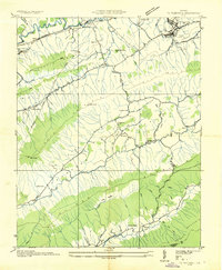 1934 Tazewell1934 Print · USGSThe Clinch River headwaters and Appalachian ridges of Tazewell County are captured here in the mid-1930s. Researchers can trace the Norfolk and Western railroad through Maxwell or locate country landmarks like Creagers Mill and the Tazewell County Fair Grounds.
 - 1935 Map of Tiptop
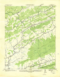 1935 Tiptop1935 Print · USGSIn the mid-thirties, the mountainous borderlands of Tazewell County were centered on the rail corridors of the Norfolk and Western Railway. Researchers can trace the exact locations of vanished community hubs like Wittens Mills, Sluss Sch, and the Burkes Garden Siding.
 - 1935 Map of Hutchinson Rock
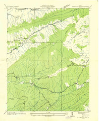 1935 Hutchinson Rock1935 Print · USGSTazewell and Bland counties met along the high ridges of the Clinch Mountains during the mid-1930s. Researchers can trace early rural life through landmarks like Hutchinson Rock, the Thompson Sch, and several localized sites like Burkes Garden No 2.
 - 1936 Map of Burkes Garden
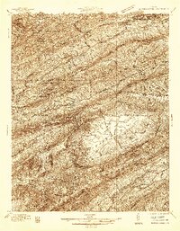 1936 Burkes Garden1936 Print · USGSTazewell and Bland Counties appear in the mid-1930s, defined by the extraordinary limestone bowl of Burkes Garden. Genealogists and historians can trace family locations near Maple Hill Cem, the Witten Mill settlement, and the industrial corridor at Bluefield.
End of results
Showing maps 1-4 of 4
Top cities near Tazewell
- Bluefield historical maps
- Saltville historical maps
- Rural Retreat historical maps
- Springville historical maps
- Gratton historical maps
- Gary historical maps
See more
Top neighborhoods of Tazewell
- Fourway historical maps
- North Tazewell historical maps
- River Jack historical maps
- Benbolt historical maps
- Drytown historical maps
Frequently asked questions
- What are the different types of historical maps available for Tazewell?
- What is the oldest map of Tazewell?
- Where can I purchase historical maps of Tazewell for my home or office?
- Where can I download high-res historical maps of Tazewell?
- Are there historical topographic maps available for Tazewell?
- Is there historical aerial imagery available for Tazewell?
- Where are historical maps of Tazewell sourced from?