2020s Maps of Tazewell, Virginia
Explore 4 historic maps of Tazewell from the 2020s. These maps offer a rare glimpse into what life looked like during the 2020s — showing old roads, neighborhoods, homes, and landmarks that have changed or disappeared over time.
Whether you're researching your family's past, planning a metal detecting trip, or studying how Tazewell's landscape evolved across the 2020s, these high-resolution maps are a powerful tool for exploring the history of this region.
- Focus on a specific era: All maps on this page are from the 2020s, giving you a focused view of this time period.
- See what’s changed: Compare century-old streets, trails, and buildings to today's modern landscape using overlays and satellite layers.
- Research with precision: Use these maps for genealogy, historical research, land use analysis, or educational projects.
- View, download, or print: Maps are fully viewable online in high resolution, and can be downloaded or printed for your own records.
Start exploring Tazewell's history through authentic maps from the 2020s. This is your window into the past.
Tazewell, VA maps
(4)- 2022 Map of Tazewell South, 2022 Print
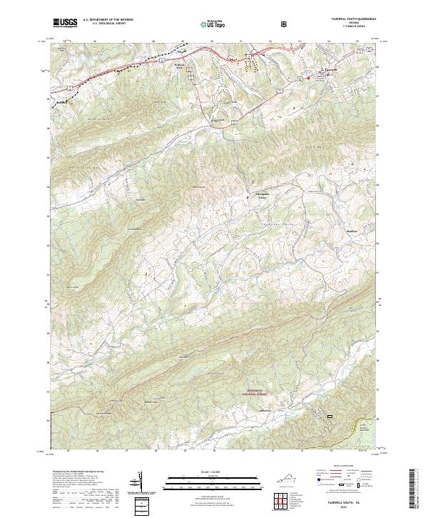 2022 Tazewell South2022 Print · USGSTazewell and its surrounding mountain valleys are captured here in the early twenty-first century, showcasing the region's historic settlements and deep topography. Trace the local landmarks of Tazewell County, from the Tazewell County Courthouse and Wittens Fort to the rural Pleasant Hill Church.
 - 2022 Map of Tiptop, 2022 Print
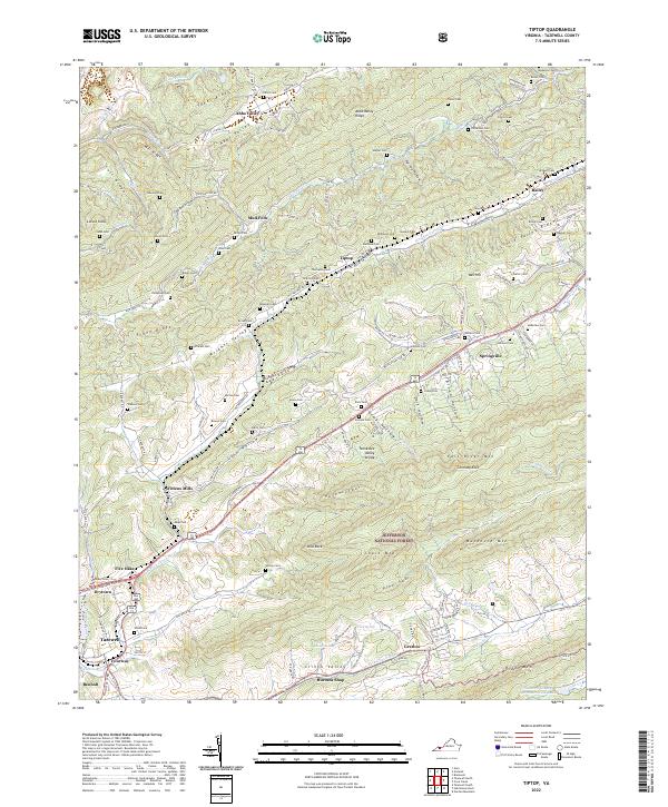 2022 Tiptop2022 Print · USGSThe Clinch Valley of Tazewell County is captured here in the early 2020s, showing the enduring rail and river corridors that shaped the region. Genealogists can locate dozens of family burial sites like Sinkford Cem and Yates Cem near historic stops at Wittens Mills and Tiptop.
 - 2022 Map of Hutchinson Rock, 2022 Print
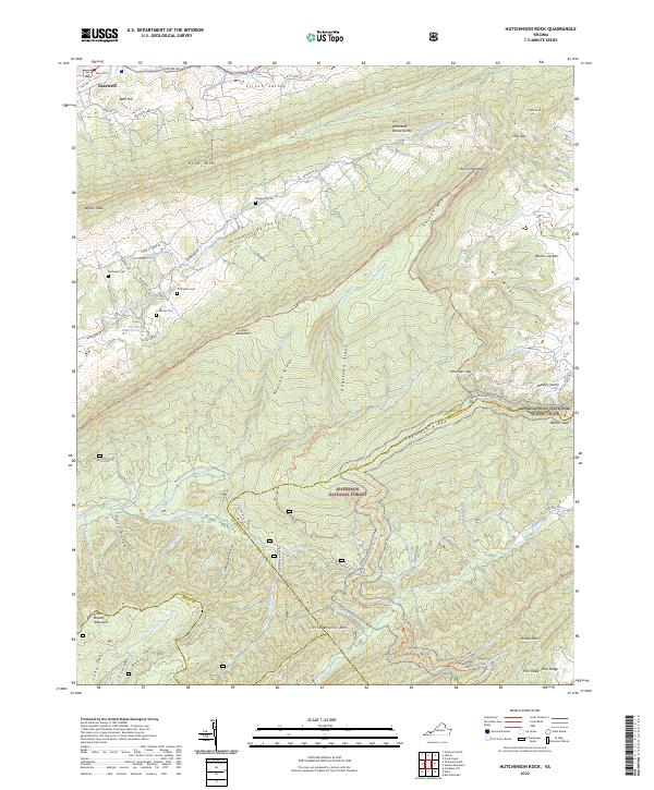 2022 Hutchinson Rock2022 Print · USGSThe high ridges of Tazewell and Bland Counties appear here during a time of conservation and outdoor recreation in Southwest Virginia. Researchers can locate family landmarks like Thompson Cem or trace the Appalachian National Scenic Trail as it crosses Garden Mountain.
 - 2023 Map of Tazewell North, 2023 Print
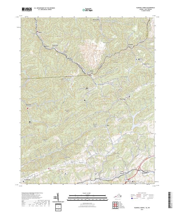 2023 Tazewell North2023 Print · USGSThe borderlands of Virginia and West Virginia are detailed here, centered on the historic communities of Tazewell and North Tazewell. Genealogists can trace family names through the Pruett Family Cem, Yost Family Cem, and the settlement at Sayersville.
End of results
Showing maps 1-4 of 4
Top cities near Tazewell
- Bluefield historical maps
- Saltville historical maps
- Rural Retreat historical maps
- Springville historical maps
- Gratton historical maps
- Gary historical maps
See more
Top neighborhoods of Tazewell
- Fourway historical maps
- North Tazewell historical maps
- River Jack historical maps
- Benbolt historical maps
- Drytown historical maps
Frequently asked questions
- What are the different types of historical maps available for Tazewell?
- What is the oldest map of Tazewell?
- Where can I purchase historical maps of Tazewell for my home or office?
- Where can I download high-res historical maps of Tazewell?
- Are there historical topographic maps available for Tazewell?
- Is there historical aerial imagery available for Tazewell?
- Where are historical maps of Tazewell sourced from?