2000s (21st Century) Maps of Benton City, Washington
Explore 3 historic maps of Benton City from the 2000s (21st Century). These maps offer a rare glimpse into what life looked like during the 2000s — showing old roads, neighborhoods, homes, and landmarks that have changed or disappeared over time.
Whether you're researching your family's past, planning a metal detecting trip, or studying how Benton City's landscape evolved across the 2000s, these high-resolution maps are a powerful tool for exploring the history of this region.
- Focus on a specific era: All maps on this page are from the 2000s, giving you a focused view of this time period.
- See what’s changed: Compare century-old streets, trails, and buildings to today's modern landscape using overlays and satellite layers.
- Research with precision: Use these maps for genealogy, historical research, land use analysis, or educational projects.
- View, download, or print: Maps are fully viewable online in high resolution, and can be downloaded or printed for your own records.
Start exploring Benton City's history through authentic maps from the 2000s. This is your window into the past.
Benton City, WA maps
(3)- 2023 Map of Benton City, 2023 Print
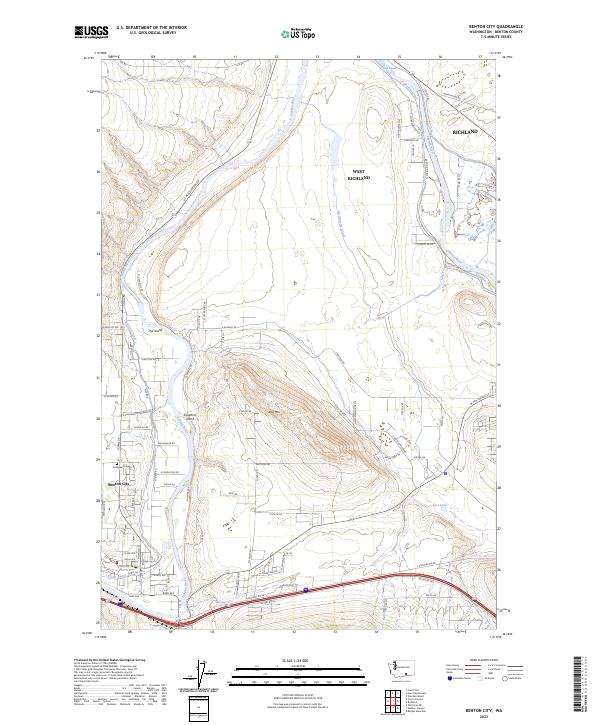 2023 Benton City2023 Print · USGSBenton City and the western reaches of the Tri-Cities are shown in this modern era as the Yakima River basin continues to evolve. Local researchers can trace water rights and land use through the Kiona Canal, Columbia Canal, and the quiet grounds of Evergreen Cem.
 - 2023 Map of Corral Canyon, 2023 Print
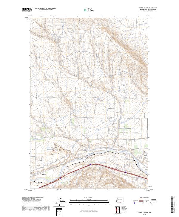 2023 Corral Canyon2023 Print · USGSBenton County's river valley and irrigation networks are shown here in modern detail, centered on the settlement of Chaffee and the winding Yakima River. Trace the engineering of the Sunnyside Canal and find family-named landmarks like Virgil O McWhorter Spring.
 - 2023 Map of Webber Canyon, 2023 Print
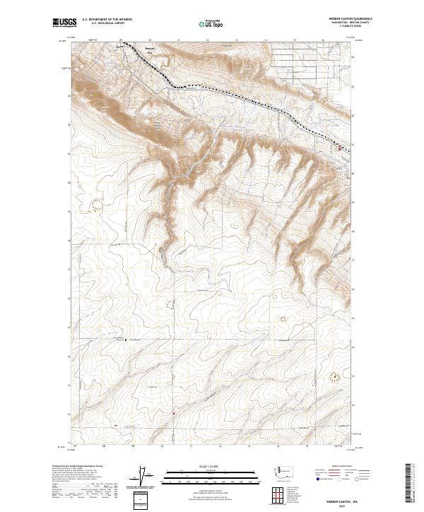 2023 Webber Canyon2023 Print · USGSBenton County agricultural lands and the Yakima River valley come into focus in this recent survey. Local historians can trace the irrigation networks of the Kennewick Main Canal and locate landmarks like the Horse Heaven Hills Cemetery and Prior Ranch.
End of results
Showing maps 1-3 of 3
Top cities near Benton City
Frequently asked questions
- What are the different types of historical maps available for Benton City?
- What is the oldest map of Benton City?
- Where can I purchase historical maps of Benton City for my home or office?
- Where can I download high-res historical maps of Benton City?
- Are there historical topographic maps available for Benton City?
- Is there historical aerial imagery available for Benton City?
- Where are historical maps of Benton City sourced from?