2020s Maps of Richland, Washington
Explore 6 historic maps of Richland from the 2020s. These maps offer a rare glimpse into what life looked like during the 2020s — showing old roads, neighborhoods, homes, and landmarks that have changed or disappeared over time.
Whether you're researching your family's past, planning a metal detecting trip, or studying how Richland's landscape evolved across the 2020s, these high-resolution maps are a powerful tool for exploring the history of this region.
- Focus on a specific era: All maps on this page are from the 2020s, giving you a focused view of this time period.
- See what’s changed: Compare century-old streets, trails, and buildings to today's modern landscape using overlays and satellite layers.
- Research with precision: Use these maps for genealogy, historical research, land use analysis, or educational projects.
- View, download, or print: Maps are fully viewable online in high resolution, and can be downloaded or printed for your own records.
Start exploring Richland's history through authentic maps from the 2020s. This is your window into the past.
Richland, WA maps
(6)- 2023 Map of Benton City, 2023 Print
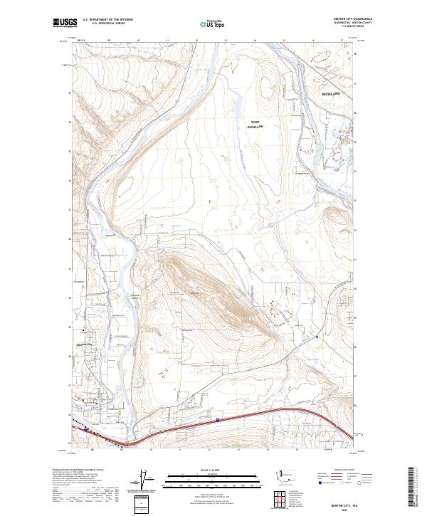 2023 Benton City2023 Print · USGSBenton City and the western reaches of the Tri-Cities are shown in this modern era as the Yakima River basin continues to evolve. Local researchers can trace water rights and land use through the Kiona Canal, Columbia Canal, and the quiet grounds of Evergreen Cem.
 - 2023 Map of Badger Mountain, 2023 Print
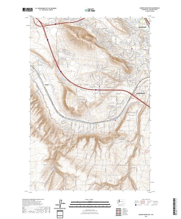 2023 Badger Mountain2023 Print · USGSBenton County undergoes modern transformation as the suburbs of Richland and Kennewick push toward the Horse Heaven Hills. Researchers can trace the essential irrigation networks of the Columbia Canal and Kennewick Main Canal across the slopes of Badger Mtn.
 - 2023 Map of Wooded Island, 2023 Print
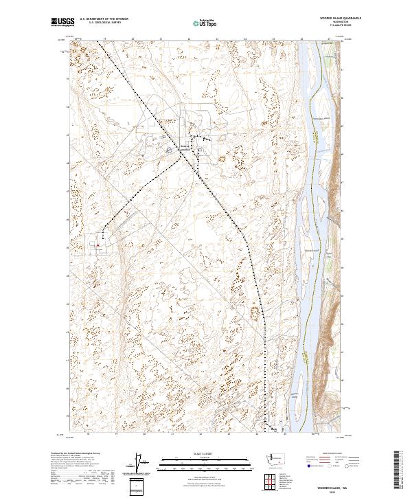 2023 Wooded Island2023 Print · USGSThe Hanford Reach and Columbia River bottomlands are captured here in a period of modern federal stewardship. Researchers can trace the river's path past Johnson Island or locate inland landmarks like Geneva Junction and Ringold Flat.
 - 2023 Map of Richland, 2023 Print
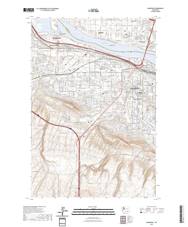
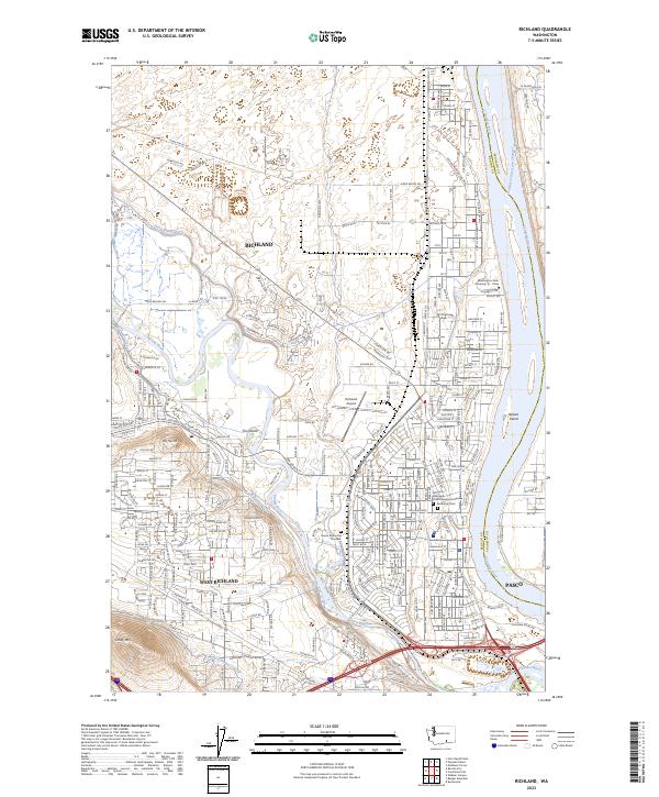 2023 Richland2023 Print · USGSRichland and the surrounding river basin are shown at the height of their modern development, centered on the historic confluence of two major waterways. Researchers can trace the layout of Resthaven Cem, the Washington State University Tri - Cities campus, and the extensive Columbia Canal network.
 - 2023 Map of Kennewick, 2023 Print
 2023 Kennewick2023 Print · USGSThe Tri-Cities area comes alive in this 2023 survey as a complex hub of river-born industry and modern irrigation. Genealogists and local historians can trace the intricate Columbia Canal network or locate Riverview Heights Cem and the BNSF Railway corridor.
 - 2023 Map of Columbia Point, 2023 Print
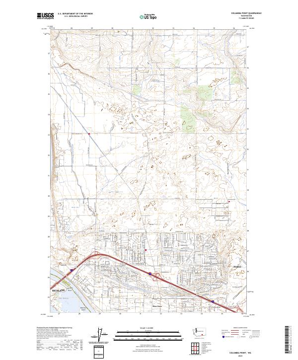 2023 Columbia Point2023 Print · USGSModern development and irrigation infrastructure converge at the Columbia River in this recent survey of the Tri-Cities area. Genealogists and local historians can trace suburban growth and regional landmarks like Tri-Cities Airport, Bateman Island, and the Esquatzel Diversion Channel.
End of results
Showing maps 1-6 of 6
Top cities near Richland
- Kennewick historical maps
- Pasco historical maps
- West Richland historical maps
- Benton City historical maps
Top neighborhoods of Richland
- Island View historical maps
- Queensgate historical maps
- South Richland historical maps
- Horn Rapids historical maps
- Meadow Springs historical maps
- Badger Mountain South historical maps
See more
Frequently asked questions
- What are the different types of historical maps available for Richland?
- What is the oldest map of Richland?
- Where can I purchase historical maps of Richland for my home or office?
- Where can I download high-res historical maps of Richland?
- Are there historical topographic maps available for Richland?
- Is there historical aerial imagery available for Richland?
- Where are historical maps of Richland sourced from?