Old Maps of Cowlitz County, Washington for Metal Detecting
Plan your next treasure hunt with 303 historic maps of Cowlitz County. Find old homesites, ghost towns, trails, and gathering spots that may be lost to time — perfect for identifying promising metal detecting locations.
- Locate forgotten sites: Uncover places like long-lost settlements, abandoned rail lines, or gathering spots.
- Plan better hunts: Use map overlays combined with LiDAR or satellite views to narrow in on historically rich areas.
- Made for detectorists: Thousands of hobbyists use these maps to discover relics, coins, and hidden history.
Use these historic maps to boost your research and find new opportunities beneath the surface of Cowlitz County.
Cowlitz County, WA maps
(303)- 1919 Map of Mayger
 1919 Mayger1919 Print · USGSThe Columbia River shoreline in the years following the Great War reveals a landscape of tidal sloughs and nascent settlements. Researchers can trace the early rail corridor of the S. P. & S. R. R. and locate riverfront sites like Mayger, Cleavelands Ldg., and Inglis.
 - 1919 Map of Mount St Helens
 1919 Mount St Helens1919 Print · USGSThe Cascades wilderness of Cowlitz and Skamania counties comes alive in this era of early forest management and mining. Trace the original profiles of Mt St Helens and Spirit Lake, and locate remote landmarks like Polar Star Mine or Basket Ferry.4 unique versions available
 - 1921 Map of Kalama
 1921 Kalama1921 Print · USGSThe Columbia River corridor is captured here in the early twenties, showing the vital rail and road networks connecting Washington and Oregon. Genealogists and historians can locate riverside settlements like Carrolls PO, industrial landmarks like the Ostrander Tunnel, and early routes like the Pacific Highway.
 - 1922 Map of St. Helens
 1922 St. Helens1922 Print · USGSThe Columbia River valley in the early twenties was a hub of logging and river commerce. Genealogists can trace family roots through old post offices like Yankton P.O. and Warren P.O. or locate historic industry at the Dupont Powder Co. site.
 - 1940 Map of La Center
 1940 La Center1940 Print · USGSClark County, Washington, is shown just before the war as a landscape of river-valley farms and timber outposts. Researchers can trace family roots through named intersections like Dollar Corner and Scotton Corner or locate vanished sites like the Ariel School.
 - 1941 Map of Yacolt
 1941 Yacolt1941 Print · USGSIn the early 1940s, Clark County's timber and river country centered on the rail-connected town of Yacolt. Researchers can trace old homesteads and landmarks like Golden Wonder Mine, Riverview School, and the remote Sunset Guard Sta.
 - 1941 Map of St Helens
 1941 St Helens1941 Print · USGSThe Columbia River waterfront near St. Helens was a thriving industrial and agricultural corridor just before the war. Trace old rail stops at Honeymoon Sta, rural schoolhouses like Shilo Basin Sch, and the shifting river islands from Deer Island to Bachelor Island.
 - 1941 Map of Olequa
 1941 Olequa1941 Print · USGSSouthwestern Washington on the eve of the Second World War shows a landscape defined by the Cowlitz River and the Northern Pacific rail line. Genealogists can trace early homesteads along Winlock to Toledo Road or locate family roots near St Francis Mission and Silver Lake.
 - 1941 Map of Clatskanie
 1941 Clatskanie1941 Print · USGSThe Columbia River shoreline and the timberlands of Columbia County are captured here just as the nation entered the war. Genealogists and researchers can trace rural life through landmarks like Crossing Cem, Erickson School, and the lookout at Benson L O.
 - 1942 Map of Toutle
 1942 Toutle1942 Print · USGSCowlitz County and the river valleys of the Cascades foothills are captured here in the early nineteen-forties. Genealogists and local historians can trace family locations near Toutle, Gilmore Corners, and St Helens, or locate the specific Toutle Lake School.
 - 1943 Map of Pigeon Springs
 1943 Pigeon Springs1943 Print · USGSCowlitz County’s timber and ranching landscapes are captured here during the 1940s, just as the CCC era transitioned into wartime resource management. Genealogists and historians can trace homesteads like Zehntbauer Ranch and industrial sites such as the Sawmill and Coweeman River Dam.
 - 1943 Map of St Helens
 1943 St Helens1943 Print · USGSThe Columbia River corridor during the mid-forties shows a bustling network of riverfront towns and upland settlements. Researchers can trace historic river landings like Caples Landing alongside rural landmarks such as Yankton, Trenholm, and Shilo Basin Sch.
 - 1948 Map of Vancouver, 1957 Print
 1948 Vancouver1957 Print · USGSPost-war growth transforms the river valleys of the Pacific Northwest as the timber and rail economy thrives. Trace family roots in Tillamook or Oregon City, and locate vanished landmarks like the spit at Bayocean or the Skamania Mine.
 - 1950 Map of Vancouver
 1950 Vancouver1950 Print · USGSCoastal Oregon and the lower Columbia River valley are captured in detail just after the war. Researchers can trace historic rail routes like the Southern Pacific or locate early settlements such as Vernonia, Gaston, and the Grand Ronde Indian Reservation.
 - 1950 Map of Vancouver, 1951 Print
 1950 Vancouver1951 Print · USGSThe Pacific Northwest urban corridor meets the rugged coast in the years following the war, showing the expansion of Portland and Vancouver. Genealogists and historians can trace the reach of the Southern Pacific RR and locate coastal communities like Tillamook, Seaside, and Tolovana Park.
 - 1952 Map of Clatskanie, 1954 Print
 1952 Clatskanie1954 Print · USGSThe lower Columbia River basin comes to life in the early fifties, showing the intricate dikes and rail lines of the Oregon and Washington border. Genealogists can locate family sites at Bryant Cemetery or trace the vanished streets of Swedetown.3 unique versions available
 - 1953 Map of Hoquiam
 1953 Hoquiam1953 Print · USGSSouthwest Washington in the early fifties shows a landscape shaped by timber, rail, and river commerce from the coast to the Cascades. Genealogists and historians can trace the development of timber towns like Ryderwood and the industrial hubs of Hoquiam and Kelso.2 unique versions available
 - 1953 Map of Toutle, 1955 Print
 1953 Toutle1955 Print · USGSCowlitz County’s timber-driven landscape comes into focus during the early fifties as logging operations expanded through the river valleys. Researchers can trace the Weyerhaeuser Timber Co Railroad, locate the Toutle Lake School, and find old sites like Eden Valley or the Windom Mine.3 unique versions available
 - 1953 Map of Castle Rock, 1955 Print
 1953 Castle Rock1955 Print · USGSThe Cowlitz River valley in the early fifties shows a busy corridor of rail lines and river settlements. Genealogists can locate several family cemeteries and former rural school sites like the Wayside Sch and Lone Hill Cemetery near Toledo.2 unique versions available
 - 1953 Map of Mt. Brynion, 1955 Print
 1953 Mt. Brynion1955 Print · USGSCowlitz County timber country is captured here in the early fifties, showing the transition from river valleys to high logging ridges. Researchers can trace the path of the Private Railroad and locate landmarks like the Coweman River Gaging Sta and Rose Valley.4 unique versions available
 - 1953 Map of Ryderwood, 1955 Print
 1953 Ryderwood1955 Print · USGSThe logging country of Lewis and Cowlitz counties is documented here in the early fifties as industrial rail gave way to trucking. Trace the transition of the company town Ryderwood, find the Snow Cem burial site, or locate the Dismantled Railroad corridors.3 unique versions available
 - 1953 Map of Pigeon Springs, 1955 Print
 1953 Pigeon Springs1955 Print · USGSCowlitz County’s timberlands and river headwaters are captured here in the early fifties, showing a remote landscape of logging camps and forest stations. You can locate early outposts like Pigeon Springs and Camp Coweman or trace mountain landmarks from Monument Peak to Washougal Falls.3 unique versions available
 - 1953 Map of Rainier, 1955 Print
 1953 Rainier1955 Print · USGSThe Columbia River waterfront at the start of the fifties reveals a heavy industrial corridor between Oregon and Washington. Genealogists and local historians can locate early landmarks like Hudson Cem, Neer City Sch, and the Reuben (site).4 unique versions available
 - 1953 Map of Kalama, 1955 Print
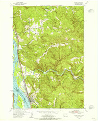 1953 Kalama1955 Print · USGSThe Columbia River corridor in the early fifties shows a bustling network of rail and river commerce. Genealogists can trace the rural life of Rose Valley through the Rose Valley School and locate ancestors at Mt Pleasant Cem.5 unique versions available
 - 1953 Map of Kelso, 1955 Print
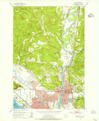 1953 Kelso1955 Print · USGSThe industrial corridor of the Cowlitz and Columbia rivers comes alive in the mid-1950s, showing the early development of the Longview-Kelso area. Researchers can trace the layout of local institutions like R A Long HS or find rural landmarks like Sandy Bend School and Huntington Rock.3 unique versions available
Showing maps 1-25 of 303
Top cities of Cowlitz County
- Longview historical maps
- Kelso historical maps
- Woodland historical maps
- Kalama historical maps
- Castle Rock historical maps
Frequently asked questions
- What are the different types of historical maps available for Cowlitz County?
- What is the oldest map of Cowlitz County?
- Where can I purchase historical maps of Cowlitz County for my home or office?
- Where can I download high-res historical maps of Cowlitz County?
- Are there historical topographic maps available for Cowlitz County?
- Is there historical aerial imagery available for Cowlitz County?
- Where are historical maps of Cowlitz County sourced from?