1980s Maps of Cowlitz County, Washington
Explore 32 historic maps of Cowlitz County from the 1980s. These maps offer a rare glimpse into what life looked like during the 1980s — showing old roads, neighborhoods, homes, and landmarks that have changed or disappeared over time.
Whether you're researching your family's past, planning a metal detecting trip, or studying how Cowlitz County's landscape evolved across the 1980s, these high-resolution maps are a powerful tool for exploring the history of this region.
- Focus on a specific era: All maps on this page are from the 1980s, giving you a focused view of this time period.
- See what’s changed: Compare century-old streets, trails, and buildings to today's modern landscape using overlays and satellite layers.
- Research with precision: Use these maps for genealogy, historical research, land use analysis, or educational projects.
- View, download, or print: Maps are fully viewable online in high resolution, and can be downloaded or printed for your own records.
Start exploring Cowlitz County's history through authentic maps from the 1980s. This is your window into the past.
Cowlitz County, WA maps
(32)- 1981 Map of Astoria, 1982 Print
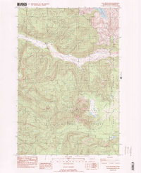
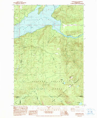
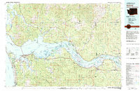 1981 Astoria1982 Print · USGSThe Oregon and Washington borderlands meet at the Columbia River estuary in the early eighties, a time of active timber transport and maritime trade. Researchers can trace the river's many islands, the grounds of Fort Stevens, and riverside towns like Cathlamet and Westport.3 unique versions available
 - 1983 Map of Winters Mtn
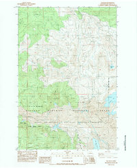
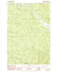
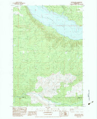 1983 Winters Mtn1983 Print · USGSThe northern reaches of the Cowlitz River valley are captured here in the early eighties, showing Riffe Lake and the shifting forest landscape. Researchers can trace the impact of volcanic activity through numerous blowdown zones and locate remote landmarks like Soda Spring and Alta Vista.
 - 1983 Map of Elk Mountain
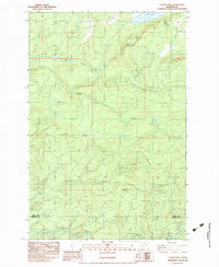
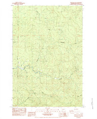
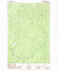
 1983 Elk Mountain1983 Print · USGSCowlitz County’s high country is captured here in the early 1980s, documenting a landscape of steep timberlands and changing river systems. Researchers can locate the Harrington Place (Site), trace the Coweeman River, and identify several Quarry and Borrow Pit sites.2 unique versions available
 - 1983 Map of Lakeview Peak
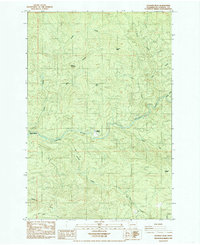
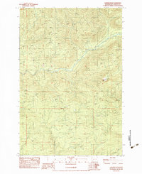 1983 Lakeview Peak1983 Print · USGSCowlitz County’s timber and river country is captured here in the early eighties, showing a landscape shaped by drainage and extraction. Researchers can locate dozens of Borrow Pit sites and trace the paths of the Kalama River and Lakeview Peak.2 unique versions available
 - 1983 Map of Coyote Mtn
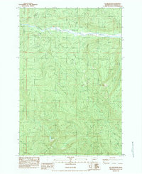
 1983 Coyote Mtn1983 Print · USGSIn the early 1980s, the timbered ridges along the Lewis and Cowlitz county line were still defined by logging camps and backcountry tracks. Genealogists and historians can trace the locations of Camp 9, Camp 10, and the inundation line of Riffe Lake.2 unique versions available
 - 1983 Map of Cougar
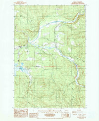
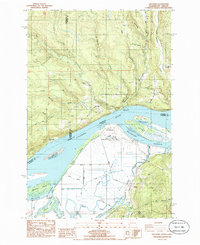
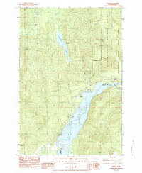 1983 Cougar1983 Print · USGSThe community of Cougar is captured here in the early eighties, positioned at the critical junction of the Gifford Pinchot National Forest and the Mount St Helens vicinity. Modern researchers can trace the development of lakeside recreation at Yale Park, Cougar Park, and the Beaver Bay Park Campground.
 - 1983 Map of Mount St. Helens, 1984 Print
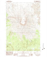 1983 Mount St. Helens1984 Print · USGSSkamania County's transformed landscape is documented here in the early 1980s, shortly after the volcanic eruption changed the face of the Cascades. Geologists and local historians can trace the new morphology of the 1980 Crater and The Breach alongside surviving features like the Lava Caves and June Lake.3 unique versions available
 - 1983 Map of Hoffstadt Mtn, 1984 Print
 1983 Hoffstadt Mtn1984 Print · USGSThe North Fork Toutle River valley is seen here just years after the 1980 eruption, showing a landscape reshaped by volcanic debris. Geologists and researchers can trace the extent of Mud Flow and Blowdown near Toutle Dam and Hoffstadt Mtn.
 - 1983 Map of Goat Mountain, 1984 Print
 1983 Goat Mountain1984 Print · USGSThe Cowlitz County high country is captured here in the early 1980s, revealing a landscape transformed by volcanic activity. Researchers can trace the recovery and terrain along the South Fork Toutle River, Disappointment Ridge, and the Mount St Helens National Volcanic Monument boundary.
 - 1983 Map of Elk Rock, 1984 Print
 1983 Elk Rock1984 Print · USGSCowlitz County’s landscape appears here in the immediate aftermath of the 1980 eruption, showing a terrain transformed by volcanic activity. Researchers can trace the extent of blowdown and mudflow across the North Fork Toutle River and newly formed Coldwater Lake.
 - 1984 Map of Hatchet Mtn
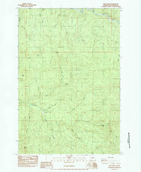
 1984 Hatchet Mtn1984 Print · USGSThe Lewis and Cowlitz county line was a hub of timber activity in the mid-1980s, defined by the North Fork Toutle River valley. Trace the logging roads and camps of the era, from 19 Mile Camp to the ridges near Hatchet Mtn.2 unique versions available
 - 1984 Map of Spirit Lake West
 1984 Spirit Lake West1984 Print · USGSSkamania County and the surrounding peaks appear here in the early 1980s, documenting a landscape reshaped by volcanic activity. Researchers can trace the Pre-Eruption Channel and locate Spirit Lake and Coldwater Lake.2 unique versions available
 - 1984 Map of Mt Mitchell
 1984 Mt Mitchell1984 Print · USGSThe Cascades of Skamania County appear in the mid-eighties as a landscape of hydroelectric power and volcanic geology. You can trace the Lewis River industrial sites like the Log Sorting Yard or explore geologic landmarks including Ape Cave and Mount Mitchell.
 - 1984 Map of Castle Rock
 1984 Castle Rock1984 Print · USGSCastle Rock and the surrounding river valleys are captured here in the early 1980s as the regional landscape adjusted to local industry and transport. Genealogists and historians can trace family-named sites like the Whittle and Hubbard Cemetery, Jackson Cemetery, and the Arkansas Valley.2 unique versions available
 - 1984 Map of Vanson Peak
 1984 Vanson Peak1984 Print · USGSThe high Cascades of Lewis and Skamania counties are captured here in the early 1980s, shortly after the Mount St. Helens eruption. Trace the rugged terrain from Vanson Peak down to the Cowlitz River and the inundated shores of Riffe Lake.
 - 1984 Map of Wolf Point
 1984 Wolf Point1984 Print · USGSCowlitz County timber and river lands are documented here in the early eighties. Local historians and researchers can trace the location of Camp Coweeman (Site) or locate landmarks like Washboard Falls and Baird Mtn.2 unique versions available
 - 1984 Map of Eden Valley
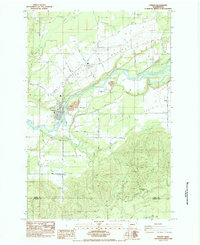
 1984 Eden Valley1984 Print · USGSThe Cowlitz River valley in the mid-1980s shows a landscape of fish hatcheries, prairie farms, and upland mines. Researchers can trace the settlement at Alexander and locate industrial sites like the Windom Mine or the Cowlitz Trout Hatchery.2 unique versions available
 - 1984 Map of Toledo
 1984 Toledo1984 Print · USGSToledo and the surrounding Cowlitz River valley are shown here in the mid-1980s as the area balanced its agricultural roots with modern development. Researchers can trace family sites near Lone Hill Cemetery, the historic St Francis Xavier Mission (Site), and the rural outpost at Knab.2 unique versions available
 - 1984 Map of Hemlock Pass
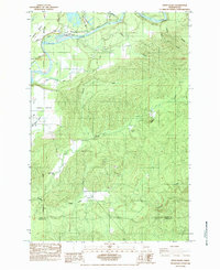
 1984 Hemlock Pass1984 Print · USGSThe rugged backcountry of Cowlitz County is captured in the early 1980s, showcasing the high ridges and deep river valleys of the Cascades. Genealogists and researchers can trace the Willamette Meridian and locate features like Ostander or the winding Coweeman River.2 unique versions available
 - 1984 Map of Toutle Mtn, 1985 Print
 1984 Toutle Mtn1985 Print · USGSThe river valleys and timberlands of Cowlitz County appear in detail here during the early 1980s. Researchers can locate small communities like Kid Valley and St. Helens, or trace the path of the North Fork Toutle River past Signal Peak.2 unique versions available
 - 1985 Map of Toutle
 1985 Toutle1985 Print · USGSCowlitz County timber and river country are mapped in the mid-1980s as industry and small communities adapted to the local landscape. Genealogists and historians can trace the foundations of Toutle and Sightly or locate landmarks like Toutle Lake School and Beigle Mountain.2 unique versions available
 - 1985 Map of Georges Peak
 1985 Georges Peak1985 Print · USGSThe Kalama River valley in the mid-1980s reveals a landscape shaped by the timber industry and outdoor recreation. Researchers can trace the winding Kalama River past riverside settlements like Camp Kalama and Pigeon Springs or locate high-country landmarks such as Georges Peak.2 unique versions available
 - 1985 Map of Woolford Creek
 1985 Woolford Creek1985 Print · USGSCowlitz County’s river-carved landscape is shown in the mid-1980s as the regional timber and fishery infrastructure developed. Trace the river's path to the Kalama Falls Salmon Hatchery and locate high points like Monument Peak or Baldy Mtn.2 unique versions available
 - 1985 Map of Oak Point
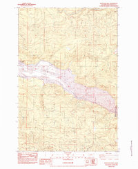
 1985 Oak Point1985 Print · USGSThe lower Columbia River shoreline in the mid-1980s reveals a complex landscape of industrial sites and pioneer cemeteries. Genealogists can locate family landmarks like Oak Point Cem and Grasseth Cem alongside river infrastructure like the Beaver Generating Plant.
 - 1985 Map of Winlock
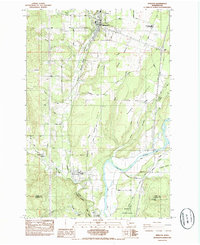 1985 Winlock1985 Print · USGSIn the mid-eighties, the towns of Winlock and Vader remained vital hubs along the dual-rail corridor of Lewis County. Researchers can trace local genealogy and land use through landmarks like Little Falls Cemetery, Mt. St. Helens High Sch., and the forested slopes of Finn Hill.2 unique versions available
Showing maps 1-25 of 32
Top cities of Cowlitz County
- Longview historical maps
- Kelso historical maps
- Woodland historical maps
- Kalama historical maps
- Castle Rock historical maps
Frequently asked questions
- What are the different types of historical maps available for Cowlitz County?
- What is the oldest map of Cowlitz County?
- Where can I purchase historical maps of Cowlitz County for my home or office?
- Where can I download high-res historical maps of Cowlitz County?
- Are there historical topographic maps available for Cowlitz County?
- Is there historical aerial imagery available for Cowlitz County?
- Where are historical maps of Cowlitz County sourced from?