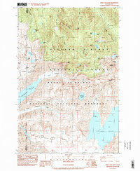
1984 Map of Spirit Lake West
USGS Topo · Published 1984About this map
Mount St Helens National Volcanic Monument and the Gifford Pinchot National Forest dominate this 1984 survey, which documents a landscape fundamentally altered by the 1980 eruption. The map includes a critical geographic reference for the North Fork Toutle River (Pre-Eruption Channel), marking the former path of the waterway before volcanic debris transformed the drainage. New features like Coldwater Lake appear alongside established high-elevation water bodies such as St Helens Lake and the massive Spirit Lake. The terrain is punctuated by sharp summits including Minnie Peak, Mount Whittier, and The Dome. Several human-made elements are noted, such as a Quarry and multiple Borrow Pit sites, used during recovery and road-building efforts in the blast zone. The sheet provides a clear record of the boundary between Cowlitz and Skamania counties amidst the recovering wilderness.
Find a feature on this map
38 named features on this map. Tap any name to fly to it.
Don’t see what you’re looking for? This feature index may not catch every label — zoom into the map to look around manually.
Map Details
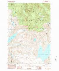
Editions of this 1984 Spirit Lake West Map
2 editions found
Other maps of this area

1919 · Mount St Helens
USGS Topo · 1:125,000

1953 · Hoquiam
USGS Topo · 1:250,000

1953 · Cougar
USGS Topo · 1:62,500

1953 · Elk Rock
USGS Topo · 1:62,500

1957 · Hoquiam
USGS Topo · 1:250,000

1957 · Spirit Lake
USGS Topo · 1:62,500

1958 · Mt St. Helens
USGS Topo · 1:62,500

1958 · Hoquiam
USGS Topo · 1:250,000

1962 · Hoquiam
USGS Topo · 1:250,000
1975 · Mt. St. Helens NE
USGS Topo · 1:24,000