Old Maps of Franklin County, Washington for Metal Detecting
Plan your next treasure hunt with 273 historic maps of Franklin County. Find old homesites, ghost towns, trails, and gathering spots that may be lost to time — perfect for identifying promising metal detecting locations.
- Locate forgotten sites: Uncover places like long-lost settlements, abandoned rail lines, or gathering spots.
- Plan better hunts: Use map overlays combined with LiDAR or satellite views to narrow in on historically rich areas.
- Made for detectorists: Thousands of hobbyists use these maps to discover relics, coins, and hidden history.
Use these historic maps to boost your research and find new opportunities beneath the surface of Franklin County.
Franklin County, WA maps
(273)- 1915 Map of Wallulah
 1915 Wallulah1915 Print · USGSThe convergence of the Snake and Columbia rivers in the mid-1910s reveals a landscape defined by steam power and irrigation. Genealogists and rail historians can trace early settlements like Attalia and Two Rivers alongside the path of the Oregon-Washington RR & Nav Co.
 - 1916 Map of Connell
 1916 Connell1916 Print · USGSIn the decade before the region's landscape was further transformed by modern irrigation, this area shows a dense network of early schoolhouses and railroad stops. Genealogists can trace family footprints through sites like Roxboro School, Hatton, and Kahlotus along the Washtucna Lake shoreline.
 - 1917 Map of Pasco
 1917 Pasco1917 Print · USGSThe confluence of the Columbia and Snake rivers in the early twentieth century shows a region being reshaped by irrigation and rail. Genealogists can trace family holdings and rural schoolhouses like Baxter School, the Farnsworth Ranch, and the Zimmerman Ferry.4 unique versions available
 - 1918 Map of Connell
 1918 Connell1918 Print · USGSEastern Washington at the end of the Great War era shows a landscape shaped by emerging railroads and a dense network of rural school districts. Genealogists and historians can trace family-named sites across Paradise Flats and locate early community hubs like Kahlotus, Connell, and Stephenson School.
 - 1918 Map of Wallula, 1942 Print
 1918 Wallula1942 Print · USGSThe river-and-rail hubs of the Walla Walla Valley are captured here as they appeared between the world wars. Researchers can trace the path of the Wallula Ferry, locate early country schools like Frog Hallow School, and follow the complex rail lines through Eureka.2 unique versions available
 - 1924 Map of Hanford
 1924 Hanford1924 Print · USGSThe Columbia River valley in the early 1920s was a landscape of pioneering ranches and riverfront towns long before the atomic age. Genealogists and historians can trace the foundations of Hanford and White Bluffs, or locate rural landmarks like the Brick School and Maplehurst Ranch.2 unique versions available
 - 1925 Map of Scooteney Lake
 1925 Scooteney Lake1925 Print · USGSFranklin County ranching and rail life are captured here in the mid-1920s, showing the early development of the Columbia Basin. Genealogists can locate family homesteads like Hendrix Sheep Ranch and Hezel Ranch or trace rural education at Kohler School.
 - 1948 Map of Starbuck, 1968 Print
 1948 Starbuck1968 Print · USGSThe Snake River canyon and Palouse coulees defined this rail-and-ranching corridor in the late 1940s. Genealogists and historians can trace the foundations of Starbuck, the riverside settlement of Riparia, and family sites like Gordon Farm.
 - 1948 Map of Ayer, 1976 Print
 1948 Ayer1976 Print · USGSThe Snake River breaks through the basalt plateau in the late 1940s, serving as a vital corridor for the Union Pacific and various family operations. Researchers can trace the riverfront at Ayer and Magallon or locate named homesteads like the Tucker Farm and Davin Ranch.
 - 1950 Map of Starbuck
 1950 Starbuck1950 Print · USGSSoutheast Washington during the late 1940s is defined by the winding Snake River and its rugged canyons. Genealogists and historians can trace the rail-and-river network of Starbuck and Riparia, or locate family sites like Gordon Farm and McGregor Ranch.
 - 1950 Map of Haas
 1950 Haas1950 Print · USGSFranklin County at the midpoint of the century reveals a landscape shaped by the Snake River and competing rail lines. Genealogists and local historians can locate early homesteads like Davin Ranch and Nunamaker Farm alongside rail stops at Sperry and McAdam.
 - 1951 Map of Scooteney Lake
 1951 Scooteney Lake1951 Print · USGSFranklin County ranching and rail history are preserved in this mid-century survey of the Washington high desert. Genealogists and historians can trace family landmarks like Rickards Ranch and the early layout of Mesa along the Pacific Northern line.
 - 1951 Map of Richland, 1955 Print
 1951 Richland1955 Print · USGSBenton County undergoes a massive industrial shift during the early Cold War era as the atomic age reshapes the desert landscape. You can trace the early footprint of the Hanford Works, the growth of RICHLAND, and the vital irrigation systems like the Columbia Canal.3 unique versions available
 - 1951 Map of Hanford, 1955 Print
 1951 Hanford1955 Print · USGSThe Columbia River basin in the early fifties shows a landscape reshaped for the atomic era. Genealogists and local historians can trace the foundations of the Hanford Townsite, White Bluffs Townsite, and several family homesteads like Pioneer Ranch.
 - 1953 Map of Walla Walla, 1964 Print
 1953 Walla Walla1964 Print · USGSSoutheast Washington enters the atomic and hydroelectric age in the mid-twentieth century as new dams reshape the desert landscape. You can trace the development of the Hanford Works, identify remote rail stops like Novara Siding, and locate the historic Dry Creek Cem.3 unique versions available
 - 1958 Map of Walla Walla
 1958 Walla Walla1958 Print · USGSThe Tri-Cities and Walla Walla region are captured here during the mid-century expansion of atomic energy and river infrastructure. Genealogists and historians can trace the early layout of Richland (AEC), the rural Hatton and Washtucna settlements, and landmarks like Palouse Falls State Park.
 - 1963 Map of Rye Grass Coulee, 1965 Print
 1963 Rye Grass Coulee1965 Print · USGSFranklin County's arid coulee country is captured in the early sixties, showing a landscape defined by industrial utility and natural drainage. Researchers can trace the path of the Pipeline past a Storage Bin or follow the Jeep Trail through the Sand Dunes.
 - 1964 Map of Levey SW, 1965 Print
 1964 Levey SW1965 Print · USGSThe Franklin County interior in the 1960s shows a landscape of shifting sands and heavy river infrastructure. Researchers can trace the Spokane Portland and Seattle rail line and the footprint of the Ice Harbor Dam along the Snake River.3 unique versions available
 - 1964 Map of Levey SE, 1965 Print
 1964 Levey SE1965 Print · USGSThe Snake River corridor in the mid-sixties reveals a landscape reshaped by the waters of Lake Sacajawea. Genealogists and historians can trace rail-side settlements like Levey, Redd, and Ash alongside landmarks such as Fishhook Park and Levey Landing.
 - 1964 Map of Slater, 1965 Print
 1964 Slater1965 Print · USGSThe Walla Walla County landscape in the mid-1960s reveals a critical junction of rail and river commerce near the Snake River. Genealogists and local historians can trace the paths of the Union Pacific and Northern Pacific through the settlements of Slater and Le Grow.2 unique versions available
 - 1964 Map of Levey NE, 1965 Print
 1964 Levey NE1965 Print · USGSFranklin County's high desert landscape was transitioning through new land management and irrigation efforts in the mid-sixties. Researchers can trace rural infrastructure and natural landmarks like Smith Canyon, Haverland Road, and the shifting Sand Dunes.
 - 1964 Map of Humorist, 1965 Print
 1964 Humorist1965 Print · USGSThe confluence of the Snake and Columbia rivers in the mid-sixties reveals a landscape reshaped by massive dam projects and wildlife conservation. Trace the intersection of the Northern Pacific rail lines near Humorist or explore the marshlands of the Mc Nary National Wildlife Refuge.2 unique versions available
 - 1964 Map of Kennewick, 1966 Print
 1964 Kennewick1966 Print · USGSThe Tri-Cities area undergoes rapid mid-century expansion where the Yakima and Columbia Rivers meet. Genealogists and local historians can trace suburban growth and irrigation through Kennewick, Riverview Heights Cem, and the Columbia Canal.2 unique versions available
 - 1964 Map of Pasco, 1966 Print
 1964 Pasco1966 Print · USGSThe Tri-Cities region underwent significant postwar transformation as irrigation and infrastructure reshaped the Columbia Basin in the 1960s. Researchers can trace the development of Pasco and Kennewick, locating sites like Vista Field and Desert Lawn Memorial Park.
 - 1964 Map of Pasco, 1967 Print
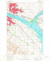 1964 Pasco1967 Print · USGSThe Tri-Cities region underwent significant transformation in the mid-sixties as the newly formed Lake Wallula reshaped the riverfronts. Genealogists and historians can trace the development of PASCO and KENNEWICK, locating long-standing landmarks like City View Cem and the Port of Pasco.2 unique versions available
Showing maps 1-25 of 273
Top cities of Franklin County
- Pasco historical maps
- Connell historical maps
- Basin City historical maps
- Mesa historical maps
- Kahlotus historical maps
Frequently asked questions
- What are the different types of historical maps available for Franklin County?
- What is the oldest map of Franklin County?
- Where can I purchase historical maps of Franklin County for my home or office?
- Where can I download high-res historical maps of Franklin County?
- Are there historical topographic maps available for Franklin County?
- Is there historical aerial imagery available for Franklin County?
- Where are historical maps of Franklin County sourced from?