1970s Maps of Franklin County, Washington
Explore 14 historic maps of Franklin County from the 1970s. These maps offer a rare glimpse into what life looked like during the 1970s — showing old roads, neighborhoods, homes, and landmarks that have changed or disappeared over time.
Whether you're researching your family's past, planning a metal detecting trip, or studying how Franklin County's landscape evolved across the 1970s, these high-resolution maps are a powerful tool for exploring the history of this region.
- Focus on a specific era: All maps on this page are from the 1970s, giving you a focused view of this time period.
- See what’s changed: Compare century-old streets, trails, and buildings to today's modern landscape using overlays and satellite layers.
- Research with precision: Use these maps for genealogy, historical research, land use analysis, or educational projects.
- View, download, or print: Maps are fully viewable online in high resolution, and can be downloaded or printed for your own records.
Start exploring Franklin County's history through authentic maps from the 1970s. This is your window into the past.
Franklin County, WA maps
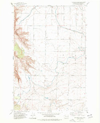
(14)- 1970 Map of Burr Canyon, 1972 Print
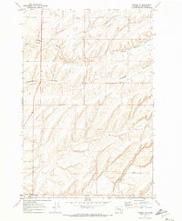
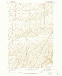 1970 Burr Canyon1972 Print · USGSFranklin County's coulee country is captured in the early 1970s, showing a landscape of deep canyons and isolated wheat ranches. Trace local history along family-named routes like Bauermeister Road or explore the terrain of Maid Coulee and Burr Canyon.
 - 1970 Map of Lower Monumental Dam, 1973 Print
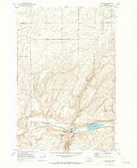
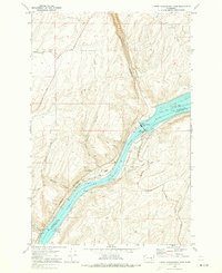 1970 Lower Monumental Dam1973 Print · USGSThe Snake River at the start of the 1970s reveals a landscape transformed by the Lower Monumental Dam and Lake Sacajawea. Researchers can trace the Burlington Northern rail line past the settlements of Farrington and Windust.
 - 1970 Map of Mesa East, 1973 Print
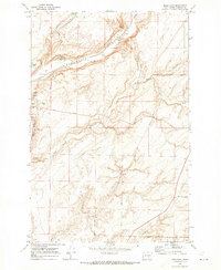 1970 Mesa East1973 Print · USGSFranklin County's dryland farming and rail corridors come into focus in the early 1970s. Trace the tracks of the Burlington Northern through Mesa and find family-named landmarks like Pepiot Road and Old Maid Coulee.
 - 1970 Map of Frischknecht, 1973 Print
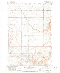 1970 Frischknecht1973 Print · USGSFranklin County grain-growing country comes into focus in the early 1970s, as the rail and road network supported the region's agricultural harvest. Genealogists and historians can trace the Burlington Northern line to the Grain Elevators at Frischknecht and locate the Paradise Flats Cem.
 - 1970 Map of Connell SE, 1973 Print
 1970 Connell SE1973 Print · USGSFranklin County's coulee-scarred plains are captured here in the early 1970s, illustrating the agricultural and infrastructural network of eastern Washington. Researchers can trace family-named routes like Bauermeister Road and find landmarks such as McLean and Five Corners.
 - 1970 Map of Kahlotus, 1973 Print
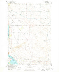
 1970 Kahlotus1973 Print · USGSKahlotus and the surrounding coulee country are captured here in the early seventies, showing a landscape defined by rail and ranching. Genealogists and local historians can trace the Union Pacific corridor, locate Lakeview Cemetery, and explore the terrain of Michigan Prairie.
 - 1970 Map of Connell, 1973 Print
 1970 Connell1973 Print · USGSFranklin County's rail and agricultural heart is captured here during the early seventies as the region's transport network matured. Researchers can trace the path of the Northern Pacific railroad through Connell or locate family-named landmarks like Myers Road and Nordheim.
 - 1970 Map of Sulphur Lake, 1973 Print
 1970 Sulphur Lake1973 Print · USGSThe Franklin and Adams County line comes alive in the early seventies, showing a landscape defined by the deep Washtucna (Depression) Coulee. Trace the Union Pacific rail corridor to find local landmarks like Sulphur Lake, Estes, and numerous grain elevators.
 - 1975 Map of Mathews Corner, 1977 Print
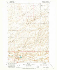
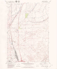
 1975 Mathews Corner1977 Print · USGSFranklin County's irrigation and canyon country are shown in detail during the mid-seventies, just as the region's agricultural infrastructure was maturing. Researchers can trace local landmarks like Mathews Corner, the Markham Sch, and the deep cuts of Parsons Canyon.
 - 1978 Map of Richland
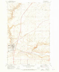
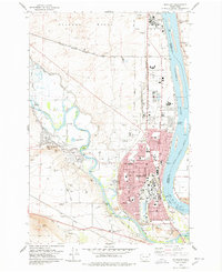 1978 Richland1978 Print · USGSRichland and West Richland are shown in the late seventies as the region functioned as a critical hub for energy and atomic research. Researchers can trace the industrial layout of the Hanford Works or locate local landmarks like the Westie Drive-in Theatre and Resthaven Cem.
 - 1978 Map of Columbia Point
 1978 Columbia Point1978 Print · USGSIn the late seventies, the Tri-Cities area was expanding across the high desert and along the shores of Lake Wallula. Researchers can trace the development of irrigation infrastructure and rural settlements through Riverview, the Sand Dunes, and Bateman Island.
 - 1978 Map of Wooded Island, 1979 Print
 1978 Wooded Island1979 Print · USGSThe Hanford nuclear site and the Columbia River meet in the late seventies, showing a secure industrial landscape during the Cold War. Researchers can trace the path of the U. S. Government Railroad past a Test Facility and islands like Wooded Island.2 unique versions available
 - 1979 Map of Priest Rapids
 1979 Priest Rapids1979 Print · USGSThe Columbia River basin in the late seventies reveals a landscape shaped by massive federal projects and rail expansion. Trace the Hanford Works perimeter, the Priest Rapids Dam, and the early growth of Royal City and Othello.2 unique versions available
 - 1979 Map of Glade
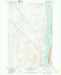
 1979 Glade1979 Print · USGSFranklin County's arid landscape shows the reach of the Columbia Basin Project in the late seventies as irrigation transformed the desert. Trace the development of infrastructure around Pasco and the Tri-Cities Airport, or follow the Burlington Northern tracks through Esquatzel Coulee.
End of results
Showing maps 1-14 of 14
Top cities of Franklin County
- Pasco historical maps
- Connell historical maps
- Basin City historical maps
- Mesa historical maps
- Kahlotus historical maps
Frequently asked questions
- What are the different types of historical maps available for Franklin County?
- What is the oldest map of Franklin County?
- Where can I purchase historical maps of Franklin County for my home or office?
- Where can I download high-res historical maps of Franklin County?
- Are there historical topographic maps available for Franklin County?
- Is there historical aerial imagery available for Franklin County?
- Where are historical maps of Franklin County sourced from?