1960s Maps of Franklin County, Washington
Explore 15 historic maps of Franklin County from the 1960s. These maps offer a rare glimpse into what life looked like during the 1960s — showing old roads, neighborhoods, homes, and landmarks that have changed or disappeared over time.
Whether you're researching your family's past, planning a metal detecting trip, or studying how Franklin County's landscape evolved across the 1960s, these high-resolution maps are a powerful tool for exploring the history of this region.
- Focus on a specific era: All maps on this page are from the 1960s, giving you a focused view of this time period.
- See what’s changed: Compare century-old streets, trails, and buildings to today's modern landscape using overlays and satellite layers.
- Research with precision: Use these maps for genealogy, historical research, land use analysis, or educational projects.
- View, download, or print: Maps are fully viewable online in high resolution, and can be downloaded or printed for your own records.
Start exploring Franklin County's history through authentic maps from the 1960s. This is your window into the past.
Franklin County, WA maps
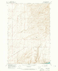
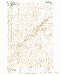
(15)- 1963 Map of Rye Grass Coulee, 1965 Print
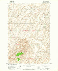
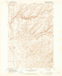 1963 Rye Grass Coulee1965 Print · USGSFranklin County's arid coulee country is captured in the early sixties, showing a landscape defined by industrial utility and natural drainage. Researchers can trace the path of the Pipeline past a Storage Bin or follow the Jeep Trail through the Sand Dunes.
 - 1964 Map of Levey SW, 1965 Print
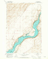
 1964 Levey SW1965 Print · USGSThe Franklin County interior in the 1960s shows a landscape of shifting sands and heavy river infrastructure. Researchers can trace the Spokane Portland and Seattle rail line and the footprint of the Ice Harbor Dam along the Snake River.3 unique versions available
 - 1964 Map of Levey SE, 1965 Print
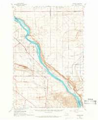
 1964 Levey SE1965 Print · USGSThe Snake River corridor in the mid-sixties reveals a landscape reshaped by the waters of Lake Sacajawea. Genealogists and historians can trace rail-side settlements like Levey, Redd, and Ash alongside landmarks such as Fishhook Park and Levey Landing.
 - 1964 Map of Slater, 1965 Print
 1964 Slater1965 Print · USGSThe Walla Walla County landscape in the mid-1960s reveals a critical junction of rail and river commerce near the Snake River. Genealogists and local historians can trace the paths of the Union Pacific and Northern Pacific through the settlements of Slater and Le Grow.2 unique versions available
 - 1964 Map of Levey NE, 1965 Print
 1964 Levey NE1965 Print · USGSFranklin County's high desert landscape was transitioning through new land management and irrigation efforts in the mid-sixties. Researchers can trace rural infrastructure and natural landmarks like Smith Canyon, Haverland Road, and the shifting Sand Dunes.
 - 1964 Map of Humorist, 1965 Print
 1964 Humorist1965 Print · USGSThe confluence of the Snake and Columbia rivers in the mid-sixties reveals a landscape reshaped by massive dam projects and wildlife conservation. Trace the intersection of the Northern Pacific rail lines near Humorist or explore the marshlands of the Mc Nary National Wildlife Refuge.2 unique versions available
 - 1964 Map of Kennewick, 1966 Print
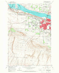 1964 Kennewick1966 Print · USGSThe Tri-Cities area undergoes rapid mid-century expansion where the Yakima and Columbia Rivers meet. Genealogists and local historians can trace suburban growth and irrigation through Kennewick, Riverview Heights Cem, and the Columbia Canal.2 unique versions available
 - 1964 Map of Pasco, 1966 Print
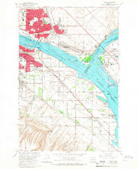
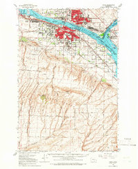 1964 Pasco1966 Print · USGSThe Tri-Cities region underwent significant postwar transformation as irrigation and infrastructure reshaped the Columbia Basin in the 1960s. Researchers can trace the development of Pasco and Kennewick, locating sites like Vista Field and Desert Lawn Memorial Park.
 - 1964 Map of Pasco, 1967 Print
 1964 Pasco1967 Print · USGSThe Tri-Cities region underwent significant transformation in the mid-sixties as the newly formed Lake Wallula reshaped the riverfronts. Genealogists and historians can trace the development of PASCO and KENNEWICK, locating long-standing landmarks like City View Cem and the Port of Pasco.2 unique versions available
 - 1965 Map of Mesa, 1966 Print
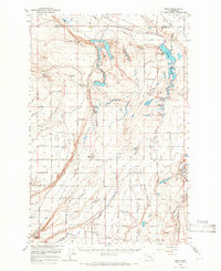 1965 Mesa1966 Print · USGSCentral Washington's desert landscape was being reshaped by irrigation in the mid-sixties. Trace the growth of Basin City, the path of the Northern Pacific Railroad, and the operations at the Othello Air Force Sta.2 unique versions available
 - 1965 Map of Eltopia, 1966 Print
 1965 Eltopia1966 Print · USGSFranklin County underwent a radical transformation in the mid-1960s as irrigation projects reshaped the landscape. Researchers can trace early settlements and family landmarks like Timmerman, locate the Markham Sch, and follow the Northern Pacific line through Eltopia.
 - 1965 Map of Hanford, 1966 Print
 1965 Hanford1966 Print · USGSThe mid-sixties Hanford area is captured here during its peak years as a secure federal site. Researchers can trace the U S Government Railroad and locate landmarks like Gable Mountain, Hanford, and the White Bluffs.2 unique versions available
 - 1966 Map of Page, 1967 Print
 1966 Page1967 Print · USGSIn the mid-1960s, this portion of Walla Walla County shows the vital rail-and-river network of the Columbia Basin. Researchers can trace the legacy of grain transport through Grain Elevators at Hatch and small settlements like Adkins and Votaw.
 - 1966 Map of Snake River, 1967 Print
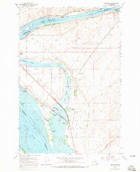
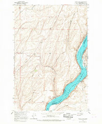 1966 Snake River1967 Print · USGSThe Snake River valley underwent a massive transformation in the mid-sixties as the reservoir of Lake Sacagawea filled the canyon floor. Researchers can trace the industrial infrastructure of the day, from the Snake River Grain Elevator to rural outposts like Walker and Sheffler.
 - 1966 Map of Elwood, 1968 Print
 1966 Elwood1968 Print · USGSWalla Walla County is captured in the mid-1960s at a vital junction of the Snake River and several major railroads. Genealogists and historians can trace family-named routes and rail sidings at Elwood, Walker, and the broad expanse of Eureka Flat.
End of results
Showing maps 1-15 of 15
Top cities of Franklin County
- Pasco historical maps
- Connell historical maps
- Basin City historical maps
- Mesa historical maps
- Kahlotus historical maps
Frequently asked questions
- What are the different types of historical maps available for Franklin County?
- What is the oldest map of Franklin County?
- Where can I purchase historical maps of Franklin County for my home or office?
- Where can I download high-res historical maps of Franklin County?
- Are there historical topographic maps available for Franklin County?
- Is there historical aerial imagery available for Franklin County?
- Where are historical maps of Franklin County sourced from?