Old Maps of Kitsap County, Washington for Metal Detecting
Plan your next treasure hunt with 168 historic maps of Kitsap County. Find old homesites, ghost towns, trails, and gathering spots that may be lost to time — perfect for identifying promising metal detecting locations.
- Locate forgotten sites: Uncover places like long-lost settlements, abandoned rail lines, or gathering spots.
- Plan better hunts: Use map overlays combined with LiDAR or satellite views to narrow in on historically rich areas.
- Made for detectorists: Thousands of hobbyists use these maps to discover relics, coins, and hidden history.
Use these historic maps to boost your research and find new opportunities beneath the surface of Kitsap County.
Kitsap County, WA maps
(168)- 1894 Map of Seattle, 1903 Print
 1894 Seattle1903 Print · USGSSeattle and its surrounding bay-side towns come alive in the 1890s, showing the region before modern industrialization reshaped the shoreline. Researchers can trace the original courses of the Dwamish River and locate early settlements like Ballard, West Seattle, and Ravenna.2 unique versions available
 - 1895 Map of Snohomish, 1954 Print
 1895 Snohomish1954 Print · USGSThe Puget Sound region in the late nineteenth century is documented here as Seattle and Everett rapidly expand via a growing rail network. Genealogists and historians can trace early waterfront settlements and inland junctions such as Mukilteo, Woodinville, and the grounds of Ft. Lawton.
 - 1897 Map of Tacoma
 1897 Tacoma1897 Print · USGSPuget Sound and the Tacoma waterfront come alive in the late 1890s, when coal railroads and river valleys drove regional growth. Genealogists can trace family roots in early island settlements like Chautauqua or inland rail towns such as Black Diamond and Wilkeson.2 unique versions available
 - 1897 Map of Seattle
 1897 Seattle1897 Print · USGSThe Puget Sound region is seen here in the late nineteenth century as the rail-and-water economy flourished. Genealogists and historians can trace early landings and rail stops like Curtis Landing, Moorland, and Kirkland Junction.10 unique versions available
 - 1900 Map of Tacoma
 1900 Tacoma1900 Print · USGSThe Puget Sound region was a hive of rail and maritime activity at the end of the Victorian era. Researchers can trace early settlements like Chautauqua, identify tribal lands at the Muckleshoot Indian Reservation, and locate mining towns such as Black Diamond.9 unique versions available
 - 1908 Map of Seattle, 1955 Print
 1908 Seattle1955 Print · USGSSeattle's maritime and urban landscape is captured during a period of rapid growth and international attention. Genealogists and historians can trace neighborhood development near Ballard, the site of the Alaska-Yukon-Pacific Exposition, and landmarks like Fort Lawton.2 unique versions available
 - 1909 Map of Seattle Special
 1909 Seattle Special1909 Print · USGSThe Seattle waterfront and its surrounding hills appear here during the year of the Alaska-Yukon-Pacific Exposition. Genealogists and historians can trace early city neighborhoods and rail lines like the Seattle-Everett Interurban or locate Lakeview Cemetery and Fort Lawton.4 unique versions available
 - 1936 Map of Point Misery, 1958 Print
 1936 Point Misery1958 Print · USGSCommunities along the Hood Canal thrived on timber and maritime trade in the mid-1930s. Genealogists and historians can trace local landmarks like Seabeck, the Lewis Lumber Co, and the Brinnon Seabeck Ferry route.3 unique versions available
 - 1937 Map of Port Orchard, 1960 Print
 1937 Port Orchard1960 Print · USGSBremerton and the Kitsap Peninsula were defined by their deep-water naval facilities and ferry networks in the years preceding World War II. Local historians can trace the early footprints of the Puget Sound Navy Yard, the Port Madison Indian Reservation, and the Fort Ward coastal defenses.2 unique versions available
 - 1937 Map of Port Gamble, 1964 Print
 1937 Port Gamble1964 Print · USGSPuget Sound and the Hood Canal meet in the 1930s, showing a world of timber mills and vital ferry crossings. Trace the old routes of the Port Gamble-Shine Auto Ferry and locate historic landmarks like the Point No Point Lighthouse and Indianola.
 - 1938 Map of Mt Constance
 1938 Mt Constance1938 Print · USGSThe eastern Olympic Peninsula comes into focus in the 1930s as a land of massive peaks and nascent federal parks. Trace the early mining efforts at the Tubal Cain Mine, lookouts like Deer Park Lookout, and the shoreline at Eldon.4 unique versions available
 - 1938 Map of Allyn, 1962 Print
 1938 Allyn1962 Print · USGSCoastal life in the South Sound is captured in the late 1930s, documenting the shoreline of the Kitsap Peninsula and the surrounding inlets. Genealogists and local historians can trace small communities like Allyn, Grapeview, and Vaughn, or locate landmarks such as Grant Sch and Twanoh State Park.2 unique versions available
 - 1940 Map of Port Gamble
 1940 Port Gamble1940 Print · USGSThe Kitsap Peninsula and Hood Canal are seen here in the final years before the bridge era, when a complex network of ferries was the lifeblood of the sound. Genealogists and local historians can trace the early footprints of Port Gamble, Hansville, and the Port Madison Indian Reservation.
 - 1940 Map of Point Misery
 1940 Point Misery1940 Print · USGSCoastal life along the Hood Canal and Dabob Bay is caught in detail just before the mid-century, from timber operations to maritime crossings. Genealogists and historians can trace the Brinnon Seabeck Ferry, identify the Barney White Ranch, and locate the Seabeck Sch.
 - 1942 Map of Edmonds, 1944 Print
 1942 Edmonds1944 Print · USGSCoastal Snohomish County and Whidbey Island are captured in the early 1940s during a period of maritime and rail expansion. Researchers can trace historic ferry lines, the Great Northern railroad, and local landmarks like Alderwood Manor and Firlands Sanitarium.
 - 1942 Map of Gig Harbor, 1954 Print
 1942 Gig Harbor1954 Print · USGSThe Kitsap Peninsula and surrounding islands are mapped here during the early 1940s, highlighting a maritime world of inlets and ferries. Trace old family sites and rural landmarks like Elgin Sch, Lisabeula, and the many landings along Henderson Bay.
 - 1943 Map of Gig Harbor
 1943 Gig Harbor1943 Print · USGSThe Puget Sound shoreline and its peninsulas are captured here in the 1940s as a maritime network of small landings and inland schools. Genealogists can trace family footprints at Sunny Slope Sch, Lisabeula, and the many homesteads near Artondale.
 - 1947 Map of The Brothers, 1957 Print
 1947 The Brothers1957 Print · USGSThe Olympic Peninsula wilderness meets the shoreline in the late 1940s, showing the rugged interior before modern expansion. Researchers can locate the John Ahl Sch near Eldon or trace mountain trails to the Webb Lookout and The Brothers.3 unique versions available
 - 1949 Map of Shilshole Bay, 1954 Print
 1949 Shilshole Bay1954 Print · USGSSeattle's northwestern waterfront is captured in the mid-century as neighborhoods like Ballard and Loyal Heights expand near the industrial shore. Trace the rail lines of the Great Northern and find historic sites like Fort Lawton and West Point Light.4 unique versions available
 - 1949 Map of Duwamish Head, 1956 Print
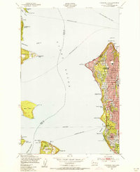 1949 Duwamish Head1956 Print · USGSThe Seattle waterfront and Puget Sound islands are captured here in the years following World War II, when ferries were the lifeblood of the sound. Genealogists and local historians can trace the development of West Seattle, Fauntleroy, and Vashon Heights alongside landmarks like Lafayette Sch and the Laurel Beach Sanatorium.3 unique versions available
 - 1949 Map of Vashon, 1956 Print
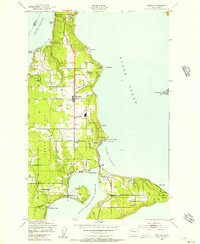 1949 Vashon1956 Print · USGSVashon and Maury Islands are captured here in the late 1940s, showing a landscape defined by waterfront settlements and maritime life. Genealogists can trace family locations in small communities like Burton, Ellisport, and Sylvan Beach, or find local landmarks such as Vashon Sch and the KOMO Radio Towers.4 unique versions available
 - 1950 Map of The Brothers
 1950 The Brothers1950 Print · USGSThe Jefferson County coast meets the Olympic peaks in the mid-century, capturing the area's transition from the Hood Canal shoreline to high wilderness. Researchers can trace early backcountry camps and coastal landmarks like John Ahl Sch, Camp Collins, and the Hamma Hamma Guard Sta.2 unique versions available
 - 1953 Map of Seabeck, 1954 Print
 1953 Seabeck1954 Print · USGSHood Canal and the Toandos Peninsula are seen here in the early fifties, documenting a landscape of small coastal settlements and timbered creeks. Researchers can locate Camp Parsons, the village of Coyle, and the historic Conference Grounds at Seabeck.4 unique versions available
 - 1953 Map of Poulsbo, 1954 Print
 1953 Poulsbo1954 Print · USGSKitsap County's shoreline and military landscape are frozen in time during the mid-fifties as naval operations and small-town life intersect. Genealogists and historians can trace family locations near Poulsbo Cemetery, the rail stop at Silverdale Siding, and schools like Pearson Sch.4 unique versions available
 - 1953 Map of Burley, 1954 Print
 1953 Burley1954 Print · USGSThe Kitsap Peninsula is captured here in the early fifties, showing a rural landscape of timber and tide. Researchers can trace the development of early communities like Burley, Glenwood, and Bethel, or locate landmarks such as Bethel Ch and South Port Orchard Airport.6 unique versions available
Showing maps 1-25 of 168
Top cities of Kitsap County
- Bremerton historical maps
- Bainbridge Island historical maps
- Silverdale historical maps
- Port Orchard historical maps
- Poulsbo historical maps
- Parkwood historical maps
See more
Frequently asked questions
- What are the different types of historical maps available for Kitsap County?
- What is the oldest map of Kitsap County?
- Where can I purchase historical maps of Kitsap County for my home or office?
- Where can I download high-res historical maps of Kitsap County?
- Are there historical topographic maps available for Kitsap County?
- Is there historical aerial imagery available for Kitsap County?
- Where are historical maps of Kitsap County sourced from?