
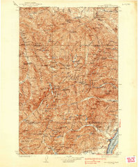
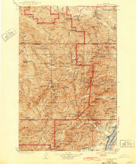
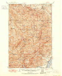
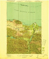
1938 Map of Mt Constance
USGS Topo · Published 1938About this map
Mt Jupiter Lookout and Deer Park Lookout anchor this high-altitude survey of the eastern Olympics during the mid-1930s. The landscape is defined by the headwaters of the Dosewallips River, Duckabush River, and Hamma Hamma River, which flow eastward toward the Hood Canal shoreline near the settlement of Eldon. At this time, the boundary between the Olympic National Forest and the newly established Olympic National Park illustrates the region's shift toward conservation.
Find a feature on this map
61 named features on this map. Tap any name to fly to it.
Don’t see what you’re looking for? This feature index may not catch every label — zoom into the map to look around manually.
Map Details
Editions of this 1938 Mt Constance Map
4 editions found
Other maps of this area
1918 · Port Angeles
USGS Topo · 1:62,500
1919 · Port Crescent
USGS Topo · 1:62,500
1921 · Satsop
USGS Topo · 1:62,500

1935 · Mount Olympus
USGS Topo · 1:62,500

1936 · Point Misery
USGS Topo · 1:62,500
1938 · Dungeness
USGS Topo · 1:62,500

1938 · Allyn
USGS Topo · 1:62,500

1939 · Port Townsend
USGS Topo · 1:62,500

1939 · Dungeness
USGS Topo · 1:62,500

1940 · Point Misery
USGS Topo · 1:62,500