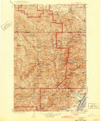
1938 Map of Mt Constance
USGS Topo · Published 1943About this map
Olympic National Park and the surrounding national forest lands dominate this 1930s topographic study, revealing a landscape defined by its glaciated peaks and the network of back-country camps that served early explorers. The map details a transition from the saltwater shoreline of Hood Canal at Eldon to the high alpine environments of the interior, where Lillian Glacier and Anderson Glacier crown the Divide. Evidence of early 20th-century industry is found at the Tubal Cain Mine and Garry Mine, while the administrative presence of the era is marked by numerous remote outposts like the Hamma Hamma Guard Sta and Elkhorn Guard Sta. The drainage systems of the Quinault River and Lillian River provide the primary corridors through the high country, connecting deep basins like Enchanted Valley to the lowlands.
Find a feature on this map
174 named features on this map. Tap any name to fly to it.
Don’t see what you’re looking for? This feature index may not catch every label — zoom into the map to look around manually.
Map Details
Editions of this 1938 Mt Constance Map
4 editions found
Other maps of this area

1918 · Port Angeles
USGS Topo · 1:62,500

1919 · Port Crescent
USGS Topo · 1:62,500

1921 · Satsop
USGS Topo · 1:62,500

1935 · Mount Olympus
USGS Topo · 1:62,500

1936 · Point Misery
USGS Topo · 1:62,500

1938 · Mt Constance
USGS Topo · 1:125,000

1938 · Dungeness
USGS Topo · 1:62,500

1938 · Allyn
USGS Topo · 1:62,500

1939 · Port Townsend
USGS Topo · 1:62,500

1939 · Dungeness
USGS Topo · 1:62,500