1960s Maps of Klickitat County, Washington
Explore 28 historic maps of Klickitat County from the 1960s. These maps offer a rare glimpse into what life looked like during the 1960s — showing old roads, neighborhoods, homes, and landmarks that have changed or disappeared over time.
Whether you're researching your family's past, planning a metal detecting trip, or studying how Klickitat County's landscape evolved across the 1960s, these high-resolution maps are a powerful tool for exploring the history of this region.
- Focus on a specific era: All maps on this page are from the 1960s, giving you a focused view of this time period.
- See what’s changed: Compare century-old streets, trails, and buildings to today's modern landscape using overlays and satellite layers.
- Research with precision: Use these maps for genealogy, historical research, land use analysis, or educational projects.
- View, download, or print: Maps are fully viewable online in high resolution, and can be downloaded or printed for your own records.
Start exploring Klickitat County's history through authentic maps from the 1960s. This is your window into the past.
Klickitat County, WA maps
(28)- 1961 Map of Yakima
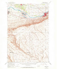
 1961 Yakima1961 Print · USGSCentral Washington thrived in the mid-century as an agricultural powerhouse defined by the Yakima River. Trace local roots through Medicine Valley School, Fort Simcoe, and the rail lines of the Northern Pacific RR.
 - 1962 Map of Phinny Hill, 1963 Print
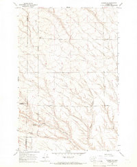
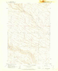 1962 Phinny Hill1963 Print · USGSKlickitat County was a landscape of deep canyons and high ridges in the early sixties. Researchers can trace rural movement along Mercer Road and Peterson Road or locate water sources like Alder Creek and various upland wells.2 unique versions available
 - 1962 Map of Canoe Ridge, 1963 Print
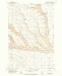
 1962 Canoe Ridge1963 Print · USGSBenton and Klickitat counties appear here in the early sixties, showing a landscape defined by industrial utility and topographic relief. Local historians can trace the paths of Waggoner Road, the prominent Dead Canyon, and early utility infrastructure like the southern Pipeline.2 unique versions available
 - 1962 Map of Alderdale, 1963 Print
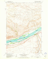
 1962 Alderdale1963 Print · USGSThe Columbia River corridor is captured here in the early sixties, showing the rail-dominated landscape of the Oregon-Washington border. Researchers can trace the dual rail lines of the Spokane Portland and Seattle and Union Pacific through Alderdale and past Thanksgiving Island.2 unique versions available
 - 1962 Map of Douty Canyon, 1963 Print
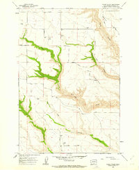
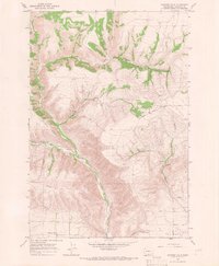
 1962 Douty Canyon1963 Print · USGSKlickitat County ranching and canyon lands are captured here in the early sixties, showing a landscape defined by seasonal water and high ridges. Genealogists and local historians can locate Sixprong Cem and trace livestock routes like Alder Spring Road and Stegeman Road.2 unique versions available
 - 1962 Map of Heppner Junction, 1963 Print
 1962 Heppner Junction1963 Print · USGSThe Columbia River corridor in the early sixties showcases the vital rail and river networks connecting Washington and Oregon. Genealogists and historians can locate Heppner Junction, Sixprong Ranch, and the paths of the Union Pacific and Spokane Portland and Seattle railroads.3 unique versions available
 - 1962 Map of Crider Valley, 1963 Print
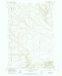
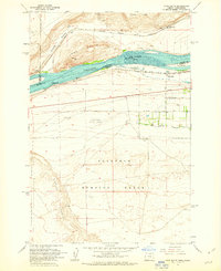
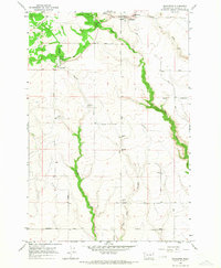
 1962 Crider Valley1963 Print · USGSKlickitat County's high-plateau agriculture is captured here in the early sixties, showing the remote settlement of Hale and the deeply carved Crider Valley. Researchers can trace old family road networks like Matsen Road and locate numerous grain Storage Bins near Alder Creek.2 unique versions available
 - 1962 Map of Crow Butte, 1963 Print
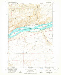
 1962 Crow Butte1963 Print · USGSThe Columbia River serves as a busy transport corridor in the early sixties, marking the border between Washington and Oregon. Researchers can trace historic river landings and military footprints through sites like Toms Camp, Castle Rock, and the Boardman Bombing Range.4 unique versions available
 - 1962 Map of Wood Gulch, 1963 Print
 1962 Wood Gulch1963 Print · USGSThe Columbia River corridor is captured here in the early 1960s, documenting the border between Washington and Oregon. Genealogists can trace family holdings at Goodknight Ranch or Whitmore Ranch while historians study the Union Pacific and Spokane Portland and Seattle rail lines.3 unique versions available
 - 1965 Map of Bluelight, 1966 Print
 1965 Bluelight1966 Print · USGSHigh desert ranching in Yakima and Klickitat counties comes into focus in the mid-sixties, dominated by the Yakima Indian Reservation. Genealogists and historians can trace old homestead sites like Donoho Ranch and the community at Bluelight near the remote Tule Canyon.
 - 1965 Map of Kusshi Creek, 1966 Print
 1965 Kusshi Creek1966 Print · USGSThe Yakima and Klickitat county line comes alive in the mid-sixties, showing a landscape of deep canyons and seasonal water sources. Trace early travel routes like Cemetery Road and Tomith Road or locate landmarks such as Devils Pocket and Lane Spring.
 - 1965 Map of Logy Creek, 1966 Print
 1965 Logy Creek1966 Print · USGSThe central Washington highlands come alive in this mid-sixties survey of the Yakima and Klickitat borderlands. Researchers can trace the old Charlie Wilson Road past Logy Creek Cow Camp and locate family landmarks like Toweatmy Cem.
 - 1965 Map of Poisel Butte, 1966 Print
 1965 Poisel Butte1966 Print · USGSThe high ridges of the Yakima Indian Reservation are captured here in the mid-sixties, showing a landscape defined by seasonal camps and upland roads. Researchers can trace family history through sites like Smina Cem or locate early structures such as Sampson Cabin and Wandlings Lower Camp.
 - 1965 Map of Bluelight, 1966 Print
 1965 Bluelight1966 Print · USGSThe Yakima Valley and the Horse Heaven Hills meet in the 1960s, showing a landscape shaped by the Northern Pacific railroad and sprawling irrigation canals. Genealogists can locate the Glade Cem and Dorothy Sch, or trace old routes like the Chief Jeep Trail and Alderdale Road.
 - 1965 Map of Prosser, 1966 Print
 1965 Prosser1966 Print · USGSThe Yakima Valley in the mid-sixties shows a sophisticated network of canals and rail lines serving the growing communities of Prosser and Grandview. Genealogists and local historians can trace family-named sites like Young Ranch, find Mabton Cem, and locate rural schools such as School No 5.
 - 1965 Map of Logy Creek SW, 1966 Print
 1965 Logy Creek SW1966 Print · USGSThe Yakima and Klickitat county line runs through these high reservation lands in the mid-sixties, where the terrain is dominated by ridges and deep drainages. Researchers can trace the Yakima Indian Reservation Boundary across Simcoe Butte and follow old tracks through Wilson Charley Canyon.
 - 1965 Map of Prosser SE, 1966 Print
 1965 Prosser SE1966 Print · USGSThe Benton County uplands in the mid-1960s reveal a landscape of deep drainage canyons and isolated ranching outposts. Researchers can trace historic property boundaries and water infrastructure along Young Road and Coyote Canyon, or locate the site of Youngs Ranch.
 - 1965 Map of Tule Prong, 1966 Print
 1965 Tule Prong1966 Print · USGSThe high plateau of the Yakima and Klickitat border region is captured here in the mid-1960s, showing the intersection of tribal lands and rural ranching. Researchers can locate the Glade Cem, the Dorothy Sch, and numerous named landmarks like Sand Ridge.
 - 1965 Map of Poisel Butte SW, 1966 Print
 1965 Poisel Butte SW1966 Print · USGSThe high plateaus and deep canyons of south-central Washington are captured here in the mid-1960s as they span the border of Yakima and Klickitat counties. Researchers can trace the Reservation Boundary and locate the Onepennee Cem or travel the length of So Happy Road.
 - 1965 Map of Hagerty Butte, 1967 Print
 1965 Hagerty Butte1967 Print · USGSThe high ridges of the Yakima and Klickitat county line are captured here in the mid-1960s, showing a landscape defined by reservation boundaries and forest management. Researchers can trace the locations of seasonal outposts like Featherbed Camp and the Kaiser Butte Guard Station.
 - 1965 Map of Poisel Butte SE, 1967 Print
 1965 Poisel Butte SE1967 Print · USGSThe high country along the Yakima and Klickitat border comes into focus in this mid-sixties survey. Genealogists and local historians can trace family-named routes and burial sites like Ferguson Road, Beaver Cem, and the remote Wandlings Lower Camp.
 - 1965 Map of Prosser SW, 1967 Print
 1965 Prosser SW1967 Print · USGSThe high plateau and deep canyons of south-central Washington are captured in the mid-1960s, showing the dramatic border between Yakima and Klickitat counties. Genealogists and researchers can trace old routes like Poeckes Road and Dead Canyon Road along the winding banks of Glade Creek.
 - 1965 Map of Goodnoe Hills, 1967 Print
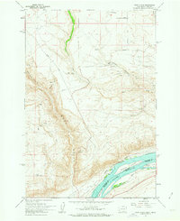
 1965 Goodnoe Hills1967 Print · USGSKlickitat County's high plateaus and deep canyons are captured here in the mid-sixties, showing the rugged transition between the hills and the river breaks. Researchers can trace historic access routes like Newell Grade Road and locate sites such as Rassmusson and Goodnoe Hills.
 - 1965 Map of Stagman Butte, 1967 Print
 1965 Stagman Butte1967 Print · USGSThe Yakima Indian Reservation highlands are shown here in the mid-1960s, documenting a remote landscape of forestry and treaty lands. Trace old mountain access routes like the Satus Ranger Station Road to landmarks such as Castle Rock, Telephone Camp, and Tadpole Lake.
 - 1965 Map of Bickleton, 1967 Print
 1965 Bickleton1967 Print · USGSBickleton and Cleveland stand as central rural hubs in Klickitat County during the mid-sixties, surrounded by a high-plateau network of named ranch roads. Genealogists and historians can locate specific landmarks like the Big Horn Sch, the local Rodeo Grounds, and the winding course of Wood Gulch.
Showing maps 1-25 of 28
Top cities of Klickitat County
- Goldendale historical maps
- White Salmon historical maps
- Bingen historical maps
- Bickleton historical maps
Frequently asked questions
- What are the different types of historical maps available for Klickitat County?
- What is the oldest map of Klickitat County?
- Where can I purchase historical maps of Klickitat County for my home or office?
- Where can I download high-res historical maps of Klickitat County?
- Are there historical topographic maps available for Klickitat County?
- Is there historical aerial imagery available for Klickitat County?
- Where are historical maps of Klickitat County sourced from?