1980s Maps of Klickitat County, Washington
Explore 21 historic maps of Klickitat County from the 1980s. These maps offer a rare glimpse into what life looked like during the 1980s — showing old roads, neighborhoods, homes, and landmarks that have changed or disappeared over time.
Whether you're researching your family's past, planning a metal detecting trip, or studying how Klickitat County's landscape evolved across the 1980s, these high-resolution maps are a powerful tool for exploring the history of this region.
- Focus on a specific era: All maps on this page are from the 1980s, giving you a focused view of this time period.
- See what’s changed: Compare century-old streets, trails, and buildings to today's modern landscape using overlays and satellite layers.
- Research with precision: Use these maps for genealogy, historical research, land use analysis, or educational projects.
- View, download, or print: Maps are fully viewable online in high resolution, and can be downloaded or printed for your own records.
Start exploring Klickitat County's history through authentic maps from the 1980s. This is your window into the past.
Klickitat County, WA maps
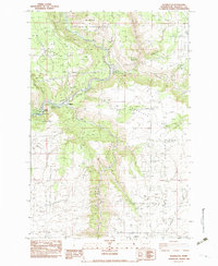
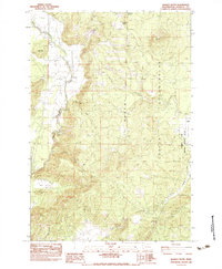
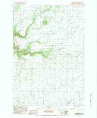
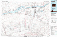
(21)- 1980 Map of Goldendale, 1981 Print
 1980 Goldendale1981 Print · USGSThe Columbia River corridor in the 1980s was a critical junction of rail, water, and highway commerce between Washington and Oregon. Genealogists and historians can trace riverside settlements like Wishram, high-country towns like Bickleton, and the grounds of the Maryhill Museum.
 - 1982 Map of Hood River, 1983 Print
 1982 Hood River1983 Print · USGSThe Columbia River Gorge in the early eighties shows a landscape shaped by massive hydroelectric projects and deep-rooted timber communities. Researchers can trace the rail-and-river network through Cascade Locks and The Dalles Dam, or explore the terrain of Gifford Pinchot National Forest.
 - 1983 Map of Indian Rock
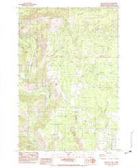
 1983 Indian Rock1983 Print · USGSHigh in the Simcoe Mountains during the early eighties, this survey captures the intersection of tribal lands and regional infrastructure. Trace the physical layout of the Yakima Indian Reservation boundary near Indian Rock and Morehead Spring.
 - 1983 Map of Grayback Mtn
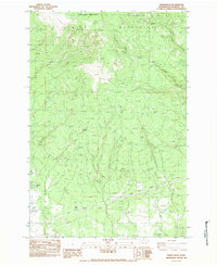
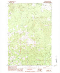
 1983 Grayback Mtn1983 Print · USGSKlickitat County was a landscape of managed wildlife areas and high-country timber camps in the early eighties. Researchers can trace the legacy of local industry and transit through the Old Railway Grade, Koldera Camp, and the Wood Pole Telephone Line.
 - 1983 Map of Appleton
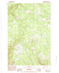 1983 Appleton1983 Print · USGSKlickitat County was a landscape of remote settlements and vital water sources in the early eighties. Researchers can trace the rural infrastructure of Appleton and Snowden or locate isolated landmarks such as the AIRSTRIP and Baker Spring.
 - 1983 Map of Wahkiacus
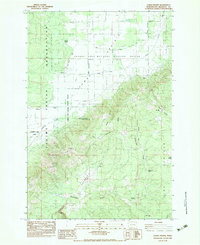
 1983 Wahkiacus1983 Print · USGSThe Klickitat River canyon and its high plateau prairies are captured here in the early 1980s. Local researchers can trace the confluence near Wahkiacus and identify early land features like The Tepee, Maddock Springs, and the deep cut of Swale Canyon.
 - 1983 Map of Quigley Butte
 1983 Quigley Butte1983 Print · USGSKlickitat County during the late seventies is captured here as a landscape of high-elevation prairies and tribal lands. Researchers can trace the boundaries of the Yakima Indian Reservation and locate old settlement points like Holmes and Laurel near the Camas Prairie wetlands.
 - 1983 Map of Dead Canyon
 1983 Dead Canyon1983 Print · USGSThe high plateau country of southern Washington is captured here in the early eighties, where the Yakima Indian Reservation meets the Klickitat River. Researchers can trace dozens of family-named water sources and landmarks including Wellenbrock Spring, Myling Spring, and Simmons Creek.
 - 1983 Map of Klickitat
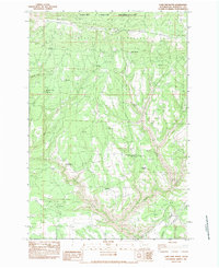
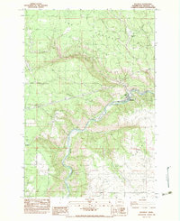 1983 Klickitat1983 Print · USGSThe river canyon and timber country of south-central Washington are captured here in the early eighties as industrial operations and small settlements shaped the landscape. Trace the footprints of Woodruff Mill, the community of Pitt, and family landmarks like Shippey Meadows.
 - 1983 Map of Luna Butte
 1983 Luna Butte1983 Print · USGSKlickitat County as it appeared in the early eighties shows a rugged landscape defined by the Klickitat Valley and the Columbia Hills. Trace the course of the Little Klickitat River or locate remote landmarks like Luna Butte.
 - 1983 Map of White Pine Buttes
 1983 White Pine Buttes1983 Print · USGSKlickitat County's high country is captured here in the early eighties, showing a landscape defined by volcanic buttes and historic territorial markers. Researchers can trace the legacy of the region through the A J Bolon Historic Mon, Brownlee Corrals, and seasonal waters like Pretty Swamp.
 - 1983 Map of Guler Mtn
 1983 Guler Mtn1983 Print · USGSKlickitat County as it appeared in the early 1980s reveals a landscape of volcanic caves and early timber sites. You can trace the locations of the Gablehouse Mill (Site) or explore the unique geology of Cheese Cave and the Lava Bridge.
 - 1983 Map of Camas Prairie
 1983 Camas Prairie1983 Print · USGSCamas Prairie and the slopes of the Cascade foothills are captured here in the early eighties as conservation and reservation lands intersect. Researchers can locate significant sites like the Whitcomb Cabin, the Dunkard Graveyard, and the Liberty Bond site.
 - 1983 Map of Goldendale
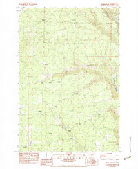
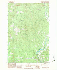
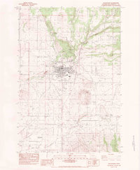 1983 Goldendale1983 Print · USGSGoldendale and the surrounding Klickitat Valley are seen here in the early 1980s, showcasing the region's agricultural and transit corridors. Researchers can trace the Single Track RR past Hamilton or locate the Astronomical Observatory and Bloodgood Spring.
 - 1983 Map of Lone Pine Butte
 1983 Lone Pine Butte1983 Print · USGSThe Simcoe Mountains of Klickitat County are captured here in the early eighties, showcasing a landscape defined by high ridges and cattle-range infrastructure. Researchers can locate the Holderman Camp (Site) and important water sources like Tumwater Corral Spring and Bear Spring.
 - 1983 Map of Centerville
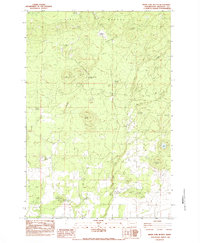
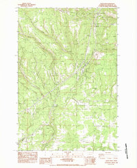
 1983 Centerville1983 Print · USGSCenterville and the high prairies of Klickitat County are documented here in the early eighties as the agricultural valley floor meets the river breaks. Researchers can trace the layout of Blockhouse, locate the Goldendale Trout Hatchery, and find the old Drive In Theater.
 - 1983 Map of Northwestern Lake
 1983 Northwestern Lake1983 Print · USGSThe White Salmon River canyon in the early eighties serves as a rugged backdrop for timber and utility infrastructure. Genealogists and hikers can locate the B Z Corner settlement, the Nestor Peak Look Out House, and the historic Lumber Flume.
 - 1983 Map of Satus Pass
 1983 Satus Pass1983 Print · USGSThe high plateau of Klickitat County during the early eighties is mapped here at the boundary of the reservation. Genealogists and historians can trace the remote landscape around Satus Pass, Brooks Memorial State Park, and the headwaters of the Little Klickitat River.
 - 1983 Map of Husum
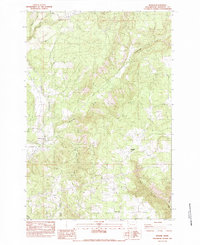 1983 Husum1983 Print · USGSKlickitat County as it appeared in the early eighties shows a landscape of river-valley settlements and upland creeks. Trace family roots and local history near Husum, McCoy Flat, or the slopes of Locke Hill.
 - 1983 Map of Luna Gulch
 1983 Luna Gulch1983 Print · USGSKlickitat County as it appeared in the early eighties shows a landscape of riverfront settlements and high-plateau agriculture. Trace the community at Towal on the Columbia River and locate family landmarks like the Grange Hall and local Cem.
 - 1984 Map of Hermiston
 1984 Hermiston1984 Print · USGSThe Columbia River basin in the 1980s reveals a landscape of massive infrastructure, from hydroelectric dams to expansive military depots. Researchers can trace the industrial footprint of the Umatilla Ordnance Depot or locate historic rail hubs at Hinkle and Stanfield.2 unique versions available
End of results
Showing maps 1-21 of 21
Top cities of Klickitat County
- Goldendale historical maps
- White Salmon historical maps
- Bingen historical maps
- Bickleton historical maps
Frequently asked questions
- What are the different types of historical maps available for Klickitat County?
- What is the oldest map of Klickitat County?
- Where can I purchase historical maps of Klickitat County for my home or office?
- Where can I download high-res historical maps of Klickitat County?
- Are there historical topographic maps available for Klickitat County?
- Is there historical aerial imagery available for Klickitat County?
- Where are historical maps of Klickitat County sourced from?