1990s Maps of Klickitat County, Washington
Explore 19 historic maps of Klickitat County from the 1990s. These maps offer a rare glimpse into what life looked like during the 1990s — showing old roads, neighborhoods, homes, and landmarks that have changed or disappeared over time.
Whether you're researching your family's past, planning a metal detecting trip, or studying how Klickitat County's landscape evolved across the 1990s, these high-resolution maps are a powerful tool for exploring the history of this region.
- Focus on a specific era: All maps on this page are from the 1990s, giving you a focused view of this time period.
- See what’s changed: Compare century-old streets, trails, and buildings to today's modern landscape using overlays and satellite layers.
- Research with precision: Use these maps for genealogy, historical research, land use analysis, or educational projects.
- View, download, or print: Maps are fully viewable online in high resolution, and can be downloaded or printed for your own records.
Start exploring Klickitat County's history through authentic maps from the 1990s. This is your window into the past.
Klickitat County, WA maps
(19)- 1993 Map of Canoe Ridge
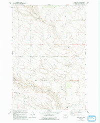
 1993 Canoe Ridge1993 Print · USGSThe arid borderlands of Benton and Klickitat counties are captured in the early 1990s, showing a landscape of deep coulees and industrial markers. Trace the path of Dead Canyon and find isolated features like the Landing Strip and Quarry Butte.
 - 1993 Map of Crow Butte
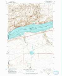
 1993 Crow Butte1993 Print · USGSThe Columbia River frontier of the early nineties is captured here as a landscape of recreation and defense. Trace the development of Crow Butte State Park or the military boundaries of the Naval Weapons Systems Training Facility.
 - 1993 Map of Phinny Hill
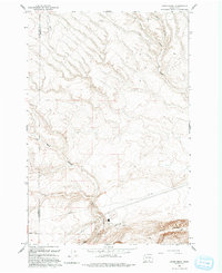
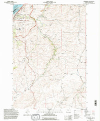
 1993 Phinny Hill1993 Print · USGSIn the early nineties, the high country of Klickitat County remained a land of deep canyons and isolated homesteads. Researchers can locate the Alderdale settlement and trace family sites like Graves and landmarks including Phinny Hill.
 - 1993 Map of Golgotha Butte
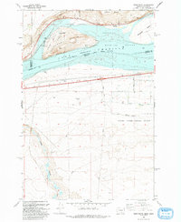
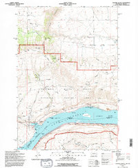
 1993 Golgotha Butte1993 Print · USGSThe Columbia River frontier along the Washington and Oregon border is captured here in the early nineties. Researchers can trace the isolated settlement of Sixprong, find the Landing Strip near the canyon floors, and locate the Gravel Pit and riverfront Boat Ramp.
 - 1994 Map of Wishram, 1995 Print
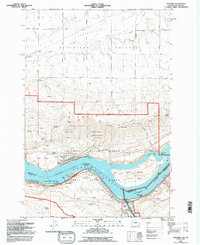 1994 Wishram1995 Print · USGSThe Columbia River corridor in the mid-nineties shows a landscape of sharp vertical relief and critical rail junctions. Researchers can trace the riverfront developments of Wishram and Celilo Village or find family landmarks like the Centerville Cem and Warwick.
 - 1994 Map of The Dalles North, 1995 Print
 1994 The Dalles North1995 Print · USGSThe Columbia River Gorge was a hub of transit and industry in the mid-nineties, where Washington and Oregon meet. Researchers can trace the river's industrial past through the Aluminum Plant and The Dalles Municipal Airport, or find family sites like Wish-Ham Cem and Lone Pine Cemetery.
 - 1994 Map of Petersburg, 1995 Print
 1994 Petersburg1995 Print · USGSMid-nineties Wasco County is shown here at the intersection of massive Columbia River energy projects and traditional wheat farming. Genealogists and local historians can trace family roots at Eightmile Cem or locate old rail-side landmarks like the Rice Grain Elevator.
 - 1994 Map of Stacker Butte, 1995 Print
 1994 Stacker Butte1995 Print · USGSThe Columbia River Gorge transitioned toward a protected scenic landscape in the 1990s as modern recreation took root along the river. Trace historical river navigation and local landmarks from Memaloose Island to the heights of Stacker Butte and the shores of Lake Celilo.
 - 1994 Map of Appleton, 1995 Print
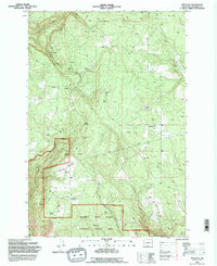 1994 Appleton1995 Print · USGSKlickitat County as it appeared in the mid-1990s reveals a high-country landscape of forest boundaries and pioneer-named water sources. Local historians can trace the early footprints of Appleton and Snowden alongside features like the Landing Strip and Baker Spring.
 - 1994 Map of The Dalles South, 1995 Print
 1994 The Dalles South1995 Print · USGSThe Dalles and Dallesport are shown in the mid-1990s as the river economy transitioned into the modern era. Genealogists can locate historic burial sites like GAR Cem and Masonic Cem while tracing the Union Pacific rail corridor.
 - 1994 Map of Biggs Junction, 1995 Print
 1994 Biggs Junction1995 Print · USGSThe Columbia River corridor is captured here in the mid-nineties, showing the vital connection between Maryhill, Washington and Biggs Junction, Oregon. Trace the cultural and transit history of the gorge through landmarks like the Stonehenge Memorial, the Maryhill Museum, and the rail-and-road hub at Rufus.
 - 1994 Map of Hood River, 1996 Print
 1994 Hood River1996 Print · USGSThe Columbia River Gorge area in the mid-1990s reflects a landscape shaped by orchards, timber, and the river economy. Genealogists and historians can trace family locations through Idelwild Cem, Frankton Sch, and the settlements of Underwood and Rockford.
 - 1994 Map of Lyle, 1996 Print
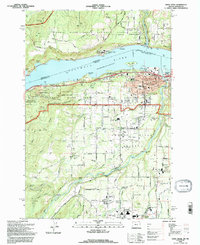
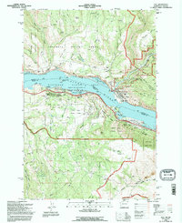 1994 Lyle1996 Print · USGSThe Columbia River Gorge in the mid-1990s shows the bustling confluence at Lyle and the transition into the Columbia Hills. Researchers can trace the riverfront rail lines, locate the Lyle Cemetery, and explore the shoreline from Rowland Lake to Chamberlain Lake.
 - 1994 Map of White Salmon, 1996 Print
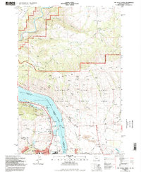
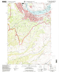
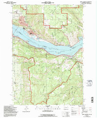 1994 White Salmon1996 Print · USGSThe Columbia River Gorge comes to life in the mid-1990s as it winds between the growing communities of White Salmon, Washington, and Hood River, Oregon. Researchers can trace local landmarks like Skyline Hospital, Pine Grove School, and the historic Mosier Cem along the southern river bluffs.
 - 1994 Map of Husum, 1996 Print
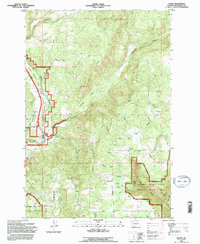 1994 Husum1996 Print · USGSKlickitat County as it appeared in the mid-nineties shows the interplay of forest management and river life. Researchers can trace land patterns near Husum and Gilmer, locate family landmarks like Mc Coy Flat, and follow the White Salmon Wild and Scenic River.
 - 1994 Map of Northwestern Lake, 1997 Print
 1994 Northwestern Lake1997 Print · USGSKlickitat County was a landscape of forest lookouts and river canyons in the mid-nineties. You can trace early timber and utility infrastructure at BZ Corner, Nestor Peak Lookout, and the Concrete Dam along Wilson Creek.
 - 1998 Map of Guler Mountain, 2003 Print
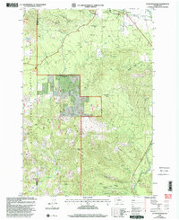 1998 Guler Mountain2003 Print · USGSThe timber and recreation lands of Klickitat County are documented here in the late nineties as the forest transition was well underway. Researchers can locate former industrial footprints like Gablehouse Mill (Site) or unique geologic landmarks including Butter Cave and Lava Bridges.
 - 1998 Map of King Mountain, 2003 Print
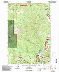
 1998 King Mountain2003 Print · USGSThe Yakama Nation lands and Gifford Pinchot Forest met in the late nineties along a landscape shaped by volcanic flows. Researchers can trace land boundaries and recreation sites like Smith Butte Sno-Park, King Mountain, and the Aiken Lava Bed.
 - 1998 Map of Trout Lake, 2003 Print
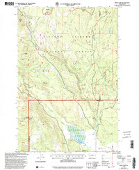 1998 Trout Lake2003 Print · USGSTrout Lake and the Gifford Pinchot National Forest are captured here in the late nineties as a hub of mountain recreation and forestry. Researchers can trace the White Salmon River past the Wicky Creek Shelter and the historic Flattop Lookout.
End of results
Showing maps 1-19 of 19
Top cities of Klickitat County
- Goldendale historical maps
- White Salmon historical maps
- Bingen historical maps
- Bickleton historical maps
Frequently asked questions
- What are the different types of historical maps available for Klickitat County?
- What is the oldest map of Klickitat County?
- Where can I purchase historical maps of Klickitat County for my home or office?
- Where can I download high-res historical maps of Klickitat County?
- Are there historical topographic maps available for Klickitat County?
- Is there historical aerial imagery available for Klickitat County?
- Where are historical maps of Klickitat County sourced from?