Old Maps of Waukon, Washington for Academic Research
Study the evolution of Waukon with 11 high-resolution historic maps. Whether you're teaching, researching, or modeling changes in land use, these maps provide essential visual documentation of urban, environmental, and geographic change.
- Analyze long-term change: Track patterns in development, transportation, and natural features.
- Ideal for environmental or urban studies: Support academic projects with primary historical map data.
- Use in the classroom or lab: Educators and researchers rely on these maps to bring historical context to life.
These maps are a powerful tool for teaching, research, and visualizing how Waukon has changed over the decades.
Waukon, WA maps
(11)- 1945 Map of Reardan
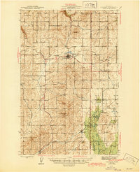 1945 Reardan1945 Print · USGSThe Lincoln County plateau in the mid-forties was a vital crossroads of the Great Northern and Northern Pacific railroads. Genealogists can locate family landmarks like District School No 1, Pleasant View Cem, and the high point of Hanning Butte.2 unique versions available
 - 1953 Map of Reardan, 1954 Print
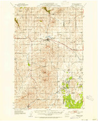 1953 Reardan1954 Print · USGSThe Lincoln County wheat country near the Spokane border is captured here during the early fifties as the region's rural social life thrived. Researchers can trace the rail-and-road network connecting Reardan and Edwall, finding local landmarks like the Pleasant View Cem and West Deep Creek Grange.2 unique versions available
 - 1955 Map of Spokane, 1965 Print
 1955 Spokane1965 Print · USGSInland Empire life in the fifties and sixties centers on the growth of Spokane and the heavy mining industry of northern Idaho. Trace mid-century landmarks like Fairchild Air Force Base, the Bunker Hill Mine, and early campuses such as Gonzaga University.2 unique versions available
 - 1958 Map of Spokane
 1958 Spokane1958 Print · USGSThe Inland Empire is shown at a mid-century peak of industrial and military activity, from the rail hubs of Spokane to the deep silver mines of northern Idaho. Researchers can trace the sprawling rail lines of the Union Pacific RR or locate landmarks like Fairchild Air Force Base and the Bunker Hill Smelter & Mine.
 - 1973 Map of Waukon, 1977 Print
 1973 Waukon1977 Print · USGSThe rural borderlands of Lincoln and Spokane counties come into focus during the early 1970s, showing a landscape shaped by dryland farming and rail transport. Researchers can locate the Waukon Grain Elevator, trace the Old Railroad Grade, and find local landmarks like the Grange Hall.
 - 1987 Map of Spokane
 1987 Spokane1987 Print · USGSGreater Spokane and its surrounding prairies are captured in the late 1980s as the region solidified its role as a regional hub. Researchers can trace family sites near Medical Lake, military life at Fairchild Air Force Base, and rural settlements like Peone and Chattaroy.
 - 2011 Map of Waukon, 2011 Print
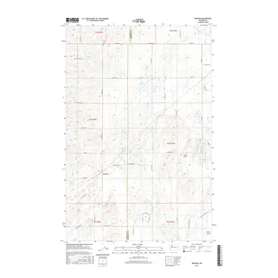
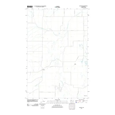 2011 Waukon2011 Print · USGSCovers Waukon, including Spokane County, Lincoln County, and other nearby areas
 - 2014 Map of Waukon, 2014 Print
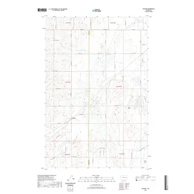
 2014 Waukon2014 Print · USGSCovers Waukon, including Spokane County, Lincoln County, and other nearby areas
 - 2017 Map of Waukon, 2017 Print
 2017 Waukon2017 Print · USGSCovers Waukon, including Spokane County, Lincoln County, and other nearby areas
 - 2020 Map of Waukon, 2020 Print
 2020 Waukon2020 Print · USGSCovers Waukon, including Spokane County, Lincoln County, and other nearby areas
 - 2023 Map of Waukon, 2023 Print
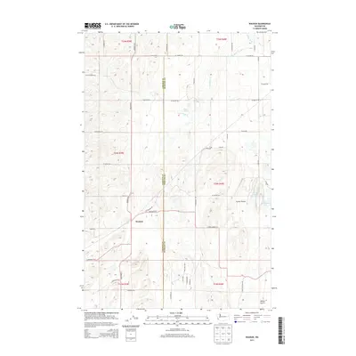
 2023 Waukon2023 Print · USGSSpokane County's rural agricultural landscape is documented here in the early twenty-first century. Genealogists and local historians can trace family-named routes and vanished connections like Waukon, Tucker Prairie, and Denny Station Rd E.
End of results
Showing maps 1-11 of 11
Top cities near Waukon
Frequently asked questions
- What are the different types of historical maps available for Waukon?
- What is the oldest map of Waukon?
- Where can I purchase historical maps of Waukon for my home or office?
- Where can I download high-res historical maps of Waukon?
- Are there historical topographic maps available for Waukon?
- Is there historical aerial imagery available for Waukon?
- Where are historical maps of Waukon sourced from?