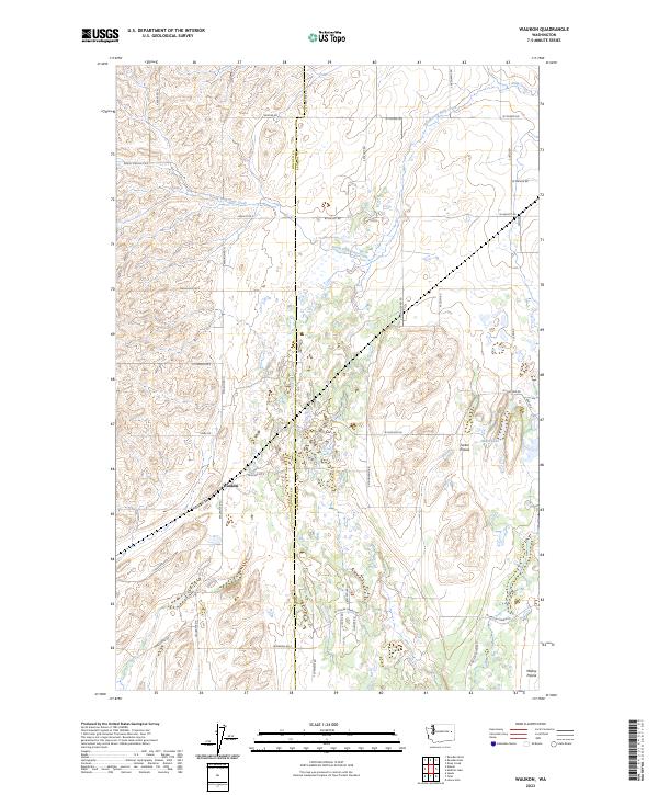
2023 Map of Waukon
USGS Topo · Published 2023About this map
Waukon serves as the central point of interest in this agricultural landscape on the border of Lincoln and Spokane Counties. The terrain is characterized by broad expanses such as Tucker Prairie and Malloy Prairie, which are defined by a network of rural roads bearing local family and locational names. The hydrology of the area is centered on the South Fork Deep Creek and Deep Creek, along with smaller features like Hedin Lake and Willow Springs. The grid of section lines and range boundaries, including t24n r39e and t24n r40e, illustrates the systematic land division of the region. Researchers can trace the legacy of local transport and settlement through named thoroughfares such as Denny Station Rd E and W Malloy Prairie Rd, which hint at the former railroad and prairie connections that once linked these isolated farmsteads.
Find a feature on this map
44 named features on this map. Tap any name to fly to it.
Don’t see what you’re looking for? This feature index may not catch every label — zoom into the map to look around manually.
Map Details
Editions of this 2023 Waukon Map
This is the sole edition of this map. No revisions or reprints were ever made.
Other maps of this area

1943 · Medical Lake
USGS Topo · 1:62,500

1945 · Reardan
USGS Topo · 1:62,500

1953 · Reardan
USGS Topo · 1:62,500

1954 · Medical Lake
USGS Topo · 1:24,000

1954 · Medical Lake
USGS Topo · 1:62,500

1954 · Cheney
USGS Topo · 1:62,500

1954 · Sprague
USGS Topo · 1:62,500

1954 · Deep Creek
USGS Topo · 1:24,000

1955 · Spokane
USGS Topo · 1:250,000

1958 · Spokane
USGS Topo · 1:250,000