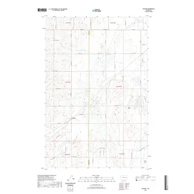
2020 Map of Waukon
USGS Topo · Published 2020About this map
Waukon sits at the heart of this high-plateau landscape, where the agricultural traditions of eastern Washington meet the geographic transition between Lincoln and Spokane counties. The area is defined by broad expanses like Tucker Prairie and Malloy Prairie, which reflect the region's long-standing reliance on open-land farming and ranching. Water is a critical but localized resource here, appearing in the drainage of S Fork Deep Cr and N Fork Deep Cr, alongside seasonal features such as Hedin Lake and the aptly named Willon Springs. The map reveals a highly structured grid of section roads named for local families and landmarks, such as Denny Station Rd E and W Tucker Prairie Rd, illustrating how the early 20th-century homesteading patterns have evolved into a modern rural transportation network.
Find a feature on this map
43 named features on this map. Tap any name to fly to it.
Don’t see what you’re looking for? This feature index may not catch every label — zoom into the map to look around manually.
Map Details
Editions of this 2020 Waukon Map
This is the sole edition of this map. No revisions or reprints were ever made.
Other maps of this area

1943 · Medical Lake
USGS Topo · 1:62,500

1945 · Reardan
USGS Topo · 1:62,500

1953 · Reardan
USGS Topo · 1:62,500

1954 · Medical Lake
USGS Topo · 1:24,000

1954 · Medical Lake
USGS Topo · 1:62,500

1954 · Cheney
USGS Topo · 1:62,500

1954 · Sprague
USGS Topo · 1:62,500

1954 · Deep Creek
USGS Topo · 1:24,000

1955 · Spokane
USGS Topo · 1:250,000

1958 · Spokane
USGS Topo · 1:250,000