1990s Maps of Pend Oreille County, Washington
Explore 34 historic maps of Pend Oreille County from the 1990s. These maps offer a rare glimpse into what life looked like during the 1990s — showing old roads, neighborhoods, homes, and landmarks that have changed or disappeared over time.
Whether you're researching your family's past, planning a metal detecting trip, or studying how Pend Oreille County's landscape evolved across the 1990s, these high-resolution maps are a powerful tool for exploring the history of this region.
- Focus on a specific era: All maps on this page are from the 1990s, giving you a focused view of this time period.
- See what’s changed: Compare century-old streets, trails, and buildings to today's modern landscape using overlays and satellite layers.
- Research with precision: Use these maps for genealogy, historical research, land use analysis, or educational projects.
- View, download, or print: Maps are fully viewable online in high resolution, and can be downloaded or printed for your own records.
Start exploring Pend Oreille County's history through authentic maps from the 1990s. This is your window into the past.
Pend Oreille County, WA maps
(34)- 1992 Map of Timber Mtn., 1996 Print
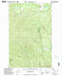
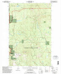 1992 Timber Mtn.1996 Print · USGSPend Oreille County in the early 1990s is shown as a preserved landscape of national forests and wildlife refuges. Researchers can locate remote industrial sites like the High Noon Mine and the fire observation post at Timber Mtn Lookout.
 - 1992 Map of Aladdin Mtn, 1996 Print
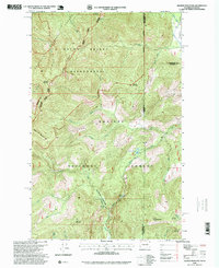
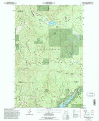 1992 Aladdin Mtn1996 Print · USGSThe northern reaches of the Colville National Forest are documented here in the early nineties, revealing a landscape defined by mountain ridges and mining claims. Researchers can locate remote industrial sites like Aladdin Mine and Middleport Mine or trace the shorelines of Lake Thomas and Big Meadow Lake.
 - 1992 Map of Tacoma Peak, 1996 Print
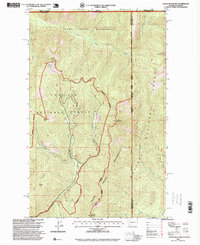
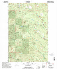 1992 Tacoma Peak1996 Print · USGSThe high timberlands of Pend Oreille County are captured here in the 1990s as the Forest Service managed the rugged border with Stevens County. Researchers can trace the drainage of Tacoma Creek and locate landmarks like Boulder Mtn, Calispell Peak, and Dirty Shirt.
 - 1992 Map of Ione, 1996 Print
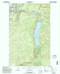
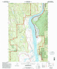
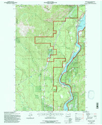
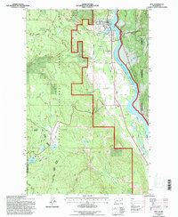 1992 Ione1996 Print · USGSPend Oreille County in the early 1990s was a landscape of deep timber and riverside industry. Trace the tracks of the Pend Oreille Valley Railroad through Ione and find several mountain waters like Lake Leo and Sullivan Lake.
 - 1992 Map of Metaline Falls, 1996 Print
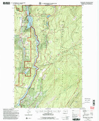
 1992 Metaline Falls1996 Print · USGSMetaline Falls and the rugged Selkirk foothills are captured here in the early nineties as a hub of mining and river power. Researchers can trace local industrial history through the Aerial Tramway and Grandview Mine or locate family sites at Pend Oreille Village and the IOOF Cem.
 - 1992 Map of Calispell Peak, 1996 Print
 1992 Calispell Peak1996 Print · USGSHigh Selkirk ridges and protected wildlife corridors define this area of Northeast Washington in the early nineties. Researchers can trace land use through alpine clearings like Hartill Meadows and family-named landmarks near Calispell Peak and Phillips Lake.
 - 1992 Map of Goddards Peak, 1996 Print
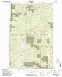
 1992 Goddards Peak1996 Print · USGSThe Stevens County high country is shown here in the early nineties, centered on the heights of the Selkirk Mountains. Trace the development of the 49° North Ski Area or locate family-named landmarks like Johnson Mtn and Bell Meadow Springs.
 - 1992 Map of Nelson Peak, 1996 Print
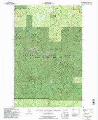
 1992 Nelson Peak1996 Print · USGSThe Stevens County mountains in the early nineties show a landscape of timber management and recreation at the edge of the national forest. Researchers can trace forest access roads to sites like Camp Hafer, Kenwood Ranch, and the waters of Deer Lake.
 - 1992 Map of Deep Lake, 1996 Print
 1992 Deep Lake1996 Print · USGSThe Stevens and Pend Oreille county line comes alive in the 1990s, showing a landscape defined by mountain mines and forest meadows. Trace historical mining operations at Thompson Wolf Mine or locate high-altitude clearings like Peterson Clearing and Smackout Valley.
 - 1992 Map of Cusick, 1996 Print
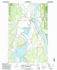 1992 Cusick1996 Print · USGSThe Pend Oreille River valley during the early nineties shows a landscape of riverfront settlements and managed forest lands. Genealogists and local historians can locate civic landmarks like the County Fairground, the Kalispel Indian Reservation, and the town of Usk.2 unique versions available
 - 1992 Map of Aladdin, 1996 Print
 1992 Aladdin1996 Print · USGSDeep in the mountains of Stevens County in the 1990s, this area reflects a landscape of remote mining and forest service history. Researchers can trace the location of the Morning Mine, the Bon Ayre School, and the small settlement of Aladdin.
 - 1992 Map of Winchester Peak, 1996 Print
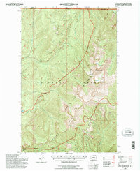
 1992 Winchester Peak1996 Print · USGSThe high timberlands of the Selkirk Mountains come into focus in the early nineties, showcasing a rugged watershed divided between two counties. Researchers can trace the winding Flowery Trail and follow the headwaters of Winchester Creek and Calispell Creek.
 - 1992 Map of Ruby, 1996 Print
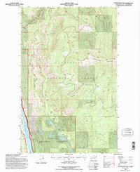
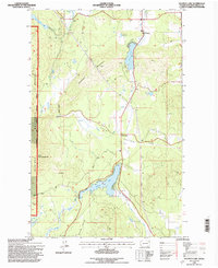
 1992 Ruby1996 Print · USGSPend Oreille County's river-fed valley and high mountain meadows are documented here in the early nineties. Researchers can trace the Diamond City (Site), follow Ruby Ferry Road, and locate family-named spots like Henry Brown Meadow.
 - 1992 Map of Jared, 1996 Print
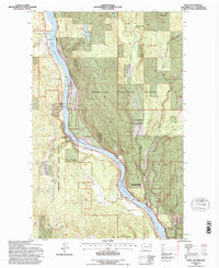
 1992 Jared1996 Print · USGSPend Oreille County's river valley is documented here in the early 1990s as it winds through tribal lands and timber country. Local historians can locate the Silver King Mine, the USAF Survival School, and early community centers like the Grange Hall and Locke.
 - 1992 Map of Gypsy Peak, 1996 Print
 1992 Gypsy Peak1996 Print · USGSThe international border and the high peaks of the Colville National Forest are documented here in the early nineties. Researchers can trace the drainage of Slate Creek or locate the remote Lead Hill Mine and the summit of Gypsy Peak.
 - 1992 Map of Scotchman Lake, 1996 Print
 1992 Scotchman Lake1996 Print · USGSThe Pend Oreille River valley and the interior wilderness of the Colville National Forest are captured here in the early nineties. Researchers can trace forest roads to high-country landmarks like Molybdenum Mountain, Deception Lake, and Scotchman Lake.
 - 1992 Map of Lake Gillette, 1996 Print
 1992 Lake Gillette1996 Print · USGSIn the early nineties, Stevens County served as a major wildlife corridor between the Colville and Kaniksu National Forests. Researchers can trace water levels and timber access roads near Lake Gillette, Scrabblers Flat, and the Little Pend Oreille River.
 - 1992 Map of Boyer Mtn, 1997 Print
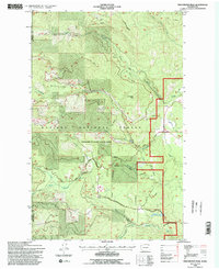
 1992 Boyer Mtn1997 Print · USGSThe high timber and alpine peaks of Pend Oreille County are documented here in the early 1990s as part of the Colville National Forest management area. Trace old mining sites such as Prospects near Power Lake and the ridgelines of Boyer Mountain.2 unique versions available
 - 1992 Map of Metaline, 1997 Print
 1992 Metaline1997 Print · USGSPend Oreille County industry and settlement meet the deep woods of the Northeast in the early nineties. Researchers can trace the river economy near Metaline and Box Canyon Dam or locate local landmarks like Perkins Cem and the Bella May Mine.
 - 1992 Map of Boundary Dam, 1997 Print
 1992 Boundary Dam1997 Print · USGSThe northern edge of Washington meets British Columbia along the Pend Oreille River in the early nineties, a landscape defined by power generation and deep-earth mining. Researchers can trace historic extraction sites like the Riverside Mine and Morning Mine or locate geologic landmarks such as Crawford Cave.2 unique versions available
 - 1992 Map of Sacheen Lake, 1997 Print
 1992 Sacheen Lake1997 Print · USGSPend Oreille County in the early nineties reveals a landscape of working forests and lakeside retreats. Genealogists and historians can trace the development of Deer Valley, locate Camp Spaulding on Davis Lake, or find the old Ski Lift near Sacheen Lake.
 - 1992 Map of Abercrombie Mtn, 1997 Print
 1992 Abercrombie Mtn1997 Print · USGSThe high peaks of the Colville National Forest stand along the Canadian border in the early nineties. Geologists and local historians can trace legacy industrial sites like Gold Hill Mine, the north end of Sullivan Lake, and the remote Hooknose Lake.
 - 1996 Map of Gleason Mountain, 1999 Print
 1996 Gleason Mountain1999 Print · USGSThe northern borderlands of Washington and Idaho are captured in the 1990s as a landscape of timber and mining. Trace old claims at the Last Chance Mine or explore the drainage of Kalispell Creek and the Bath Creek Gorge.
 - 1996 Map of Helmer Mountain, 1999 Print
 1996 Helmer Mountain1999 Print · USGSThe Washington-Idaho borderlands in the 1990s remained a vast wilderness of high peaks and ancient forests. Researchers can trace the protected Roosevelt Grove of Ancient Cedars, find remote Muskegon Lake, and locate Granite Falls.
 - 1996 Map of Salmo Mountain, 1999 Print
 1996 Salmo Mountain1999 Print · USGSHigh in the Selkirk Mountains during the mid-nineties, this survey captures the tri-state border region of Washington, Idaho, and Canada. Trace the high ridgelines between Salmo Mountain and Shedroof Mountain, or find the noted Lookout and Gypsy Meadows.
Showing maps 1-25 of 34
Top cities of Pend Oreille County
- Newport historical maps
- Ione historical maps
- Metaline Falls historical maps
- Cusick historical maps
- Metaline historical maps
Frequently asked questions
- What are the different types of historical maps available for Pend Oreille County?
- What is the oldest map of Pend Oreille County?
- Where can I purchase historical maps of Pend Oreille County for my home or office?
- Where can I download high-res historical maps of Pend Oreille County?
- Are there historical topographic maps available for Pend Oreille County?
- Is there historical aerial imagery available for Pend Oreille County?
- Where are historical maps of Pend Oreille County sourced from?