Old Maps of Pend Oreille County, Washington for Genealogy
Trace your family roots with 292 historic maps of Pend Oreille County. These high-res maps reveal old neighborhoods, homesites, landmarks, and streets — helping you uncover where your ancestors lived and how the area evolved over time.
- Explore historic neighborhoods: Identify where your relatives may have lived in the 1800s or 1900s.
- Compare maps over time: Trace the changes in streets, buildings, and landmarks for multi-generational research.
- Perfect for genealogy & ancestry research: Used by family historians and researchers to map out lineage and migration.
These maps are an incredible resource for exploring your personal connection to Pend Oreille County's past.
Pend Oreille County, WA maps
(292)- 1927 Map of Chewelah, 1957 Print
 1927 Chewelah1957 Print · USGSStevens County was a hub of mining and rail during the late twenties, centered on the Colville River valley. Genealogists can trace family footprints through dozens of rural landmarks like Halfway House, Camas Sch, and the United Copper Mine.
 - 1929 Map of Colville, 1958 Print
 1929 Colville1958 Print · USGSNorthern Washington's mining and timber country is captured here in the late 1920s. Researchers can trace dozens of mountain workings like Electric Point Mine and local landmarks including Old Fort Colville and Evergreen Cem.2 unique versions available
 - 1930 Map of Chewelah
 1930 Chewelah1930 Print · USGSStevens County's mining and timber landscape comes alive in the late 1920s, showing the vital rail-to-river corridor. Trace family roots and vanished industrial sites from Springdale to Chewelah, including the United Copper Mine and Bear Creek Sch.2 unique versions available
 - 1933 Map of Colville
 1933 Colville1933 Print · USGSIn the early thirties, this corner of Washington was a powerhouse of mining and timber activity along the Columbia River. Local historians can trace the foundations of Colville and Northport, and locate historic landmarks like Old Fort Colville or the Electric Point Mine.2 unique versions available
 - 1934 Map of Metaline, 1959 Print
 1934 Metaline1959 Print · USGSThe Pend Oreille River valley was a hub of mining and rail activity in the 1930s as the railroad pushed north toward the Canadian border. Genealogists and historians can trace the foundations of Metaline Falls and Tiger or locate the Bunker Hill Mine and Lincoln Sch.
 - 1936 Map of Newport
 1936 Newport1936 Print · USGSThe Pend Oreille River valley in the 1930s reveals a landscape of railroad towns and timber outposts along the Idaho border. Genealogists can locate family-named school districts like Locke Sch and Otter Creek Sch, alongside settlements at Dalkena, Cusick, and Scotia.2 unique versions available
 - 1942 Map of Metaline
 1942 Metaline1942 Print · USGSThe Pend Oreille River valley and the surrounding Selkirk Mountains are shown here in the early 1940s, during a period of intense mining and timber activity. Genealogists and historians can trace rail-side settlements like Ione and Tiger or locate mining sites such as Josephine Mine and Bunker Hill Mines.3 unique versions available
 - 1942 Map of Newport
 1942 Newport1942 Print · USGSPend Oreille River country is captured here during the early 1940s, showing the vital rail and river links between Newport and the mountain frontier. Researchers can trace family homesteads near old schools like Fertile Valley Sch or locate the Indian Mission and Dalkena mill site.3 unique versions available
 - 1952 Map of Deep Lake, 1953 Print
 1952 Deep Lake1953 Print · USGSNortheastern Washington’s timber and mineral interior is captured here in the early fifties as backcountry camps and mines defined the local economy. Researchers can locate remote sites like Smackout Camp, the Bechtol Mine, and the Divine Place along the county border.4 unique versions available
 - 1952 Map of Aladdin, 1954 Print
 1952 Aladdin1954 Print · USGSNortheastern Washington’s timber and mining country is captured here during the early fifties, showing a landscape defined by the Colville National Forest. Genealogists and historians can trace former community hubs like Aladdin and the Bon Ayre Sch, or locate family sites like the Scott Homestead.
 - 1958 Map of Sandpoint, 1966 Print
 1958 Sandpoint1966 Print · USGSThe Idaho Panhandle and Northeast Washington are shown here in the late fifties, when timber and hydroelectric power drove the local economy. Trace family roots in rail-side towns like Cusick or Metaline Falls, and locate landmarks like the Albeni Falls Dam or Falls Ranger Station.2 unique versions available
 - 1963 Map of Sandpoint
 1963 Sandpoint1963 Print · USGSNorthern Idaho and eastern Washington are shown in the early sixties as a high-country network of timber, mining, and rail. Genealogists and historians can trace the Great Northern line through Metaline Falls, Bonners Ferry, and past the Finch Mine.
 - 1964 Map of Calispell Peak, 1966 Print
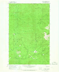 1964 Calispell Peak1966 Print · USGSThe high divide between Stevens and Pend Oreille counties is captured here in the mid-1960s, showing a rugged landscape of national forests and seasonal meadows. Researchers can trace family-named landmarks like Pal Moore Meadow and Hartill Meadows or locate Phillips Lake near the game range boundary.3 unique versions available
 - 1964 Map of Goddards Peak, 1966 Print
 1964 Goddards Peak1966 Print · USGSStevens County’s high peaks and national forest boundaries are captured here in the mid-1960s. Researchers can trace historic access routes like the Flowery Trail Road to landmarks such as the Lookout Tower on Chewelah Mtn.4 unique versions available
 - 1964 Map of Chewelah Mtn, 1966 Print
 1964 Chewelah Mtn1966 Print · USGSThe mining and rail corridor of the Colville River valley comes into sharp focus during the mid-sixties. Genealogists and historians can locate family-named landmarks and industrial sites like the Copper King No 1 Mine, St Marys Mission, and the Northern Pacific RR through Chewelah.2 unique versions available
 - 1965 Map of Nelson Peak, 1967 Print
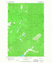 1965 Nelson Peak1967 Print · USGSThe timbered high country of the Stevens and Pend Oreille county line is captured here in the mid-sixties. Genealogists and historians can locate remote landmarks like Camp Hafer, Kaniksu Ranch, and several mining prospects near Nelson Peak.3 unique versions available
 - 1966 Map of Aladdin, 1969 Print
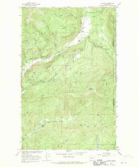 1966 Aladdin1969 Print · USGSMountainous mining country near the Stevens and Pend Oreille County line comes into focus in the mid-1960s. Researchers can locate remote industrial sites like the Morning Mine or trace community roots in the Bon Ayre Valley near the Bon Ayre School.3 unique versions available
 - 1966 Map of Lake Gillette, 1969 Print
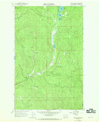 1966 Lake Gillette1969 Print · USGSThe mid-1960s landscape of Stevens County is defined here by the chain of lakes along the Little Pend Oreille River. Genealogists and historians can trace old homestead sites and clearings like Scrabblers Flat, Hosmer, and the Spruce Canyon Youth Camp.4 unique versions available
 - 1967 Map of Aladdin Mtn, 1969 Print
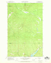 1967 Aladdin Mtn1969 Print · USGSThe high Selkirk country straddling the Stevens and Pend Oreille county line is captured here in the late sixties. Researchers can trace the legacy of local prospecting at the Aladdin Mine and Middleport Mine, or locate historic lakeside spots like Princess Pine Camp.4 unique versions available
 - 1967 Map of Gypsy Peak, 1971 Print
 1967 Gypsy Peak1971 Print · USGSPend Oreille County sits along the international border in the late sixties, showing a wilderness of mineral prospects and high lookout points. Genealogists and hikers can trace old routes like the Lookout Cr Trail to find the Lead Hill Mine or the Lookout Tower atop Sullivan Mtn.3 unique versions available
 - 1967 Map of Timber Mtn., 1971 Print
 1967 Timber Mtn.1971 Print · USGSPend Oreille and Stevens counties are captured in the late sixties as a landscape of high-altitude mining and wildlife conservation. Researchers can locate the High Noon Mine, trace the Tacoma Divide Road, and explore the bounds of the Little Pend Oreille Nat Wildlife Refuge.2 unique versions available
 - 1967 Map of Ione, 1971 Print
 1967 Ione1971 Print · USGSThe Pend Oreille River valley in the late sixties shows a landscape defined by timber, rail, and water. Genealogists and historians can locate the Riverside Cem near Ione or trace the Milwaukee Road railroad through Tiger.4 unique versions available
 - 1967 Map of Scotchman Lake, 1971 Print
 1967 Scotchman Lake1971 Print · USGSThe wilderness of the Colville National Forest is captured here in the late sixties, showing the high-country drainages of Pend Oreille. Researchers can trace the Milwaukee Road rail line or locate remote waters like Scotchman Lake and Deception Lake.3 unique versions available
 - 1967 Map of Boundary Dam, 1971 Print
 1967 Boundary Dam1971 Print · USGSIn the late sixties, the canyon of the Pend Oreille River was a center of utility and mining at the edge of the Canadian border. Genealogists and historians can trace industrial roots at the Pend Oreille Mine or locate the solitary Harvey Grave deep in the hills.2 unique versions available
 - 1967 Map of Salmo Mtn., 1971 Print
 1967 Salmo Mtn.1971 Print · USGSThe high Selkirk wilderness of the late sixties is documented here at the intersection of the Washington, Idaho, and Canadian borders. Trace historical access routes through the mountains via the Pack Trail system and locate the Lookout Tower atop Salmo Mountain.3 unique versions available
Showing maps 1-25 of 292
Top cities of Pend Oreille County
- Newport historical maps
- Ione historical maps
- Metaline Falls historical maps
- Cusick historical maps
- Metaline historical maps
Frequently asked questions
- What are the different types of historical maps available for Pend Oreille County?
- What is the oldest map of Pend Oreille County?
- Where can I purchase historical maps of Pend Oreille County for my home or office?
- Where can I download high-res historical maps of Pend Oreille County?
- Are there historical topographic maps available for Pend Oreille County?
- Is there historical aerial imagery available for Pend Oreille County?
- Where are historical maps of Pend Oreille County sourced from?