1900s (20th Century) Maps of Pierce County, Washington
Explore 147 historic maps of Pierce County from the 1900s (20th Century). These maps offer a rare glimpse into what life looked like during the 1900s — showing old roads, neighborhoods, homes, and landmarks that have changed or disappeared over time.
Whether you're researching your family's past, planning a metal detecting trip, or studying how Pierce County's landscape evolved across the 1900s, these high-resolution maps are a powerful tool for exploring the history of this region.
- Focus on a specific era: All maps on this page are from the 1900s, giving you a focused view of this time period.
- See what’s changed: Compare century-old streets, trails, and buildings to today's modern landscape using overlays and satellite layers.
- Research with precision: Use these maps for genealogy, historical research, land use analysis, or educational projects.
- View, download, or print: Maps are fully viewable online in high resolution, and can be downloaded or printed for your own records.
Start exploring Pierce County's history through authentic maps from the 1900s. This is your window into the past.
Pierce County, WA maps
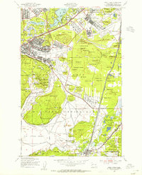
(147)- 1900 Map of Tacoma
 1900 Tacoma1900 Print · USGSThe Puget Sound region was a hive of rail and maritime activity at the end of the Victorian era. Researchers can trace early settlements like Chautauqua, identify tribal lands at the Muckleshoot Indian Reservation, and locate mining towns such as Black Diamond.9 unique versions available
 - 1901 Map of Snoqualmie Pass, 1956 Print
 1901 Snoqualmie Pass1956 Print · USGSSnoqualmie Pass and the central Cascades are seen here during the early years of transcontinental rail expansion. Trace the original Northern Pacific route through the Stampede Tunnel and past early mountain stops like Easton, Hyak, and Ronald.2 unique versions available
 - 1902 Map of Mount Aix
 1902 Mount Aix1902 Print · USGSThe eastern Cascades around Yakima are captured here at the start of the twentieth century, showing a high-country landscape of early mining and pack trails. Genealogists and historians can locate the site of Fife's Mine, the settlement at Goose Prairie, and early landmarks like Lake House.
 - 1903 Map of Snoqualmie
 1903 Snoqualmie1903 Print · USGSThe Cascade Range at the turn of the century was a landscape of high-altitude rail engineering and timber potential. Trace the Northern Pacific RR through the Stampede Tunnel to early mountain settlements like Easton and Lester.6 unique versions available
 - 1904 Map of Mt Aix
 1904 Mt Aix1904 Print · USGSThe high mountain passes and forest reserves of the Central Cascades are captured here at the start of the century. Genealogists and researchers can trace early outposts like Russell Ranch and the Lake House, or locate the Fires Mine and remote Mc Allister Meadows.6 unique versions available
 - 1913 Map of Cedar Lake
 1913 Cedar Lake1913 Print · USGSThe foothills and peaks of the Cascades appear here just before World War I as industry pushed into the wilderness. Trace early timber and rail history through Kerriston, Selleck, and the Cedar Falls Power Plant.5 unique versions available
 - 1916 Map of Chehalis
 1916 Chehalis1916 Print · USGSDuring a period of rapid development along the Chehalis and Skookumchuck Rivers, these valleys supported a thriving network of timber camps and rail towns. Genealogists can trace family landmarks like Logan Hill School, the Centralia Seminary, and the Salmon Creek Mill.4 unique versions available
 - 1924 Map of Mt Rainier
 1924 Mt Rainier1924 Print · USGSLewis and Pierce counties are shown during the mid-twenties, when the timber economy and the National Forest system were establishing their regional footprint. Genealogists and researchers can locate early rural schools like Cline School and Cora School or trace the network of forest outposts like Packwood Ranger Sta.6 unique versions available
 - 1928 Map of Mt Rainier
 1928 Mt Rainier1928 Print · USGSThe Washington Cascades in the late 1920s reveal a landscape of glaciated peaks and emerging river valley communities. Trace early mountaineering and park history at Longmire, or locate family-named landmarks like Schooley and the Cora School near the Cowlitz River.6 unique versions available
 - 1937 Map of Olympia
 1937 Olympia1937 Print · USGSThe state capital and the southern inlets of Puget Sound are captured here during the mid-1930s as the region's rail and maritime networks matured. Genealogists and historians can locate vanished schoolhouses like Plainview Sch, old coastal landings at Boston Harbor, and early industry at Union Mills.2 unique versions available
 - 1937 Map of Eatonville
 1937 Eatonville1937 Print · USGSThe timber and mining corridors of Pierce and Lewis Counties are captured here in the mid-1930s. Genealogists and historians can trace the early footprints of Eatonville, locate the Ladd Mine, and follow the path of the Chicago Milwaukee St Paul and Pacific RR.3 unique versions available
 - 1938 Map of Allyn, 1962 Print
 1938 Allyn1962 Print · USGSCoastal life in the South Sound is captured in the late 1930s, documenting the shoreline of the Kitsap Peninsula and the surrounding inlets. Genealogists and local historians can trace small communities like Allyn, Grapeview, and Vaughn, or locate landmarks such as Grant Sch and Twanoh State Park.2 unique versions available
 - 1940 Map of Anderson Island
 1940 Anderson Island1940 Print · USGSCoastal Washington at the start of the 1940s shows a landscape of strategic military installations and island prisons. You can trace the development of Fort Lewis, the boundaries of the Nisqually Indian Reservation, and the layout of the Federal Penitentiary on McNeil Island.
 - 1941 Map of Tanwax Lake
 1941 Tanwax Lake1941 Print · USGSPierce County was a busy corridor for timber and defense just before the war, as shown in this detailed 1941 survey. Genealogists and historians can locate Camp 1 Logging Camp, the old Lacamas School, and the winding Chicago Milwaukee St Paul and Pacific rail line.
 - 1941 Map of Tacoma South, 1958 Print
 1941 Tacoma South1958 Print · USGSThe Puyallup Valley and southern Tacoma outskirts appear here in the early 1940s, just as the region’s rail and military infrastructure reached peak complexity. Genealogists can trace early homesteads and pioneer landmarks like the Site of Old Camp Montgomery and the Mary Mount Military Academy.
 - 1942 Map of Gig Harbor, 1954 Print
 1942 Gig Harbor1954 Print · USGSThe Kitsap Peninsula and surrounding islands are mapped here during the early 1940s, highlighting a maritime world of inlets and ferries. Trace old family sites and rural landmarks like Elgin Sch, Lisabeula, and the many landings along Henderson Bay.
 - 1942 Map of Lake Tapps, 1962 Print
 1942 Lake Tapps1962 Print · USGSThe foothills of the Cascades meet the Puyallup Valley in the 1940s, showing a landscape defined by logging and coal extraction. Genealogists can locate family names on markers like Spar Pole Hill or trace rural social hubs like the Sunrise Grange Hall.3 unique versions available
 - 1943 Map of Gig Harbor
 1943 Gig Harbor1943 Print · USGSThe Puget Sound shoreline and its peninsulas are captured here in the 1940s as a maritime network of small landings and inland schools. Genealogists can trace family footprints at Sunny Slope Sch, Lisabeula, and the many homesteads near Artondale.
 - 1944 Map of Lake Tapps
 1944 Lake Tapps1944 Print · USGSPierce County during the early 1940s reveals a landscape of industrial river towns and hill-country resource extraction. Genealogists can trace family roots through the Kelly Lake Sch, Coal Mines near Wilkeson, and the Sunrise Grange Hall.3 unique versions available
 - 1944 Map of Tacoma South
 1944 Tacoma South1944 Print · USGSPierce County during the war years shows a landscape of growing towns and deep-rooted history between the river valleys and the prairie. Genealogists and historians can trace family roots through numerous country schools like Kirby Sch or locate 19th-century frontier outposts like the Site of Old Camp Montgomery (1854).
 - 1944 Map of Yelm
 1944 Yelm1944 Print · USGSThe Nisqually River valley and the surrounding prairies are captured here during the 1940s as military and rail infrastructure reshaped the landscape. Researchers can trace the rail corridors of the Northern Pacific, the Centralia Power Plant, and local landmarks like Collins Sch and Vail.2 unique versions available
 - 1944 Map of Ohop Valley
 1944 Ohop Valley1944 Print · USGSThe Ohop Valley and surrounding Pierce County timberlands are shown here during the mid-1940s, just as the region’s hydroelectric and forestry infrastructure was maturing. Genealogists and researchers can trace rural life through sites like the Grange Hall, Edgerton Sch, and the logging community at Clay City.
 - 1948 Map of Anderson Island, 1955 Print
 1948 Anderson Island1955 Print · USGSThe South Sound shoreline and its island communities are captured here just after the war as military and suburban footprints expanded. Genealogists and researchers can trace local landmarks from McNeil Island to the Visitation Academy and the rail stops at Nisqually Station.
 - 1948 Map of Fort Lewis, 1955 Print
 1948 Fort Lewis1955 Print · USGSFort Lewis and McChord Air Force Base are captured during the height of post-war military activity. Local researchers can trace old rail lines, the Indian Cem, and family landmarks like Davis Woods and McCall Hill.
 - 1948 Map of Nisqually, 1955 Print
 1948 Nisqually1955 Print · USGSThe Nisqually River delta and the South Puget Sound coastline are captured here in the late 1940s. Genealogists and historians can trace the early layout of Dupont, the Fort Lewis Military Reservation, and rail stops like St Clair Sta and Nisqually Sta.
Showing maps 1-25 of 147
Top cities of Pierce County
- Tacoma historical maps
- South Hill historical maps
- Lakewood historical maps
- Puyallup historical maps
- Parkland historical maps
- Spanaway historical maps
See more
Frequently asked questions
- What are the different types of historical maps available for Pierce County?
- What is the oldest map of Pierce County?
- Where can I purchase historical maps of Pierce County for my home or office?
- Where can I download high-res historical maps of Pierce County?
- Are there historical topographic maps available for Pierce County?
- Is there historical aerial imagery available for Pierce County?
- Where are historical maps of Pierce County sourced from?