1950s Maps of Pierce County, Washington
Explore 39 historic maps of Pierce County from the 1950s. These maps offer a rare glimpse into what life looked like during the 1950s — showing old roads, neighborhoods, homes, and landmarks that have changed or disappeared over time.
Whether you're researching your family's past, planning a metal detecting trip, or studying how Pierce County's landscape evolved across the 1950s, these high-resolution maps are a powerful tool for exploring the history of this region.
- Focus on a specific era: All maps on this page are from the 1950s, giving you a focused view of this time period.
- See what’s changed: Compare century-old streets, trails, and buildings to today's modern landscape using overlays and satellite layers.
- Research with precision: Use these maps for genealogy, historical research, land use analysis, or educational projects.
- View, download, or print: Maps are fully viewable online in high resolution, and can be downloaded or printed for your own records.
Start exploring Pierce County's history through authentic maps from the 1950s. This is your window into the past.
Pierce County, WA maps
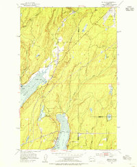
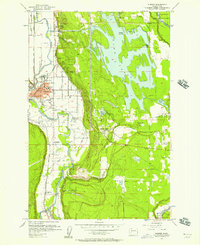
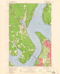
(39)- 1950 Map of Yakima, 1951 Print
 1950 Yakima1951 Print · USGSThe Yakima Valley and the towering Cascades meet in this mid-century survey of South Central Washington. Genealogists and local historians can trace the irrigation-era growth of Yakima, the historic Fort Simcoe outpost, and the White Swan Mission on the Yakima Indian Reservation.
 - 1953 Map of Hoquiam
 1953 Hoquiam1953 Print · USGSSouthwest Washington in the early fifties shows a landscape shaped by timber, rail, and river commerce from the coast to the Cascades. Genealogists and historians can trace the development of timber towns like Ryderwood and the industrial hubs of Hoquiam and Kelso.2 unique versions available
 - 1953 Map of Burley, 1954 Print
 1953 Burley1954 Print · USGSThe Kitsap Peninsula is captured here in the early fifties, showing a rural landscape of timber and tide. Researchers can trace the development of early communities like Burley, Glenwood, and Bethel, or locate landmarks such as Bethel Ch and South Port Orchard Airport.6 unique versions available
 - 1953 Map of Sylvan, 1954 Print
 1953 Sylvan1954 Print · USGSThe Key Peninsula and Fox Island areas are shown here in the early fifties during a period of transition and coastal growth. Researchers can find coastal settlements like Glencove and Sylvan, the State Biological Sta and Fish Hatchery, and the Fox Island Bridge Under Construction.5 unique versions available
 - 1953 Map of Vaughn, 1954 Print
 1953 Vaughn1954 Print · USGSCoastal life in the early fifties unfolds along Case Inlet, where remote settlements and island homesteads defined the South Sound. Genealogists and historians can trace the foundations of Grapeview, Home, and Vaughn alongside landmarks like Stretch Island and the Lakebay School.4 unique versions available
 - 1953 Map of Gig Harbor, 1955 Print
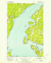
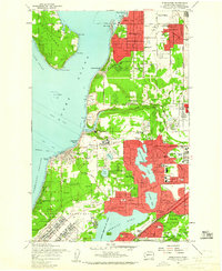
 1953 Gig Harbor1955 Print · USGSThe maritime reaches of the Puget Sound come to life in the early fifties, showing the developing shores of the Kitsap Peninsula and Tacoma. Trace family roots at the Artondale Cem or explore historic sites like Ft Nisqually (Restoration) and the Tacoma Smelter.
 - 1953 Map of Belfair, 1955 Print
 1953 Belfair1955 Print · USGSThe head of Hood Canal and the North Bay waterfront are captured here in the early fifties, showing the rural development of Mason and Kitsap Counties. Genealogists and local historians can trace the foundations of Belfair, Allyn, and Victor, alongside landmarks like the Belfair Sch and the Northern Pacific rail line.4 unique versions available
 - 1953 Map of Olalla, 1955 Print
 1953 Olalla1955 Print · USGSThe Puget Sound shoreline comes alive in the early fifties, mapping the coastal communities of Kitsap County and Vashon Island. Trace family roots at Fraola Cemetery or explore the waterfront history of Olalla and Lisabeula.6 unique versions available
 - 1956 Map of Mineral, 1957 Print
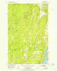
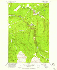
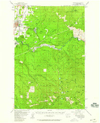
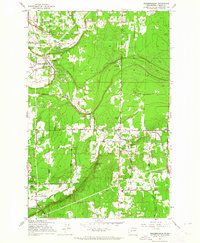
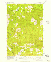 1956 Mineral1957 Print · USGSThe timber and rail corridors of eastern Lewis County come alive in this mid-fifties survey of the forest lands between the Nisqually and Cowlitz rivers. Researchers can locate vanished rail stops and fire watch stations like Kosmos Lookout, the settlement of Carlson, and the old Cem near Mineral Lake.3 unique versions available
 - 1956 Map of Orting, 1957 Print
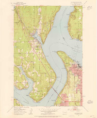
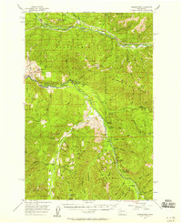
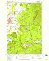
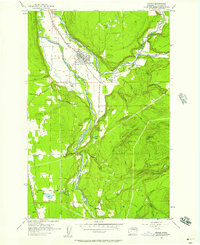 1956 Orting1957 Print · USGSThe river valleys of Pierce County supported a busy network of rail lines and veterans' services during the mid-fifties. Researchers can trace the grounds of the State Soldiers Home, locate the Puyallup River Fish Hatchery, or follow the Northern Pacific tracks through Crocker.5 unique versions available
 - 1956 Map of Sumner, 1957 Print
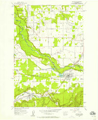
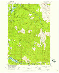
 1956 Sumner1957 Print · USGSThe Puyallup and Stuck River valleys come alive in the mid-fifties as a bustling corridor of rail lines and early hydropower. Trace the industrial footprint of Dieringer or locate family roots near Alderton and the Kelly Lake Sch (Aban'd).4 unique versions available
 - 1956 Map of Greenwater, 1958 Print
 1956 Greenwater1958 Print · USGSThe Green River and White River valleys in the mid-1950s reveal a landscape of timber-rail settlements and mountain camps. Genealogists and historians can trace the Northern Pacific line through Nagrom or locate sites like Hot Springs and the Camp Sheppard Boy Scout Camp.4 unique versions available
 - 1956 Map of Buckley, 1958 Print
 1956 Buckley1958 Print · USGSPierce and King counties in the mid-fifties reveal a landscape of river-valley farms and emerging towns connected by the Northern Pacific. Genealogists can locate family sites near Krain Cem, South Prairie, and community hubs like Sunrise Grange.4 unique versions available
 - 1956 Map of Wilkeson, 1958 Print
 1956 Wilkeson1958 Print · USGSPierce County’s mining and timber heartland comes into focus during the mid-fifties as industrial rail lines reach deep into the Cascade foothills. Researchers can trace the Northern Pacific through the streets of Wilkeson and Carbonado or locate remote sites like the Electron Lookout.3 unique versions available
 - 1956 Map of Enumclaw, 1958 Print
 1956 Enumclaw1958 Print · USGSThe area around Enumclaw in the mid-1950s shows a landscape of massive civil engineering and industrial logging. Trace the Pacific Northern Logging RR or find remote sites like the Copper King Mine and Rainier State Sch.3 unique versions available
 - 1956 Map of Enumclaw, 1958 Print
 1956 Enumclaw1958 Print · USGSThe plateau around Enumclaw is captured here in the mid-fifties, showing a landscape defined by timber processing and river management. Researchers can trace the Pacific Northern Railroad and locate local landmarks like Upper Mill and the Rainier State School.5 unique versions available
 - 1956 Map of Kapowsin, 1958 Print
 1956 Kapowsin1958 Print · USGSPierce County’s timber and hydroelectric corridors are in clear view during the mid-fifties, from the rail lines at Kapowsin to the heights of The Divide. Researchers can trace the path of the Electron Flume Road or locate family sites at Neff Ranch and Voss Resort.3 unique versions available
 - 1957 Map of Hoquiam
 1957 Hoquiam1957 Print · USGSCoastal timber ports and inland rail hubs define Southwest Washington during the late fifties. Genealogists can trace early twentieth-century settlements like Bordeaux, Tono, and Cosmopolis alongside the expanding tracks of the Northern Pacific.
 - 1957 Map of Wenatchee, 1973 Print
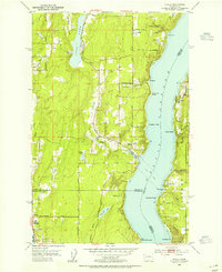
 1957 Wenatchee1973 Print · USGSThe northern Cascades and Columbia River valley appear here in the mid-fifties, showing the region's critical rail and transit corridors. Researchers can trace the routes of the Great Northern RR and Milwaukee Road through settlements like Skykomish, Baring, and Dryden.2 unique versions available
 - 1958 Map of Yakima, 1964 Print
 1958 Yakima1964 Print · USGSThe Yakima Valley in the late fifties shows a landscape of mountain peaks and irrigated plains at the height of its rail-era development. Researchers can trace the lineage of early settlements through sites like Fort Simcoe, the Wenas Cemetery, and the Yakima Indian Agency School.3 unique versions available
 - 1958 Map of Seattle, 1966 Print
 1958 Seattle1966 Print · USGSThe Puget Sound region in the mid-fifties showcases a balance of urban growth and Olympic wilderness. Trace the industrial waterfronts of Tacoma, old naval facilities like Keyport Naval Res, and mountain peaks like Mount Constance.3 unique versions available
 - 1958 Map of Hoquiam, 1969 Print
 1958 Hoquiam1969 Print · USGSSouthwest Washington and the Columbia River estuary appear here in the mid-century, before major landscape shifts. Researchers can trace the rail lines of the Northern Pacific, locate the Fort Henness Site, or explore the Naselle Air Force Station.2 unique versions available
 - 1959 Map of Steilacoom, 1960 Print
 1959 Steilacoom1960 Print · USGSSteilacoom and the South Sound area are shown in the late fifties as military and institutional lands defined the local geography. Researchers can trace the Steilacoom Ferry route and find family landmarks like Clover Park High Sch and New Tacoma Cemetery.5 unique versions available
 - 1959 Map of Gig Harbor, 1960 Print
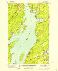
 1959 Gig Harbor1960 Print · USGSThe maritime communities surrounding Gig Harbor and West Tacoma come to life in the late fifties as suburban growth meets heavy industry. Genealogists and historians can trace Gig Harbor Cemetery, the Tacoma Smelter works, and the Camp Sealth grounds.5 unique versions available
 - 1959 Map of Frederickson, 1964 Print
 1959 Frederickson1964 Print · USGSPierce County landscape at the close of the fifties shows a mix of timber, industry, and growing rural communities. Genealogists and researchers can trace local landmarks like Graham Sch, the Chicago Milwaukee St Paul and Pacific line, and Patterson Spring.3 unique versions available
Showing maps 1-25 of 39
Top cities of Pierce County
- Tacoma historical maps
- South Hill historical maps
- Lakewood historical maps
- Puyallup historical maps
- Parkland historical maps
- Spanaway historical maps
See more
Frequently asked questions
- What are the different types of historical maps available for Pierce County?
- What is the oldest map of Pierce County?
- Where can I purchase historical maps of Pierce County for my home or office?
- Where can I download high-res historical maps of Pierce County?
- Are there historical topographic maps available for Pierce County?
- Is there historical aerial imagery available for Pierce County?
- Where are historical maps of Pierce County sourced from?