Old Maps of Home, Washington for Academic Research
Study the evolution of Home with 12 high-resolution historic maps. Whether you're teaching, researching, or modeling changes in land use, these maps provide essential visual documentation of urban, environmental, and geographic change.
- Analyze long-term change: Track patterns in development, transportation, and natural features.
- Ideal for environmental or urban studies: Support academic projects with primary historical map data.
- Use in the classroom or lab: Educators and researchers rely on these maps to bring historical context to life.
These maps are a powerful tool for teaching, research, and visualizing how Home has changed over the decades.
Home, WA maps
(12)- 1938 Map of Allyn, 1962 Print
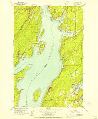
 1938 Allyn1962 Print · USGSCoastal life in the South Sound is captured in the late 1930s, documenting the shoreline of the Kitsap Peninsula and the surrounding inlets. Genealogists and local historians can trace small communities like Allyn, Grapeview, and Vaughn, or locate landmarks such as Grant Sch and Twanoh State Park.2 unique versions available
 - 1953 Map of Vaughn, 1954 Print
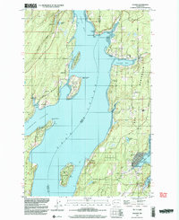
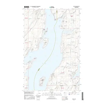
 1953 Vaughn1954 Print · USGSCoastal life in the early fifties unfolds along Case Inlet, where remote settlements and island homesteads defined the South Sound. Genealogists and historians can trace the foundations of Grapeview, Home, and Vaughn alongside landmarks like Stretch Island and the Lakebay School.4 unique versions available
 - 1958 Map of Seattle, 1966 Print
 1958 Seattle1966 Print · USGSThe Puget Sound region in the mid-fifties showcases a balance of urban growth and Olympic wilderness. Trace the industrial waterfronts of Tacoma, old naval facilities like Keyport Naval Res, and mountain peaks like Mount Constance.3 unique versions available
 - 1962 Map of Seattle
 1962 Seattle1962 Print · USGSThe Puget Sound region and Olympic Peninsula are shown at a peak of mid-century growth. Genealogists and historians can trace rail lines like the Pacific Coast RR or locate landmarks such as Fort Lawton and the Bothell Power Station.
 - 1975 Map of Tacoma, 1977 Print
 1975 Tacoma1977 Print · USGSThe Puget Sound region in the mid-seventies reveals a landscape of growing urban centers and massive federal installations. Genealogists and historians can trace the development of Tacoma and Olympia, or locate landmarks like the McNeil Island Penitentiary and Fort Lewis Military Reservation.
 - 1990 Map of Vaughn, 2003 Print
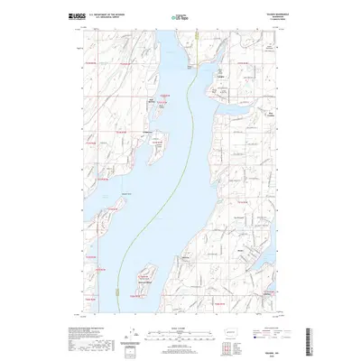
 1990 Vaughn2003 Print · USGSThe Key Peninsula and Case Inlet appear in the 1990s as a quiet network of coastal settlements and maritime harbors. Researchers can trace the layout of waterfront communities like Grapeview and Lakebay or locate local landmarks including the Vaughn Community Church and Key Peninsula Sch.
 - 1991 Map of Tacoma
 1991 Tacoma1991 Print · USGSThe South Sound and Tacoma waterfront appear here in the early nineties, showing a landscape defined by deep-water inlets and massive federal installations. Researchers can trace the development of Lakewood Center or locate the historic rail lines of the Burlington Northern Railroad and Union Pacific Railroad.
 - 2011 Map of Vaughn, 2011 Print
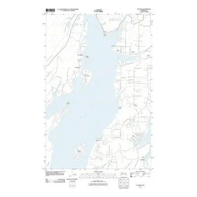 2011 Vaughn2011 Print · USGSCovers Home, including Grapeview, Lakebay, and other nearby areas
 - 2014 Map of Vaughn, 2014 Print
 2014 Vaughn2014 Print · USGSCovers Home, including Grapeview, Lakebay, and other nearby areas
 - 2017 Map of Vaughn, 2017 Print
 2017 Vaughn2017 Print · USGSCovers Home, including Grapeview, Lakebay, and other nearby areas
 - 2020 Map of Vaughn, 2020 Print
 2020 Vaughn2020 Print · USGSCovers Home, including Grapeview, Lakebay, and other nearby areas
 - 2023 Map of Vaughn, 2023 Print
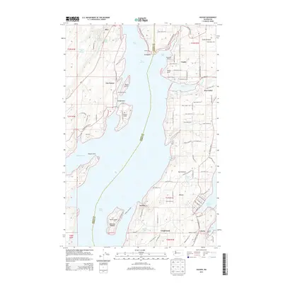
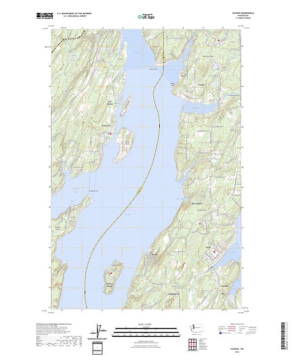 2023 Vaughn2023 Print · USGSThe intricate shorelines of the Great Peninsula and Key Peninsula are mapped here in the early twenty-first century. Researchers can trace the local road networks connecting waterfront communities like Lakebay, Home, and Vaughn, or locate the Vaughn Bay Cem.
End of results
Showing maps 1-12 of 12
Top cities near Home
- Tacoma historical maps
- Lakewood historical maps
- Olympia historical maps
- Lacey historical maps
- Bremerton historical maps
- University Place historical maps
See more
Frequently asked questions
- What are the different types of historical maps available for Home?
- What is the oldest map of Home?
- Where can I purchase historical maps of Home for my home or office?
- Where can I download high-res historical maps of Home?
- Are there historical topographic maps available for Home?
- Is there historical aerial imagery available for Home?
- Where are historical maps of Home sourced from?