Old Maps of Northwoods, Washington for Genealogy
Trace your family roots with 14 historic maps of Northwoods. These high-res maps reveal old neighborhoods, homesites, landmarks, and streets — helping you uncover where your ancestors lived and how the area evolved over time.
- Explore historic neighborhoods: Identify where your relatives may have lived in the 1800s or 1900s.
- Compare maps over time: Trace the changes in streets, buildings, and landmarks for multi-generational research.
- Perfect for genealogy & ancestry research: Used by family historians and researchers to map out lineage and migration.
These maps are an incredible resource for exploring your personal connection to Northwoods's past.
Northwoods, WA maps
(14)- 1919 Map of Mount St Helens
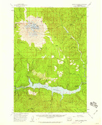
 1919 Mount St Helens1919 Print · USGSThe Cascades wilderness of Cowlitz and Skamania counties comes alive in this era of early forest management and mining. Trace the original profiles of Mt St Helens and Spirit Lake, and locate remote landmarks like Polar Star Mine or Basket Ferry.4 unique versions available
 - 1953 Map of Hoquiam
 1953 Hoquiam1953 Print · USGSSouthwest Washington in the early fifties shows a landscape shaped by timber, rail, and river commerce from the coast to the Cascades. Genealogists and historians can trace the development of timber towns like Ryderwood and the industrial hubs of Hoquiam and Kelso.2 unique versions available
 - 1957 Map of Hoquiam
 1957 Hoquiam1957 Print · USGSCoastal timber ports and inland rail hubs define Southwest Washington during the late fifties. Genealogists can trace early twentieth-century settlements like Bordeaux, Tono, and Cosmopolis alongside the expanding tracks of the Northern Pacific.
 - 1958 Map of Mt St. Helens, 1959 Print
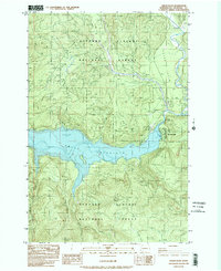
 1958 Mt St. Helens1959 Print · USGSThe peaks and forests of Skamania County appear here in the late fifties, just as the Lewis River was being transformed by hydroelectric development. Hikers and historians can trace old routes like St Helens Way and locate early camps including Butte Camp and Jackpine Shelter.3 unique versions available
 - 1958 Map of Hoquiam, 1969 Print
 1958 Hoquiam1969 Print · USGSSouthwest Washington and the Columbia River estuary appear here in the mid-century, before major landscape shifts. Researchers can trace the rail lines of the Northern Pacific, locate the Fort Henness Site, or explore the Naselle Air Force Station.2 unique versions available
 - 1962 Map of Hoquiam
 1962 Hoquiam1962 Print · USGSSouthwest Washington in the late fifties is defined by the bustling timber ports of Hoquiam and the rail-linked commerce of the interior valleys. Genealogists and historians can trace the early footprints of settlements like Raymond and Pe Ell, or locate family sites at Grand Mound Cem and Odd Fellows Cem.
 - 1975 Map of Mt. St. Helens SE, 1980 Print
 1975 Mt. St. Helens SE1980 Print · USGSCovers Northwoods, including Skamania County, United States, and other nearby areas
 - 1983 Map of Cedar Flats, 1984 Print
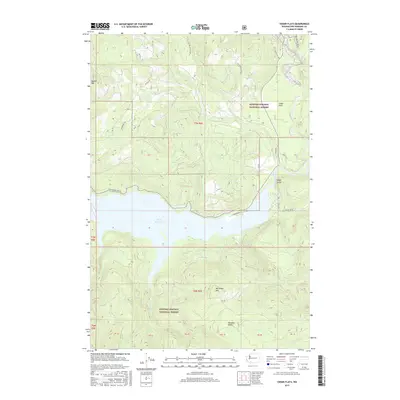
 1983 Cedar Flats1984 Print · USGSThe Gifford Pinchot National Forest is shown here in the early 1980s following the Mount St. Helens eruption. Trace the developing recreation and utility sites around Swift Reservoir, including Northwoods and Swift Forest Campground.2 unique versions available
 - 1998 Map of Cedar Flats, 2003 Print
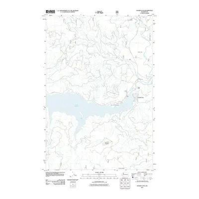
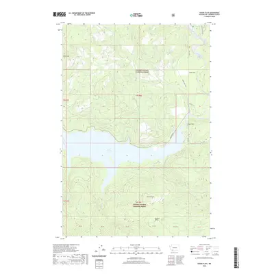
 1998 Cedar Flats2003 Print · USGSSkamania County's timberlands and waterways are captured here in the late nineties, documenting the area surrounding the Swift Reservoir. Historians and hikers can trace the Cedar Flats Nature Trail or locate the settlement at Northwoods and the Eagle Cliffs.
 - 2011 Map of Cedar Flats, 2011 Print
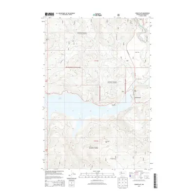
 2011 Cedar Flats2011 Print · USGSCovers Northwoods, including Skamania County, United States, and other nearby areas
 - 2013 Map of Cedar Flats, 2013 Print
 2013 Cedar Flats2013 Print · USGSCovers Northwoods, including Skamania County, United States, and other nearby areas
 - 2017 Map of Cedar Flats, 2017 Print
 2017 Cedar Flats2017 Print · USGSCovers Northwoods, including Skamania County, United States, and other nearby areas
 - 2020 Map of Cedar Flats, 2020 Print
 2020 Cedar Flats2020 Print · USGSCovers Northwoods, including Skamania County, United States, and other nearby areas
 - 2023 Map of Cedar Flats, 2023 Print
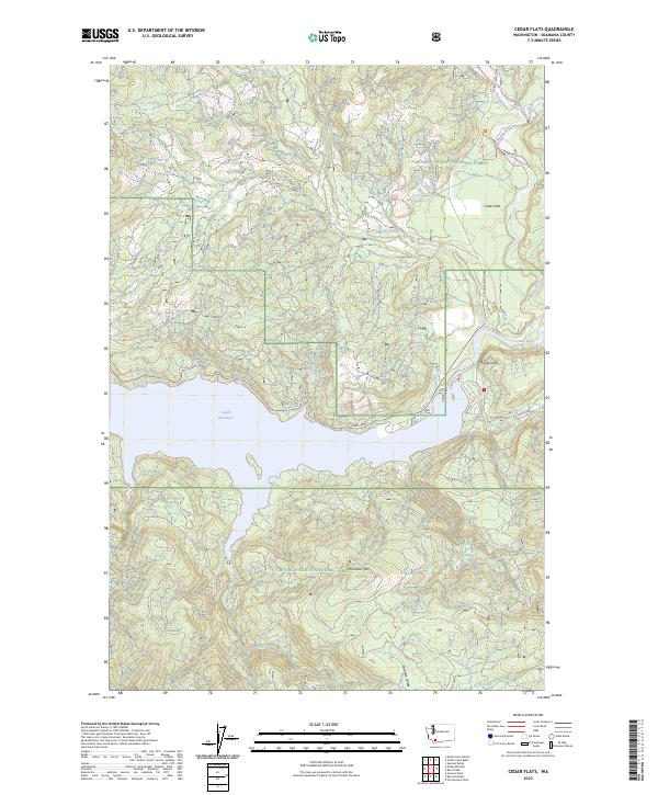 2023 Cedar Flats2023 Print · USGSSkamania County's mountain wilderness and the upper reaches of the Lewis River are documented here in the early twenty-first century. Outdoorsmen and local historians can trace the paths around Swift Reservoir, Eagle Cliffs, and the valley of Cedar Flats.
End of results
Showing maps 1-14 of 14
Frequently asked questions
- What are the different types of historical maps available for Northwoods?
- What is the oldest map of Northwoods?
- Where can I purchase historical maps of Northwoods for my home or office?
- Where can I download high-res historical maps of Northwoods?
- Are there historical topographic maps available for Northwoods?
- Is there historical aerial imagery available for Northwoods?
- Where are historical maps of Northwoods sourced from?