1980s Maps of Startup, Washington
Explore 3 historic maps of Startup from the 1980s. These maps offer a rare glimpse into what life looked like during the 1980s — showing old roads, neighborhoods, homes, and landmarks that have changed or disappeared over time.
Whether you're researching your family's past, planning a metal detecting trip, or studying how Startup's landscape evolved across the 1980s, these high-resolution maps are a powerful tool for exploring the history of this region.
- Focus on a specific era: All maps on this page are from the 1980s, giving you a focused view of this time period.
- See what’s changed: Compare century-old streets, trails, and buildings to today's modern landscape using overlays and satellite layers.
- Research with precision: Use these maps for genealogy, historical research, land use analysis, or educational projects.
- View, download, or print: Maps are fully viewable online in high resolution, and can be downloaded or printed for your own records.
Start exploring Startup's history through authentic maps from the 1980s. This is your window into the past.
Startup, WA maps
(3)- 1989 Map of Lake Chaplain
 1989 Lake Chaplain1989 Print · USGSSnohomish County water systems and forests are captured here in the late eighties, featuring the critical Lake Chaplain reservoir. Trace local industrial footprints through the Powerhouse, the Quarry, and an extensive Aqueduct network.
 - 1989 Map of Wallace Lake
 1989 Wallace Lake1989 Print · USGSSnohomish County during the late eighties shows a landscape of deep forests, hydroelectric power, and mountain recreation. Researchers can trace the path of an Old Railroad Grade, locate the Lockwood Mine, or study the impact of Culmback Dam on Spada Lake.
 - 1989 Map of Gold Bar
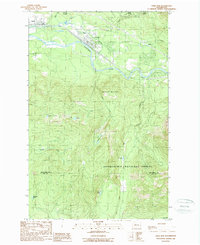 1989 Gold Bar1989 Print · USGSThe Skykomish River valley in the late eighties shows the timber and transport routes that shaped Snohomish County. Trace the paths of an OLD RR GRADE and find local landmarks like the FISH HATCHERY or the high waters of Duffey Lakes.2 unique versions available
End of results
Showing maps 1-3 of 3
Top cities near Startup
- Everett historical maps
- Sammamish historical maps
- Monroe historical maps
- Duvall historical maps
- Woods Creek historical maps
- Sultan historical maps
See more
Frequently asked questions
- What are the different types of historical maps available for Startup?
- What is the oldest map of Startup?
- Where can I purchase historical maps of Startup for my home or office?
- Where can I download high-res historical maps of Startup?
- Are there historical topographic maps available for Startup?
- Is there historical aerial imagery available for Startup?
- Where are historical maps of Startup sourced from?