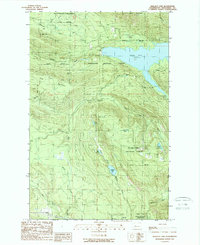
1989 Map of Wallace Lake
USGS Topo · Published 1989About this map
Wallace Falls State Park and the surrounding wilderness of the Snoqualmie National Forest dominate this landscape in the late 1980s. The hydrology of the region is defined by the massive reservoir of Spada Lake, held by the Culmback Dam, which feeds the Sultan River system. The map records the intersection of industrial history and recreation, documenting an Old Railroad Grade winding through the timberlands and the Lockwood Mine situated on the slopes of Blue Mountain. Hikers and local historians can trace the network of drainage systems including Olney Creek, which drops over Olney Falls, and the various high-elevation water bodies like Shaw Lake, Jay Lake, and Wallace Lake. A series of steel tower trans lines cut through the forest, marking the modern infrastructure required to move power from this mountainous watershed.
Find a feature on this map
32 named features on this map. Tap any name to fly to it.
Don’t see what you’re looking for? This feature index may not catch every label — zoom into the map to look around manually.
Map Details
Editions of this 1989 Wallace Lake Map
This is the sole edition of this map. No revisions or reprints were ever made.
Other maps of this area

1899 · Stillaguamish
USGS Topo · 1:125,000

1901 · Stilaguamish
USGS Topo · 1:125,000

1921 · Sultan
USGS Topo · 1:125,000

1923 · Sultan
USGS Topo · 1:125,000

1953 · Sultan
USGS Topo · 1:24,000

1955 · Concrete
USGS Topo · 1:250,000

1956 · Monroe
USGS Topo · 1:62,500

1956 · Granite Falls
USGS Topo · 1:62,500

1957 · Silverton
USGS Topo · 1:62,500

1957 · Index
USGS Topo · 1:62,500