1900s (20th Century) Maps of Startup, Washington
Explore 12 historic maps of Startup from the 1900s (20th Century). These maps offer a rare glimpse into what life looked like during the 1900s — showing old roads, neighborhoods, homes, and landmarks that have changed or disappeared over time.
Whether you're researching your family's past, planning a metal detecting trip, or studying how Startup's landscape evolved across the 1900s, these high-resolution maps are a powerful tool for exploring the history of this region.
- Focus on a specific era: All maps on this page are from the 1900s, giving you a focused view of this time period.
- See what’s changed: Compare century-old streets, trails, and buildings to today's modern landscape using overlays and satellite layers.
- Research with precision: Use these maps for genealogy, historical research, land use analysis, or educational projects.
- View, download, or print: Maps are fully viewable online in high resolution, and can be downloaded or printed for your own records.
Start exploring Startup's history through authentic maps from the 1900s. This is your window into the past.
Startup, WA maps
(12)- 1921 Map of Sultan
 1921 Sultan1921 Print · USGSThe Snoqualmie and Skykomish river valleys are defined by timber and rail in the 1920s. Researchers can trace early industry through the Apex Mines, Coke Ovens, and rural schools like Mountain View School.4 unique versions available
 - 1923 Map of Sultan
 1923 Sultan1923 Print · USGSThe Skykomish and Snoqualmie river valleys thrive in the early twenties as centers of timber and rail. Genealogists can trace family roots through rural sites like Forest Glade School or follow the Lumber RR lines to the Apex Mines.4 unique versions available
 - 1953 Map of Sultan, 1955 Print
 1953 Sultan1955 Print · USGSThe river-and-rail corridor of the Skykomish Valley is captured here in the early fifties, centering on the town of Sultan. Researchers can trace the Great Northern line and discover upland features like Drunken Charlie Lake and the Old Railroad Grade.4 unique versions available
 - 1956 Map of Monroe, 1958 Print
 1956 Monroe1958 Print · USGSSnohomish County in the mid-fifties shows a landscape of river-valley agriculture and upland timber. Trace the Great Northern rail lines through Monroe and Sultan, or locate rural landmarks like Wagner Sch and the State Reformatory.2 unique versions available
 - 1957 Map of Index, 1959 Print
 1957 Index1959 Print · USGSThe mountain corridors of the North Cascades come alive in the late 1950s as the rail and timber industries thrive. Researchers can trace the path of the Great Northern Railway through mountain towns like Gold Bar and find old extraction sites like the Kromona Mine.3 unique versions available
 - 1957 Map of Wenatchee, 1973 Print
 1957 Wenatchee1973 Print · USGSThe northern Cascades and Columbia River valley appear here in the mid-fifties, showing the region's critical rail and transit corridors. Researchers can trace the routes of the Great Northern RR and Milwaukee Road through settlements like Skykomish, Baring, and Dryden.2 unique versions available
 - 1975 Map of Skykomish River, 1977 Print
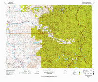 1975 Skykomish River1977 Print · USGSThe Cascades meet the river valleys in the mid-seventies, showing the vital rail corridors and mountain towns along the Skykomish River. Researchers can trace the path of the Pacific Crest National Scenic Trail and locate historic sites like State Reformatory Farm No 2 and the Old Cascade Tunnel.2 unique versions available
 - 1989 Map of Lake Chaplain
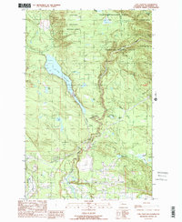 1989 Lake Chaplain1989 Print · USGSSnohomish County water systems and forests are captured here in the late eighties, featuring the critical Lake Chaplain reservoir. Trace local industrial footprints through the Powerhouse, the Quarry, and an extensive Aqueduct network.
 - 1989 Map of Wallace Lake
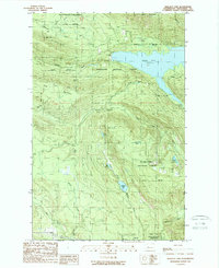 1989 Wallace Lake1989 Print · USGSSnohomish County during the late eighties shows a landscape of deep forests, hydroelectric power, and mountain recreation. Researchers can trace the path of an Old Railroad Grade, locate the Lockwood Mine, or study the impact of Culmback Dam on Spada Lake.
 - 1989 Map of Gold Bar
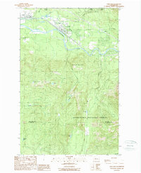 1989 Gold Bar1989 Print · USGSThe Skykomish River valley in the late eighties shows the timber and transport routes that shaped Snohomish County. Trace the paths of an OLD RR GRADE and find local landmarks like the FISH HATCHERY or the high waters of Duffey Lakes.2 unique versions available
 - 1993 Map of Sultan
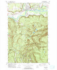 1993 Sultan1993 Print · USGSSultan sits at the confluence of two major rivers in the early nineties, where timber history meets a growing valley community. Trace the remnants of the Old Railroad Grade or locate high-country landmarks like Drunken Charlie Lake and Lake Elsie.
 - 1997 Map of Sultan, 2003 Print
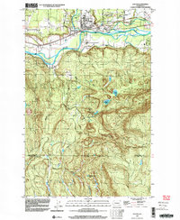 1997 Sultan2003 Print · USGSThe confluence of the Skykomish and Sultan rivers defines this late-century landscape, showing the town of Sultan as it transitioned from a timber hub to a growing residential community. Researchers can trace historic industrial footprints and local landmarks like the Cemetery, the Old Railroad Grade, and Drunken Charlie Lake.
End of results
Showing maps 1-12 of 12
Top cities near Startup
- Everett historical maps
- Sammamish historical maps
- Monroe historical maps
- Duvall historical maps
- Woods Creek historical maps
- Sultan historical maps
See more
Frequently asked questions
- What are the different types of historical maps available for Startup?
- What is the oldest map of Startup?
- Where can I purchase historical maps of Startup for my home or office?
- Where can I download high-res historical maps of Startup?
- Are there historical topographic maps available for Startup?
- Is there historical aerial imagery available for Startup?
- Where are historical maps of Startup sourced from?