Old Maps of Yakima, Washington for Academic Research
Study the evolution of Yakima with 38 high-resolution historic maps. Whether you're teaching, researching, or modeling changes in land use, these maps provide essential visual documentation of urban, environmental, and geographic change.
- Analyze long-term change: Track patterns in development, transportation, and natural features.
- Ideal for environmental or urban studies: Support academic projects with primary historical map data.
- Use in the classroom or lab: Educators and researchers rely on these maps to bring historical context to life.
These maps are a powerful tool for teaching, research, and visualizing how Yakima has changed over the decades.
Yakima, WA maps
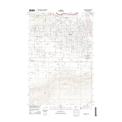
(38)- 1899 Map of Ellensburg, 1957 Print
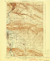
 1899 Ellensburg1957 Print · USGSCentral Washington at the turn of the century shows a landscape of growing river towns and high ridges. Researchers can trace early railroad expansion along the Northern Pacific RR or locate rural outposts like Tampico, Ahtanum, and Nile.
 - 1901 Map of Ellensburg
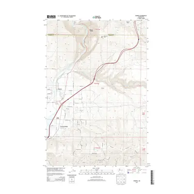
 1901 Ellensburg1901 Print · USGSCentral Washington at the turn of the century shows a landscape shaped by river valleys and high ridges. Trace the early Northern Pacific Railway line through Ellensburg and the remote outposts of Nile and Tampico.6 unique versions available
 - 1936 Map of Yakima East
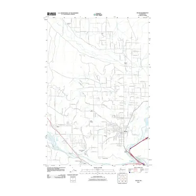
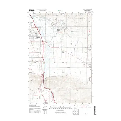
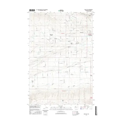
 1936 Yakima East1936 Print · USGSYakima and the Moxee Valley are shown here in the mid-1930s as the regional irrigation and rail networks were fully established. Genealogists and local historians can trace family locations near Pease Ranch, Moxee City, and schools like Central Sch.
 - 1941 Map of Yakima East
 1941 Yakima East1941 Print · USGSThe Yakima Valley was a hub of irrigation and rail transport in the early 1940s, as intensive canal networks reshaped the landscape. Local historians can trace family homesteads along Beaudry Road and Charon Rd, or locate the First Reformed Ch and the State Fairgrounds.2 unique versions available
 - 1950 Map of Yakima, 1951 Print
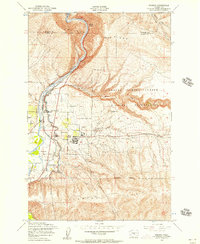
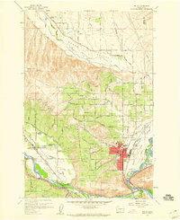
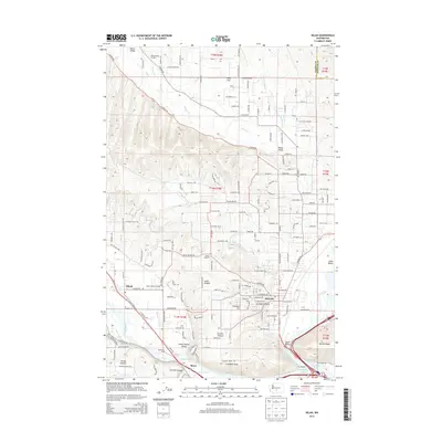
 1950 Yakima1951 Print · USGSThe Yakima Valley and the towering Cascades meet in this mid-century survey of South Central Washington. Genealogists and local historians can trace the irrigation-era growth of Yakima, the historic Fort Simcoe outpost, and the White Swan Mission on the Yakima Indian Reservation.
 - 1953 Map of Pomona, 1957 Print
 1953 Pomona1957 Print · USGSThe Yakima Valley's mid-century transition is documented here as irrigation projects and military expansion reshaped the land. Researchers can trace the Northern Pacific tracks through Pomona or locate military infrastructure like the Post Headquarters and Target Range.4 unique versions available
 - 1953 Map of Yakima East, 1957 Print
 1953 Yakima East1957 Print · USGSThe mid-century growth of the Yakima Valley is on full display here, showing the era's bustling rail corridors and expanding irrigation. Genealogists and local historians can locate the Pioneer Cemetery, St Michaels Church, and old school sites like Adams School.3 unique versions available
 - 1953 Map of Yakima East, 1958 Print
 1953 Yakima East1958 Print · USGSThe Yakima Valley in the early fifties shows a landscape of military reservations and expanding irrigation. Trace the growth of Moxee City and Union Gap or locate family roots at Holland Cem and Central School.3 unique versions available
 - 1958 Map of Yakima West, 1960 Print
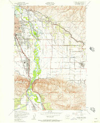
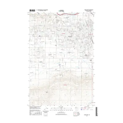
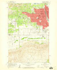 1958 Yakima West1960 Print · USGSYakima entered a period of robust post-war growth during the late fifties, expanding its residential and educational footprint westward. Researchers can trace family-named schools and early landmarks like Yakima Valley Jr College, Tahoma Cem, and the State Fish Hatchery.5 unique versions available
 - 1958 Map of Selah, 1960 Print
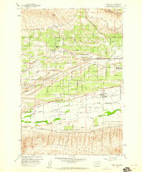
 1958 Selah1960 Print · USGSThe Yakima Valley fruit-growing region is captured here in the late fifties, showing the expansion of Selah and neighboring Gleed. Genealogists and historians can trace local landmarks like the Wenas Valley Grange, Advent Church, and the Northern Pacific rail lines.4 unique versions available
 - 1958 Map of Wiley City, 1960 Print
 1958 Wiley City1960 Print · USGSThe fertile Ahtanum Valley is captured here in the late fifties, showcasing a landscape defined by orchards and early irrigation. Researchers can locate Wiley City, the Tietonview Grange, and several tribal burial grounds like Saluskin Cemetery.3 unique versions available
 - 1958 Map of Yakima, 1964 Print
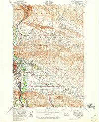
 1958 Yakima1964 Print · USGSThe Yakima Valley in the late fifties shows a landscape of mountain peaks and irrigated plains at the height of its rail-era development. Researchers can trace the lineage of early settlements through sites like Fort Simcoe, the Wenas Cemetery, and the Yakima Indian Agency School.3 unique versions available
 - 1961 Map of Yakima
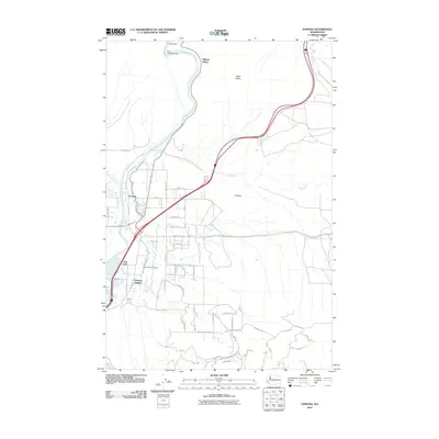
 1961 Yakima1961 Print · USGSCentral Washington thrived in the mid-century as an agricultural powerhouse defined by the Yakima River. Trace local roots through Medicine Valley School, Fort Simcoe, and the rail lines of the Northern Pacific RR.
 - 2011 Map of Yakima West, 2011 Print
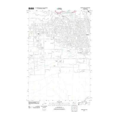 2011 Yakima West2011 Print · USGSCovers Yakima, including Selah, Union Gap, and other nearby areas
 - 2011 Map of Selah, 2011 Print
 2011 Selah2011 Print · USGSCovers Yakima, including Selah, Gleed, and other nearby areas
 - 2011 Map of Wiley City, 2011 Print
 2011 Wiley City2011 Print · USGSCovers Yakima, including Summitview, Elliott Ave, and other nearby areas
 - 2011 Map of Pomona, 2011 Print
 2011 Pomona2011 Print · USGSCovers Yakima, including Pomona Heights, East Selah, and other nearby areas
 - 2011 Map of Yakima East, 2011 Print
 2011 Yakima East2011 Print · USGSCovers Yakima, including Union Gap, Moxee, and other nearby areas
 - 2013 Map of Wiley City, 2013 Print
 2013 Wiley City2013 Print · USGSCovers Yakima, including Summitview, Elliott Ave, and other nearby areas
 - 2013 Map of Yakima West, 2013 Print
 2013 Yakima West2013 Print · USGSCovers Yakima, including Selah, Union Gap, and other nearby areas
 - 2013 Map of Pomona, 2013 Print
 2013 Pomona2013 Print · USGSCovers Yakima, including Pomona Heights, East Selah, and other nearby areas
 - 2013 Map of Yakima East, 2013 Print
 2013 Yakima East2013 Print · USGSCovers Yakima, including Union Gap, Moxee, and other nearby areas
 - 2013 Map of Selah, 2013 Print
 2013 Selah2013 Print · USGSCovers Yakima, including Selah, Gleed, and other nearby areas
 - 2017 Map of Wiley City, 2017 Print
 2017 Wiley City2017 Print · USGSCovers Yakima, including Summitview, Elliott Ave, and other nearby areas
 - 2017 Map of Yakima West, 2017 Print
 2017 Yakima West2017 Print · USGSCovers Yakima, including Selah, Union Gap, and other nearby areas
Showing maps 1-25 of 38
Top cities near Yakima
- Toppenish historical maps
- Selah historical maps
- Union Gap historical maps
- Wapato historical maps
- Moxee historical maps
- Ahtanum historical maps
See more
Top neighborhoods of Yakima
- West Valley historical maps
- Washington Park historical maps
- Fruitvale historical maps
- Riverview Manor historical maps
Frequently asked questions
- What are the different types of historical maps available for Yakima?
- What is the oldest map of Yakima?
- Where can I purchase historical maps of Yakima for my home or office?
- Where can I download high-res historical maps of Yakima?
- Are there historical topographic maps available for Yakima?
- Is there historical aerial imagery available for Yakima?
- Where are historical maps of Yakima sourced from?