Old Maps of Fayette County, West Virginia for Genealogy
Trace your family roots with 99 historic maps of Fayette County. These high-res maps reveal old neighborhoods, homesites, landmarks, and streets — helping you uncover where your ancestors lived and how the area evolved over time.
- Explore historic neighborhoods: Identify where your relatives may have lived in the 1800s or 1900s.
- Compare maps over time: Trace the changes in streets, buildings, and landmarks for multi-generational research.
- Perfect for genealogy & ancestry research: Used by family historians and researchers to map out lineage and migration.
These maps are an incredible resource for exploring your personal connection to Fayette County's past.
Fayette County, WV maps
(99)- 1887 Map of Hinton
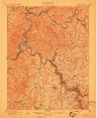
 1887 Hinton1887 Print · USGSSouthern West Virginia’s rugged river corridors and mineral spring resorts come alive in this late nineteenth-century survey. Trace the rail-and-river economy through the Big Bend Tunnel, the Greenbrier Stock Yards, and the historic springs at Red Sulphur Springs.
 - 1889 Map of Nicholas
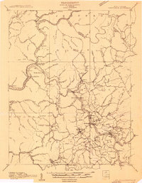
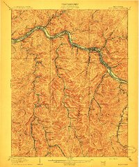
 1889 Nicholas1889 Print · USGSNicholas County and parts of the surrounding highlands are documented here in the late nineteenth century. Genealogists can trace family landmarks and river life through recorded sites like Carnifax Ferry, Beaver Mills, and Mt. Nebo.
 - 1891 Map of Nicholas
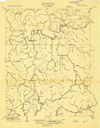
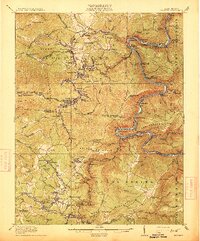
 1891 Nicholas1891 Print · USGSNicholas County and the surrounding highlands are captured here in the late nineteenth century, when mountain life depended on a network of river crossings. Genealogists can trace family roots through sites like Nicholas C.h., Hookersville, and early river crossings such as Carnifax Ferry.
 - 1891 Map of Raleigh
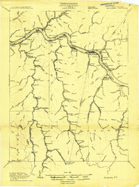
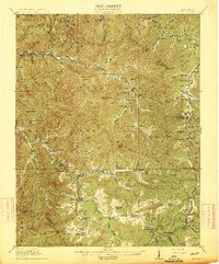
 1891 Raleigh1891 Print · USGSRaleigh County and the New River Gorge are captured in the late nineteenth century during the initial rise of the coal industry. Genealogists can trace family holdings along Paint Creek or locate early river settlements such as Quinnimont and Fire Creek.
 - 1892 Map of Hinton
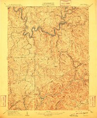
 1892 Hinton1892 Print · USGSSouthern West Virginia in the late nineteenth century centers on the river-and-rail hub of Hinton and the high ridges of the Alleghenies. Researchers can trace early railroad engineering at the Big Bend Tunnel or locate historic mineral spring resorts like Salt Sulphur Springs and Blue Sulphur Springs.5 unique versions available
 - 1897 Map of Kanawha Falls
 1897 Kanawha Falls1897 Print · USGSWest Virginia's river valleys and burgeoning industrial corridors are captured here in the late nineteenth century. You can trace the early rail networks and riverside settlements such as Montgomery, Clendenin, and the river engineering at Lock 2.
 - 1897 Map of Raleigh
 1897 Raleigh1897 Print · USGSThe New River Gorge area at the height of the coal and rail boom comes to life on this late nineteenth-century sheet. Genealogists and historians can trace riverside rail stops like Thurmond and Glenjean, or explore the high-plateau settlement at Marshes P.O. (Trap Hill).
 - 1900 Map of Kanawha Falls
 1900 Kanawha Falls1900 Print · USGSThe Kanawha and Elk rivers converge here at the turn of the century as the coal and rail industries were rapidly transforming the West Virginia landscape. Genealogists and historians can trace riverside settlements like Montgomery and Coalburg or follow the paths of the Chesapeake and Ohio RR and early river navigation at Lock 2.
 - 1901 Map of Nicholas
 1901 Nicholas1901 Print · USGSCentral West Virginia's river valleys and high ridges are shown here at the turn of the century as the timber industry expanded. Genealogists can trace family landmarks and river crossings like Camden on Gauley, Wainville P.O., and Bays Ferry Ford.3 unique versions available
 - 1901 Map of Kanawha Falls
 1901 Kanawha Falls1901 Print · USGSWest Virginia's coal and rail heartland is captured here at the end of the nineteenth century, as river navigation and railroads transformed the Kanawha Valley. Genealogists and historians can trace the early footprints of Montgomery, find family sites near Kanawha Falls, and locate landmarks like Hawks Nest or Powellton.3 unique versions available
 - 1902 Map of Raleigh
 1902 Raleigh1902 Print · USGSRaleigh County and the New River Gorge were entering their industrial peak when this survey was conducted in the late nineteenth century. Researchers can trace the early rail network of the CHESAPEAKE AND OHIO RR through booming towns like Thurmond, Beury, and East Sewell.3 unique versions available
 - 1908 Map of Clay
 1908 Clay1908 Print · USGSThe river and rail network of central West Virginia dominates this territory at the start of the century. Trace early Appalachian settlement patterns through the COAL AND COKE RR and rural landmarks like Rosetta School and Big Sycamore Eldorado PO.2 unique versions available
 - 1908 Map of Fayetteville
 1908 Fayetteville1908 Print · USGSFayette County was at the heart of the coal and rail boom when this survey was conducted. Researchers can trace the early industrial footprint of the Chesapeake and Ohio Railroad through settlements like Ansted, Gauley Bridge, and Kanawha Falls.
 - 1908 Map of Montgomery
 1908 Montgomery1908 Print · USGSWest Virginia's industrial heartland is revealed in the early twentieth century as a dense network of coal towns and river locks. Trace the rail-and-river economy through Cabin Creek Junction, the Wheeler Islands, and the namesake town of Montgomery.
 - 1910 Map of Clay
 1910 Clay1910 Print · USGSWest Virginia's coal and timber country comes alive in this survey of the Elk River valley just after the turn of the century. Genealogists and historians can trace the early rail networks of the Coke and Coke RR and locate vanished rural hubs like Yankee Dam PO and Triplett School.3 unique versions available
 - 1910 Map of Fayetteville
 1910 Fayetteville1910 Print · USGSThe West Virginia coalfields were in full operation when this survey was conducted, showing the dense rail networks along the Gauley River. Local historians can trace family-named sites and industrial hamlets like Nuttallburg, Gauley Bridge, and Kaymoor.4 unique versions available
 - 1910 Map of Montgomery
 1910 Montgomery1910 Print · USGSThe industrial corridor of the Kanawha Valley is seen here in the early 1900s, defined by the river and the competing rail lines of the era. Genealogists and historians can trace the foundations of coal-field communities at Paint Creek Junction, Coalburg, and Pratt PO.3 unique versions available
 - 1911 Map of Marshes
 1911 Marshes1911 Print · USGSRaleigh County and the surrounding highlands are shown just after the turn of the century, when mountain life centered on isolated creek hollows. Genealogists can trace family footprints through dozens of rural landmarks like Meadow Inn School, Matville P O, and Peachtree School.
 - 1911 Map of Beckley
 1911 Beckley1911 Print · USGSThe coal and rail landscape of Raleigh and Fayette counties comes to life in the years before the Great War. Genealogists can trace family roots through numerous remote settlements and rural landmarks like Mount Hope, Silver Cliff School, and the winding New River.
 - 1912 Map of Meadow Creek
 1912 Meadow Creek1912 Print · USGSWest Virginia's Fayette and Greenbrier borderlands are captured here in the early twentieth century, showing a landscape of timber and mountain settlements. Genealogists can locate dozens of country schools like Rock of Ages School and Eureka School, alongside the Sandstone Falls on the New River.3 unique versions available
 - 1913 Map of Beckley
 1913 Beckley1913 Print · USGSRaleigh and Fayette counties are shown at the height of the coal era, when the New River canyon hummed with steam power and industry. Genealogists can locate family homesteads near vanished landmarks like the Krise PO Glade, Excelsior School, and the Lanark Sta railroad stop.3 unique versions available
 - 1914 Map of Eccles
 1914 Eccles1914 Print · USGSRaleigh County's mountain settlements and coal-country railways are captured here in the early twentieth century. Researchers can trace the heritage of rural communities through dozens of schoolhouses like White Rose School and local landmarks such as Meadow Inn or the Trap Hill Marshes PO.2 unique versions available
 - 1914 Map of Winona
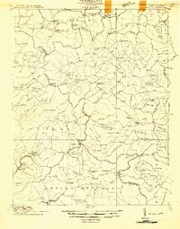 1914 Winona1914 Print · USGSCentral West Virginia's rugged highlands are captured here just as the timber industry began to reshape the landscape. Local historians can trace early mountain life through dozens of named schools like Bean School and crossings such as Carnefix Ferry and Raders Ford.2 unique versions available
 - 1915 Map of Meadow Creek
 1915 Meadow Creek1915 Print · USGSThe West Virginia highlands come to life in this detailed survey of the mountain ridges and river valleys just before the First World War. Genealogists can locate dozens of country schools and remote post offices like Rock of Ages School, Brownwood Lawton P.O., and Layland.3 unique versions available
 - 1916 Map of Winona
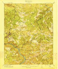
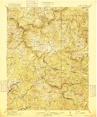 1916 Winona1916 Print · USGSNicholas and Fayette Counties are documented here before the mid-century industrial shifts, showing a world of river crossings and mountain schools. Genealogists can trace family footprints at Carnifex Ferry, Withrows Mill, and dozens of rural sites like Nutterville.3 unique versions available
Showing maps 1-25 of 99
Top cities of Fayette County
- Oak Hill historical maps
- Fayetteville historical maps
- Ansted historical maps
- Mount Hope historical maps
- Gauley Bridge historical maps
- Boomer historical maps
See more
Frequently asked questions
- What are the different types of historical maps available for Fayette County?
- What is the oldest map of Fayette County?
- Where can I purchase historical maps of Fayette County for my home or office?
- Where can I download high-res historical maps of Fayette County?
- Are there historical topographic maps available for Fayette County?
- Is there historical aerial imagery available for Fayette County?
- Where are historical maps of Fayette County sourced from?