1960s Maps of Kanawha County, West Virginia
Explore 16 historic maps of Kanawha County from the 1960s. These maps offer a rare glimpse into what life looked like during the 1960s — showing old roads, neighborhoods, homes, and landmarks that have changed or disappeared over time.
Whether you're researching your family's past, planning a metal detecting trip, or studying how Kanawha County's landscape evolved across the 1960s, these high-resolution maps are a powerful tool for exploring the history of this region.
- Focus on a specific era: All maps on this page are from the 1960s, giving you a focused view of this time period.
- See what’s changed: Compare century-old streets, trails, and buildings to today's modern landscape using overlays and satellite layers.
- Research with precision: Use these maps for genealogy, historical research, land use analysis, or educational projects.
- View, download, or print: Maps are fully viewable online in high resolution, and can be downloaded or printed for your own records.
Start exploring Kanawha County's history through authentic maps from the 1960s. This is your window into the past.
Kanawha County, WV maps
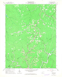
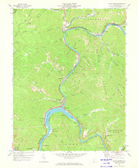
(16)- 1961 Map of Charleston
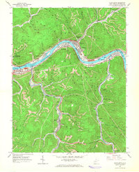
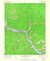
 1961 Charleston1961 Print · USGSWest Virginia's capital region and the highlands to the east are shown in detail during the early sixties. Genealogists and historians can trace rail networks like the Baltimore and Ohio RR and find early state parks such as Watoga State Park.
 - 1961 Map of Bluefield
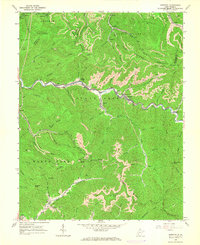
 1961 Bluefield1961 Print · USGSThe coalfields and mountain ridges of southern West Virginia and southwest Virginia are captured in the early sixties. Genealogists can trace family ties through rail-linked towns like Princeton and Richlands or along the shores of Bluestone Reservoir.
 - 1962 Map of Julian, 1964 Print
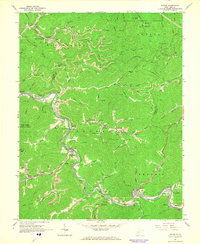
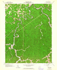 1962 Julian1964 Print · USGSBoone and Lincoln Counties are shown in the early sixties as the rail-and-river economy hummed along the Little Coal River. Researchers can trace family history at the White Cem or locate former landmarks like McCorkle School and Horse Creek Junction.4 unique versions available
 - 1965 Map of Pax, 1966 Print
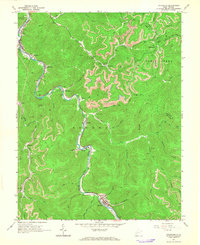
 1965 Pax1966 Print · USGSWest Virginia coal country was in full swing when this mid-sixties survey documented the junction of Fayette and Raleigh counties. Genealogists can trace family landmarks like Workman Cem and Pax Sch alongside the tracks of the Norfolk and Western rail line.3 unique versions available
 - 1965 Map of Belle, 1966 Print
 1965 Belle1966 Print · USGSMid-century industry and coal mining define the Kanawha valley in the 1960s as river traffic and railroads converge near Belle and Marmet. Genealogists and historians can trace the steep hollows to find local landmarks like Lens Creek Ch, Mitchell Cem, and the specialized Opera House Hol.4 unique versions available
 - 1965 Map of Eskdale, 1966 Print
 1965 Eskdale1966 Print · USGSCoal valley life in the mid-sixties is centered on the winding Cabin Creek corridor and its surrounding ridges. Genealogists and researchers can trace family-named sites like Perry Cem and Johnson Cem alongside railroad hubs at Cane Fork Yards.2 unique versions available
 - 1965 Map of Cedar Grove, 1966 Print
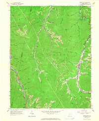
 1965 Cedar Grove1966 Print · USGSThe Kanawha River valley was a hub of rail and coal activity in the mid-sixties, with industry and towns lining both banks. Genealogists can trace the communities of Cedar Grove, Glasgow, and Pratt, along with local landmarks like Mt Zion Ch and Woodland Cem.3 unique versions available
 - 1965 Map of Dorothy, 1966 Print
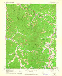
 1965 Dorothy1966 Print · USGSThe Coal River region in the mid-sixties is a complex network of industrial mining and valley settlements. Genealogists and historians can trace the foundations of coal-camp life through labels like Township High Sch, Stanley Cems, and the Chesapeake and Ohio railroad.3 unique versions available
 - 1965 Map of Racine, 1966 Print
 1965 Racine1966 Print · USGSThe Coal River valley in the mid-sixties reveals a landscape shaped by coal production and rail transport. Genealogists can trace family names at Snodgrass Cem and Barker Cem, while mapping the community of Brushton (Costa PO).3 unique versions available
 - 1965 Map of Sylvester, 1966 Print
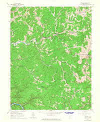
 1965 Sylvester1966 Print · USGSBoone and Kanawha counties are shown in the mid-1960s as the coal industry transformed the high ridges and valley floors. Genealogists and historians can trace family names at White Oak Cem and Seth Cem or locate the Drive-in Theater and numerous Strip Mines.2 unique versions available
 - 1965 Map of Montgomery, 1966 Print
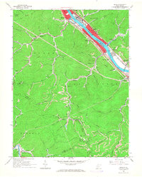
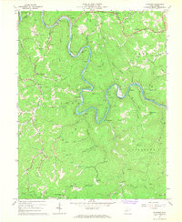
 1965 Montgomery1966 Print · USGSThe Kanawha River valley was a humming corridor of coal and rail in the 1960s, with towns like Montgomery and London tightly squeezed between the water and the ridges. Genealogists and historians can trace the industrial footprint of Alloy, find rural landmarks like St Anthony Ch, or locate the London Lock & Dam No 3.2 unique versions available
 - 1965 Map of Powellton, 1966 Print
 1965 Powellton1966 Print · USGSThe Fayette and Kanawha County border comes alive in the mid-sixties, showing a landscape defined by coal mining and heavy rail. Trace family roots and industrial sites from the tipple at Mahan to the cemeteries at Johnson Cem and Meadow Haven Memorial Park.2 unique versions available
 - 1966 Map of Newton, 1968 Print
 1966 Newton1968 Print · USGSCentral West Virginia in the mid-sixties reveals a rugged landscape defined by the gas and oil industry and small river-bottom settlements. Genealogists and local historians can trace family roots through sites like Left Hand, Ovapa Ch, and Grose Cem.2 unique versions available
 - 1967 Map of Elkhurst, 1968 Print
 1967 Elkhurst1968 Print · USGSThe Elk River valley in the late sixties reveals a landscape of tight river bends and mountain hollows shaped by the timber and gas industries. Genealogists and local historians can trace family-named sites and small settlements like Procious, Elkhurst, and Mt Carmel Church.2 unique versions available
 - 1967 Map of Bentree, 1968 Print
 1967 Bentree1968 Print · USGSThe coal and rail corridors of Clay County are meticulously detailed here during the late sixties. Researchers can trace family sites and local landmarks from Indore Chapel and Lilly No 11 Sch to the busy Strip Mines along the Chesapeake and Ohio line.2 unique versions available
 - 1969 Map of Gauley Bridge, 1973 Print
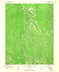
 1969 Gauley Bridge1973 Print · USGSIn the late 1960s, the confluence of the Gauley and New Rivers served as a vital industrial artery for West Virginia's rail and coal sectors. Researchers can pinpoint long-standing landmarks like Bailey Memorial Ch, trace the Penn Central tracks, and locate sites like K & M Junction and Glen Ferris.3 unique versions available
End of results
Showing maps 1-16 of 16
Top cities of Kanawha County
- Charleston historical maps
- South Charleston historical maps
- St. Albans historical maps
- Dunbar historical maps
- Marmet historical maps
- Chesapeake historical maps
See more
Frequently asked questions
- What are the different types of historical maps available for Kanawha County?
- What is the oldest map of Kanawha County?
- Where can I purchase historical maps of Kanawha County for my home or office?
- Where can I download high-res historical maps of Kanawha County?
- Are there historical topographic maps available for Kanawha County?
- Is there historical aerial imagery available for Kanawha County?
- Where are historical maps of Kanawha County sourced from?