1970s Maps of Fairmont, West Virginia
Explore 2 historic maps of Fairmont from the 1970s. These maps offer a rare glimpse into what life looked like during the 1970s — showing old roads, neighborhoods, homes, and landmarks that have changed or disappeared over time.
Whether you're researching your family's past, planning a metal detecting trip, or studying how Fairmont's landscape evolved across the 1970s, these high-resolution maps are a powerful tool for exploring the history of this region.
- Focus on a specific era: All maps on this page are from the 1970s, giving you a focused view of this time period.
- See what’s changed: Compare century-old streets, trails, and buildings to today's modern landscape using overlays and satellite layers.
- Research with precision: Use these maps for genealogy, historical research, land use analysis, or educational projects.
- View, download, or print: Maps are fully viewable online in high resolution, and can be downloaded or printed for your own records.
Start exploring Fairmont's history through authentic maps from the 1970s. This is your window into the past.
Fairmont, WV maps
(2)- 1976 Map of Rivesville, 1979 Print
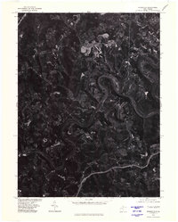 1976 Rivesville1979 Print · USGSThe Monongahela River valley comes into sharp focus during the mid-seventies in this detailed aerial study. Researchers can examine the industrial landscape and trace development patterns near settlements like Everettville and Booth along the river banks.
 - 1976 Map of Grant Town, 1979 Print
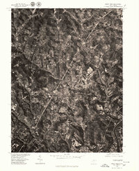 1976 Grant Town1979 Print · USGSMarion County in the mid-seventies is revealed through high-resolution aerial photography, documenting the rugged coal-country terrain before modern expansion. Researchers can trace the clear footprints of towns like Grant Town, Barrackville, and Fairview alongside the Monongahela River.
End of results
Showing maps 1-2 of 2
Top cities near Fairmont
- Morgantown historical maps
- Clarksburg historical maps
- Bridgeport historical maps
- Grafton historical maps
- Westover historical maps
- Pleasant Valley historical maps
See more
Top neighborhoods of Fairmont
- Gaston historical maps
- Hillcrest historical maps
- Shagtown historical maps
- West End historical maps
- Beverly Hills historical maps
- Edgemont historical maps
See more
Frequently asked questions
- What are the different types of historical maps available for Fairmont?
- What is the oldest map of Fairmont?
- Where can I purchase historical maps of Fairmont for my home or office?
- Where can I download high-res historical maps of Fairmont?
- Are there historical topographic maps available for Fairmont?
- Is there historical aerial imagery available for Fairmont?
- Where are historical maps of Fairmont sourced from?