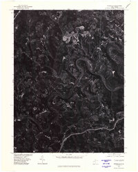
1976 Map of Rivesville
USGS Topo · Published 1979About this map
The Monongahela River carves a dramatic, winding path through the heart of this mid-1970s orthophotoquad, serving as the central geographic feature of the region. This aerial perspective, captured in April 1976, reveals a landscape defined by sharp elevation changes and the heavy influence of industry and infrastructure along the river valley. The dense woodland is interrupted by significant clearings and earthworks, particularly near Everettville, highlighting the intersection of rural life and extractive land use common to this part of West Virginia. The small settlement of Booth sits along a tight bend in the river, showing how the local topography forced development into the narrow floodplains and ridges overlooking the water. This orthophotograph provides an unfiltered look at the actual ground cover and site conditions of the era, from the winding rural roads to the industrial footprints carved into the hillsides.
Find a feature on this map
3 named features on this map. Tap any name to fly to it.
Don’t see what you’re looking for? This feature index may not catch every label — zoom into the map to look around manually.
Map Details
Editions of this 1976 Rivesville Map
This is the sole edition of this map. No revisions or reprints were ever made.
Other maps of this area

1886 · St. George
USGS Topo · 1:125,000

1891 · St. George
USGS Topo · 1:125,000

1902 · Fairmont
USGS Topo · 1:62,500

1902 · Morgantown
USGS Topo · 1:62,500

1904 · Blacksville
USGS Topo · 1:62,500

1907 · Thornton
USGS Topo · 1:62,500

1923 · Blacksville
USGS Topo · 1:62,500

1923 · Fairmont
USGS Topo · 1:62,500

1925 · Blacksville
USGS Topo · 1:62,500

1925 · Morgantown
USGS Topo · 1:62,500