
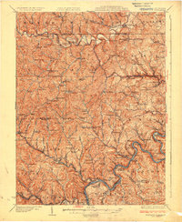
1925 Map of Blacksville
USGS Topo · Published 1925About this map
Dunkard Creek and its many winding tributaries define the rural landscape of Monongalia and Marion Counties during the mid-1920s. This era shows a densely settled countryside reliant on neighborhood institutions, evidenced by a high concentration of local educational and religious sites such as the Democrat School, Tenants Chapel, and Rocky Point School. The southern portion of the map reveals the industrial influence of the Monongahela River valley, where the Baltimore and Ohio RR tracks follow the river's edge, serving coal operations like the Montana Mines.
Find a feature on this map
159 named features on this map. Tap any name to fly to it.
Don’t see what you’re looking for? This feature index may not catch every label — zoom into the map to look around manually.
Map Details
Editions of this 1925 Blacksville Map
4 editions found
Other maps of this area

1886 · St. George
USGS Topo · 1:125,000

1891 · St. George
USGS Topo · 1:125,000

1900 · Masontown
USGS Topo · 1:62,500

1901 · Waynesburg
USGS Topo · 1:62,500

1902 · Clarksburg
USGS Topo · 1:62,500

1902 · Fairmont
USGS Topo · 1:62,500

1902 · Morgantown
USGS Topo · 1:62,500

1903 · Masontown
USGS Topo · 1:62,500

1904 · Blacksville
USGS Topo · 1:62,500

1904 · Waynesburg
USGS Topo · 1:62,500