Old Maps of Valley Falls, West Virginia for Genealogy
Trace your family roots with 15 historic maps of Valley Falls. These high-res maps reveal old neighborhoods, homesites, landmarks, and streets — helping you uncover where your ancestors lived and how the area evolved over time.
- Explore historic neighborhoods: Identify where your relatives may have lived in the 1800s or 1900s.
- Compare maps over time: Trace the changes in streets, buildings, and landmarks for multi-generational research.
- Perfect for genealogy & ancestry research: Used by family historians and researchers to map out lineage and migration.
These maps are an incredible resource for exploring your personal connection to Valley Falls's past.
Valley Falls, WV maps
(15)- 1902 Map of Fairmont
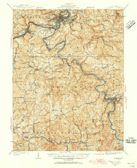
 1902 Fairmont1902 Print · USGSMarion and Taylor Counties were hubs of coal and transit at the opening of the twentieth century, as the rail lines followed the winding rivers. Genealogists can trace early family settlements and work sites from the Tyrconnell Mines to rural Nebo Church and Boothsville.4 unique versions available
 - 1923 Map of Fairmont, 1956 Print
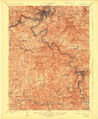
 1923 Fairmont1956 Print · USGSMarion and Taylor counties are shown during the height of their rail and coal era in the early twentieth century. Researchers can trace family origins through dozens of named landmarks like Jane Memorial Church, T McConnell Mines, and the river crossing at Benton Ferry.2 unique versions available
 - 1926 Map of Fairmont
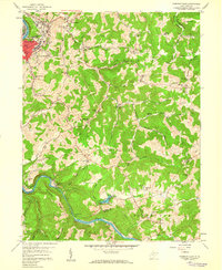
 1926 Fairmont1926 Print · USGSMarion and Taylor counties are shown during the mid-twenties when coal mining and the rail industry shaped the river valleys. Researchers can locate vanished landmarks like the Tyrconnell Mines and community centers such as Pruntytown and Mt Zion Church.3 unique versions available
 - 1949 Map of Clarksburg
 1949 Clarksburg1949 Print · USGSThe upper Ohio River valley and the industrial heart of West Virginia come into focus during this post-war period. Genealogists and researchers can trace the rail corridors of the Baltimore and Ohio and locate centers like Fairmont, Grafton, and Waynesburg.
 - 1956 Map of Clarksburg, 1966 Print
 1956 Clarksburg1966 Print · USGSThe Ohio River valley and the industrial heart of West Virginia are seen here in the mid-1950s as rail and river commerce thrived. Researchers can trace historic transport lines like the Baltimore and Ohio RR and locate ancestral homes in Clarksburg, Moundsville, or Parkersburg.2 unique versions available
 - 1958 Map of Fairmont East, 1959 Print
 1958 Fairmont East1959 Print · USGSMarion County's river valleys and ridgelines are captured here in the late fifties as the regional economy balanced coal mining and industry. Genealogists can locate family landmarks like the Hayhurst Cem, Mission Farm, and rural centers such as Quiet Dell Sch.3 unique versions available
 - 1961 Map of Clarksburg
 1961 Clarksburg1961 Print · USGSThe mid-century industrial and river landscapes of West Virginia and Ohio are detailed here, centered on the Ohio River. Researchers can trace the Baltimore and Ohio rail lines connecting towns like Parkersburg, Clarksburg, and Monongah.
 - 1982 Map of Clarksburg, 1983 Print
 1982 Clarksburg1983 Print · USGSNorth Central West Virginia in the early eighties reveals a landscape deeply connected to its coal and gas resources. Genealogists and researchers can trace family landmarks and historical settlements from Clarksburg to Buckhannon, or locate sites like Quiet Dell and Watters Smith Memorial State Park.
 - 1988 Map of Clarksburg, 1989 Print
 1988 Clarksburg1989 Print · USGSThe central Appalachians are documented in detail during the late eighties, showing the industrial and river-based economies of West Virginia, Ohio, and Pennsylvania. Researchers can trace historic rail routes like the B & O RR and locate river towns from St Marys to Parkersburg.
 - 1999 Map of Fairmont East, 2000 Print
 1999 Fairmont East2000 Print · USGSMarion County hill country and river valleys are documented here at the close of the century. Genealogists can trace family landmarks like Maple Grove Cem and rural centers such as Bunners Ridge Ch or Meadowdale Sch.
 - 2011 Map of Fairmont East, 2011 Print
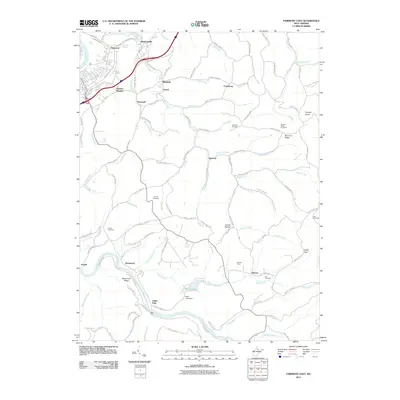 2011 Fairmont East2011 Print · USGSCovers Valley Falls, including Fairmont, Meadowdale, and other nearby areas
 - 2014 Map of Fairmont East, 2014 Print
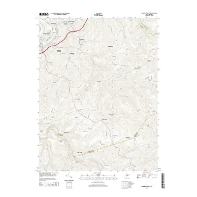 2014 Fairmont East2014 Print · USGSCovers Valley Falls, including Fairmont, Meadowdale, and other nearby areas
 - 2016 Map of Fairmont East, 2016 Print
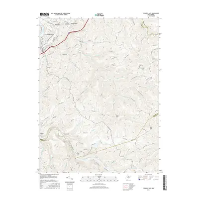 2016 Fairmont East2016 Print · USGSCovers Valley Falls, including Fairmont, Meadowdale, and other nearby areas
 - 2019 Map of Fairmont East, 2019 Print
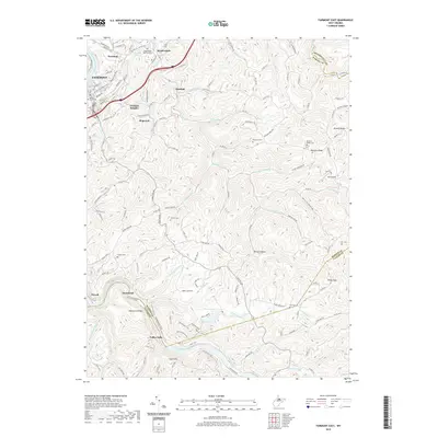 2019 Fairmont East2019 Print · USGSCovers Valley Falls, including Fairmont, Meadowdale, and other nearby areas
 - 2023 Map of Fairmont East, 2023 Print
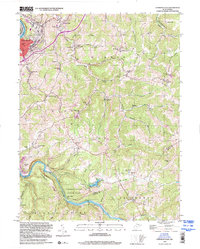
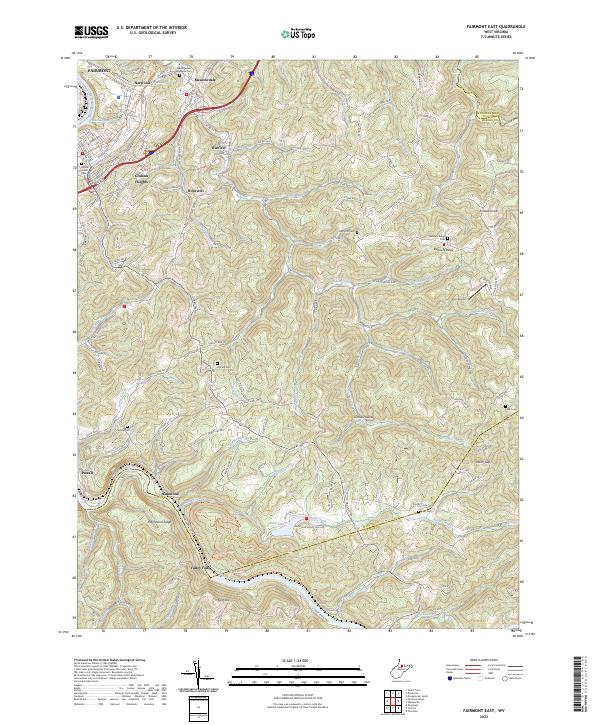 2023 Fairmont East2023 Print · USGSMarion County's highland ridges and river valleys are captured here in the early twenty-first century as the area east of Fairmont continues its transition. Researchers can locate many family burial sites such as Hayhurst Cem or trace the river's path through Valley Falls State Park.
End of results
Showing maps 1-15 of 15
Top cities near Valley Falls
- Morgantown historical maps
- Fairmont historical maps
- Clarksburg historical maps
- Bridgeport historical maps
- Grafton historical maps
- Westover historical maps
See more
Frequently asked questions
- What are the different types of historical maps available for Valley Falls?
- What is the oldest map of Valley Falls?
- Where can I purchase historical maps of Valley Falls for my home or office?
- Where can I download high-res historical maps of Valley Falls?
- Are there historical topographic maps available for Valley Falls?
- Is there historical aerial imagery available for Valley Falls?
- Where are historical maps of Valley Falls sourced from?