Old Maps of Mason County, West Virginia for Genealogy
Trace your family roots with 145 historic maps of Mason County. These high-res maps reveal old neighborhoods, homesites, landmarks, and streets — helping you uncover where your ancestors lived and how the area evolved over time.
- Explore historic neighborhoods: Identify where your relatives may have lived in the 1800s or 1900s.
- Compare maps over time: Trace the changes in streets, buildings, and landmarks for multi-generational research.
- Perfect for genealogy & ancestry research: Used by family historians and researchers to map out lineage and migration.
These maps are an incredible resource for exploring your personal connection to Mason County's past.
Mason County, WV maps
(145)- 1892 Map of Huntington, 1895 Print
 1892 Huntington1895 Print · USGSWest Virginia and Ohio meet along the river in the late nineteenth century, showing the rail-fueled growth of Huntington and Wayne. Local historians can trace the paths of the Chesapeake and Ohio Railroad past Barboursville and find early landmarks like Blue Sulphur Sp's and Davis Mill.
 - 1898 Map of Huntington
 1898 Huntington1898 Print · USGSNear the turn of the century, the Ohio River valley was transforming through the expansion of the Chesapeake and Ohio RR. Modern researchers can trace early nineteenth-century settlements from the bustling streets of Huntington to the inland hubs of Hamlin and Barboursville.3 unique versions available
 - 1902 Map of Milton
 1902 Milton1902 Print · USGSTeays Valley and the western Virginia hill country are shown here at the turn of the century, as the railroad era transformed the region's commerce. Genealogists can trace early homesteads and landmarks like Howell Mill, Salt Rock, and the Ben Johnson Ford.3 unique versions available
 - 1906 Map of Glenwood, 1958 Print
 1906 Glenwood1958 Print · USGSThe Ohio River valley was a bustling corridor of steam and rail at the start of the 1900s, anchoring the border between Mason County and Ohio. Researchers can trace riverside settlements like Mercers Bottom, find vanished post offices such as Thivener PO, and follow the Baltimore and Ohio RR through Apple Grove.
 - 1906 Map of Winfield, 1961 Print
 1906 Winfield1961 Print · USGSThe Kanawha River valley at the turn of the century shows a landscape defined by river locks and the growing influence of the railroad. Genealogists and historians can trace old homesteads and landings from Redhouse Shoals to the small village of Confidence.
 - 1907 Map of Pomeroy
 1907 Pomeroy1907 Print · USGSMeigs County at the peak of the river-and-rail era shows a landscape of busy Ohio River towns and remote hillside post offices. Genealogists can trace family footprints near Pomeroy, the Bunker Hill Church, and the dual settlement of Pagetown Downingston PO.3 unique versions available
 - 1907 Map of Keno, 1919 Print
 1907 Keno1919 Print · USGSMeigs County and the Ohio River valley appear in high detail just after the turn of the century, showing a landscape defined by river trade and rail. Researchers can trace family sites at Nease Settlement, find the Minersville PO, or locate old schools like Morningstar School and Redbrush School.3 unique versions available
 - 1908 Map of Glenwood
 1908 Glenwood1908 Print · USGSThe Ohio River valley at the turn of the century shows a landscape of riverfront rail towns and high ridges before modern development. Genealogists can trace early post offices like Yellowtown Thivener PO and settlements at Mercers Bottom or Ben Lomond.3 unique versions available
 - 1908 Map of Winfield
 1908 Winfield1908 Print · USGSThe Kanawha River valley at the turn of the century shows a landscape defined by river traffic and rail expansion. Genealogists and historians can trace riverside settlements like Winfield and Buffalo, or find lost rail stops and river locks including Lock No 10 and Black Betsey.3 unique versions available
 - 1908 Map of Ravenswood
 1908 Ravenswood1908 Print · USGSEarly 1900s life along the Ohio River comes alive in this survey of the West Virginia and Ohio borderlands. Genealogists and historians can trace family locations near landmarks like Antioch Church, Letart Falls, and the old K and M RR line.2 unique versions available
 - 1908 Map of Point Pleasant
 1908 Point Pleasant1908 Print · USGSThe confluence of the Ohio and Kanawha Rivers comes alive in the Edwardian era, showing a landscape defined by steamboats and steam engines. Genealogists can trace family roots through riverside landings and local institutions like the Ohio Epileptic Home, Hickory Chapel, and the Gallipolis Ferry.3 unique versions available
 - 1926 Map of Ravenswood
 1926 Ravenswood1926 Print · USGSThe Ohio River valley in the mid-1920s reveals a landscape of tight river bends and bustling waterfront towns like Ravenswood and Hartford. Researchers can trace the early rail network of the Baltimore and Ohio and locate numerous rural landmarks such as Jackson Chapel and the Mountain Flower School.
 - 1926 Map of Point Pleasant, 1958 Print
 1926 Point Pleasant1958 Print · USGSAt the meeting of the Ohio and Kanawha rivers, this 1920s landscape captures a bustling network of river commerce and railroad towns. Researchers can trace historic river crossings like the Gallipolis Ferry and locate early institutional landmarks including the Epileptic Home and State Industrial School.
 - 1928 Map of Ravenswood
 1928 Ravenswood1928 Print · USGSThe Ohio River's great winding oxbows dominate the landscape in the late twenties, anchoring a world of river-town commerce and hilltop farming. Genealogists can trace hundreds of family-named landmarks, from the Mountain Flower School to the Antioch Church and the rails of the Baltimore & Ohio RR.3 unique versions available
 - 1929 Map of Point Pleasant
 1929 Point Pleasant1929 Print · USGSThe riverfronts of the Ohio and Kanawha serve as the industrial spine for this region during the late 1920s. Researchers can trace genealogical roots through dozens of local landmarks like Ambrosia PO, Clipper Mill, and the Morning Star School.2 unique versions available
 - 1931 Map of Milton, 1963 Print
 1931 Milton1963 Print · USGSWestern West Virginia at the height of the railroad era shows a landscape of river-valley towns and ridge-top communities. Trace the vanished world of rural education and commerce at Howell Mill, Skyhigh Sch, and the busy rail stop at Milton.
 - 1935 Map of Milton
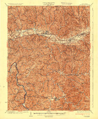 1935 Milton1935 Print · USGSCabell and Lincoln Counties appear here in the mid-1930s, defined by the winding river valleys and ridge-top communities of the Appalachian Plateau. Genealogists can trace early homesteads and social hubs through numerous sites like Howell Mill, Skyhigh Sch, and Bethesda Ch.3 unique versions available
 - 1947 Map of Columbus, 1948 Print
 1947 Columbus1948 Print · USGSCentral Ohio in the late 1940s is captured in this survey, showing the post-war transition of its rail hubs and military airfield expansions. Genealogists and historians can trace the paths of the Ohio Canal, the Pennsylvania RR lines, and the Camp Sherman Military Reservation.
 - 1949 Map of Clarksburg
 1949 Clarksburg1949 Print · USGSThe upper Ohio River valley and the industrial heart of West Virginia come into focus during this post-war period. Genealogists and researchers can trace the rail corridors of the Baltimore and Ohio and locate centers like Fairmont, Grafton, and Waynesburg.
 - 1954 Map of Charleston
 1954 Charleston1954 Print · USGSWest Virginia’s industrial heart and mountain highlands are captured here during the mid-fifties, centered on the capital city. Researchers can trace historic river-and-rail corridors along the Kanawha River and locate remote peaks within the Monongahela National Forest.
 - 1956 Map of Clarksburg, 1966 Print
 1956 Clarksburg1966 Print · USGSThe Ohio River valley and the industrial heart of West Virginia are seen here in the mid-1950s as rail and river commerce thrived. Researchers can trace historic transport lines like the Baltimore and Ohio RR and locate ancestral homes in Clarksburg, Moundsville, or Parkersburg.2 unique versions available
 - 1957 Map of Beech Hill, 1959 Print
 1957 Beech Hill1959 Print · USGSThe Kanawha River valley in the late fifties was a landscape of small river towns and upland hollows defined by the New York Central rail line. Researchers can trace family ties at Flatrock Cem or locate rural landmarks like Hickory Chapel and the Franklin D Roosevelt Sch.2 unique versions available
 - 1957 Map of Huntington, 1966 Print
 1957 Huntington1966 Print · USGSThe industrial heart of the Ohio River valley is captured here in the mid-sixties, showing the growth of Huntington and Ashland. Researchers can trace the extensive rail networks of the Chesapeake and Ohio RR and locate sites like the Chief Cornstalk Hunting Ground.3 unique versions available
 - 1957 Map of Charleston, 1966 Print
 1957 Charleston1966 Print · USGSMid-century West Virginia unfolds along the industrial Kanawha River valley and into the high Allegheny Mountains. Genealogists and historians can trace the vital rail lines of the Chesapeake and Ohio and locate riverside settlements from Saint Albans to Buckhannon.3 unique versions available
 - 1958 Map of Charleston
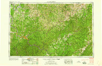 1958 Charleston1958 Print · USGSMid-century West Virginia is defined here by the industrial corridor of the Kanawha River and the high ridges of the Allegheny Mountains. Researchers can trace the rail networks of the New York Central or locate remote highland communities like Pickens and Hillsboro.
Showing maps 1-25 of 145
Top cities of Mason County
- Point Pleasant historical maps
- New Haven historical maps
- Mason historical maps
- Hartford City historical maps
- Henderson historical maps
- Leon historical maps
Frequently asked questions
- What are the different types of historical maps available for Mason County?
- What is the oldest map of Mason County?
- Where can I purchase historical maps of Mason County for my home or office?
- Where can I download high-res historical maps of Mason County?
- Are there historical topographic maps available for Mason County?
- Is there historical aerial imagery available for Mason County?
- Where are historical maps of Mason County sourced from?