2020s Maps of Mason County, West Virginia
Explore 16 historic maps of Mason County from the 2020s. These maps offer a rare glimpse into what life looked like during the 2020s — showing old roads, neighborhoods, homes, and landmarks that have changed or disappeared over time.
Whether you're researching your family's past, planning a metal detecting trip, or studying how Mason County's landscape evolved across the 2020s, these high-resolution maps are a powerful tool for exploring the history of this region.
- Focus on a specific era: All maps on this page are from the 2020s, giving you a focused view of this time period.
- See what’s changed: Compare century-old streets, trails, and buildings to today's modern landscape using overlays and satellite layers.
- Research with precision: Use these maps for genealogy, historical research, land use analysis, or educational projects.
- View, download, or print: Maps are fully viewable online in high resolution, and can be downloaded or printed for your own records.
Start exploring Mason County's history through authentic maps from the 2020s. This is your window into the past.
Mason County, WV maps
(16)- 2023 Map of Arlee, 2023 Print
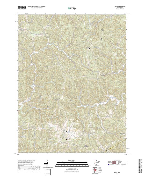 2023 Arlee2023 Print · USGSSettlement in the Mason and Putnam County hills is captured here in the early 2020s, showing a landscape of deep hollows and narrow ridges. Researchers can trace family history through numerous landmarks including Zion Baptist Cem, Potts Chapel Cem, and the small community at Arlee.
 - 2023 Map of Hurricane, 2023 Print
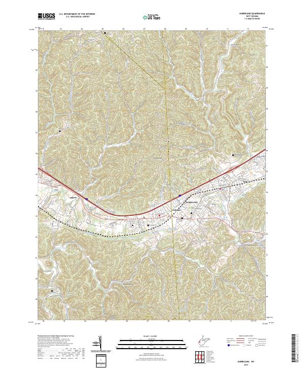 2023 Hurricane2023 Print · USGSThe Teays Valley corridor comes into focus in the early 2020s, showing the modern layout of Hurricane, Milton, and Culloden. Genealogists can trace family plots at Valley View Memorial Park Cem, Zoar Cem, and Martin Cem among the many ridgelines.
 - 2023 Map of Cottageville, 2023 Print
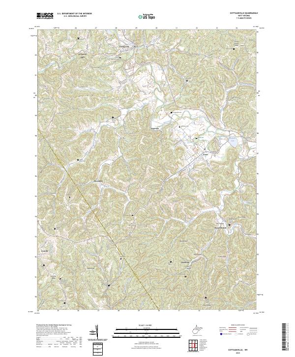 2023 Cottageville2023 Print · USGSWest Virginia's Jackson County uplands come into focus here, showing the rural communities along Mill Creek in the 2020s. Researchers can locate dozens of family burial grounds and historical landmarks like Antioch Church, Blaine Memorial Cem, and Hutchison Lake.
 - 2023 Map of Mount Olive, 2023 Print
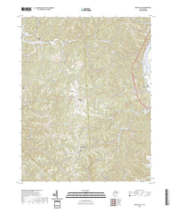 2023 Mount Olive2023 Print · USGSThe Mason and Putnam county borderlands are shown here in modern detail, where ridge-top communities overlook the Kanawha River valley. Genealogists can trace family sites at Mount Zion Cem, Staten Chapel Cem, and Fraziers Bottom United Methodists Church.
 - 2023 Map of Elmwood, 2023 Print
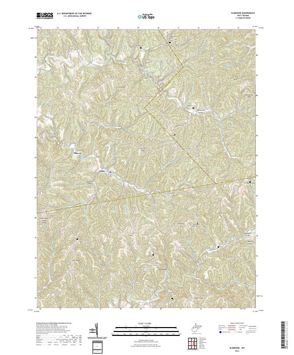 2023 Elmwood2023 Print · USGSThe hills of Putnam and Jackson counties are captured here in the early twenty-first century, showing the enduring rural character of the region. Researchers can trace family history through numerous burial sites like Sayre Cem, Walker Chapel Cem, and the aptly named Tightsqueeze Hollow.
 - 2023 Map of Chester, 2023 Print
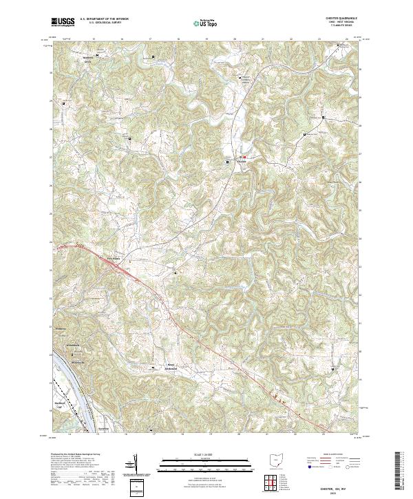 2023 Chester2023 Print · USGSThe Ohio River bend south of Meigs County comes to life in this recent study of the riverfront and its interior uplands. Genealogists can trace family names through numerous sites like Pine Grove Cem, Mount Herman Cem, and the historic Nease Settlement.
 - 2023 Map of Robertsburg, 2023 Print
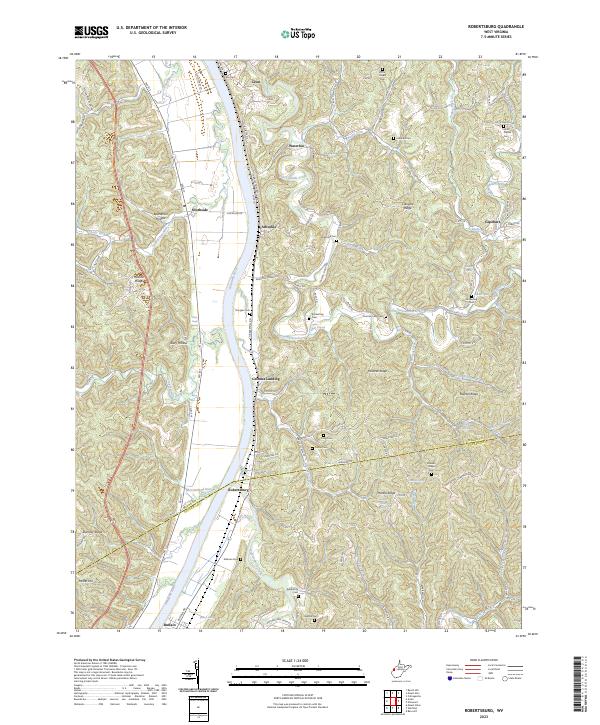 2023 Robertsburg2023 Print · USGSThe Kanawha River valley and its surrounding ridges in Mason County are captured here in the early 2020s. Genealogists can locate family burial sites such as Atkeson Cem and Kimberling Cem or trace early settlements like Grimms Landing and Robertsburg.
 - 2023 Map of New Haven, 2023 Print
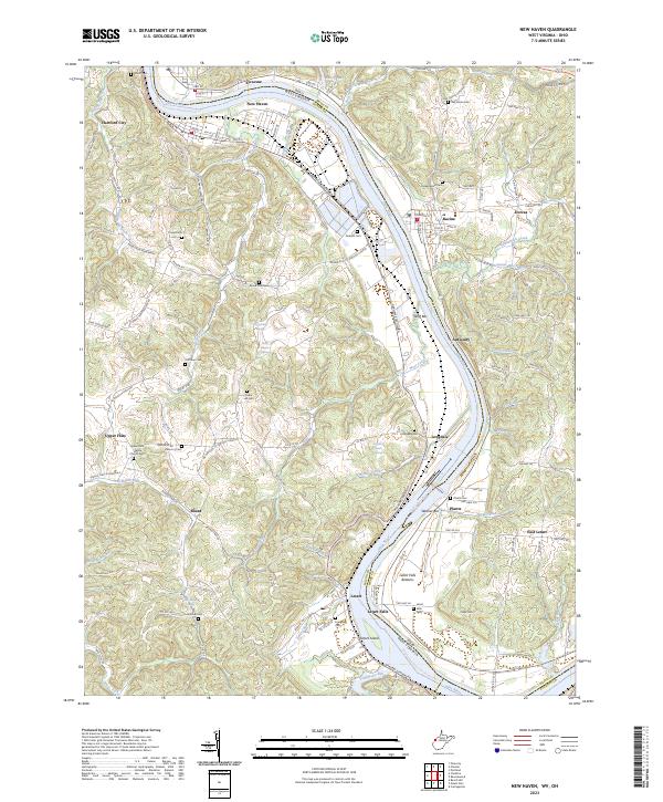 2023 New Haven2023 Print · USGSThe riverfront communities of Mason County and Meigs County are shown here in modern detail as they line the banks of the Ohio. Researchers can locate numerous local burial sites and landmarks like Upper Flats White Church Cem, Letart Falls, and the prominent Letart Island.
 - 2023 Map of Beech Hill, 2023 Print
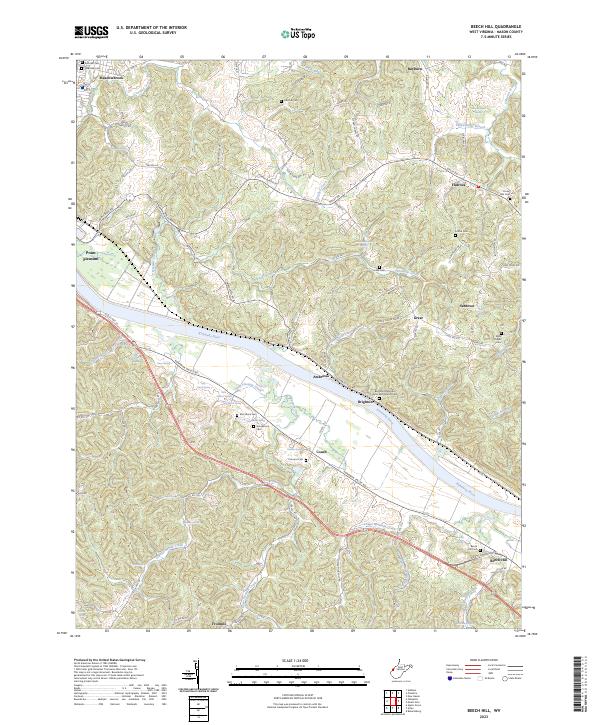 2023 Beech Hill2023 Print · USGSMason County's riverfront communities and upland ridges are mapped here in the modern era, showing the enduring rural character of the West Virginia landscape. Genealogists can trace family heritage through numerous hillside burial sites like McCulloch Cem, Henderson Cem, and the Beech Hill Cem.
 - 2023 Map of Addison, 2023 Print
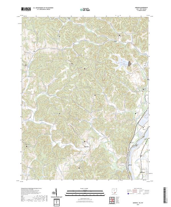 2023 Addison2023 Print · USGSGallia County, Ohio, along the West Virginia border, reveals a landscape of riverfront industry and rural ridge-top life. Researchers can trace family ties at the Roush Cem and Rife Cem or explore the geography around Bulaville and Addison.
 - 2023 Map of Cheshire, 2023 Print
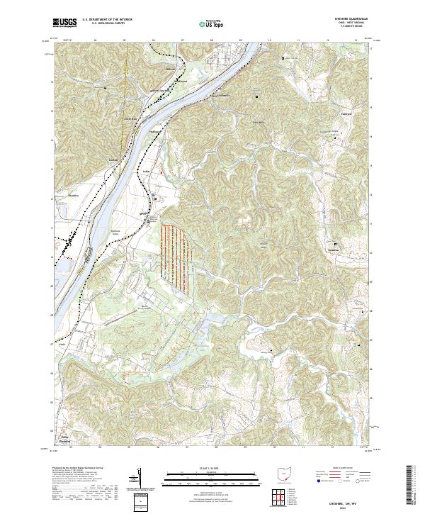 2023 Cheshire2023 Print · USGSThe Ohio River valley at the border of Ohio and West Virginia is shown here in detail during the early 2020s. Researchers can locate family sites and rural landmarks like Clifton - Hill Cem, the Mason County Airport, and the rail junction at Hobson Junction.
 - 2023 Map of Gallipolis, 2023 Print
 2023 Gallipolis2023 Print · USGSThe Ohio River valley at the border of Ohio and West Virginia comes alive in this survey of the river-and-rail corridor. Genealogists can trace family roots at Mound Hill and Pioneer Cem, or locate historic sites like the Gallia County Courthouse and the old Gallipolis Ferry crossing.
 - 2023 Map of Apple Grove, 2023 Print
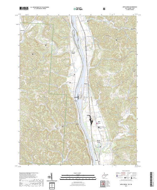 2023 Apple Grove2023 Print · USGSThe Ohio River borderlands between Ohio and West Virginia are detailed in this recent survey of the valley and its flanking ridges. Researchers can trace numerous burial sites like Bethel Methodist Episcopal Cem and riverside hamlets such as Mercers Bottom and Apple Grove.
 - 2023 Map of Glenwood, 2023 Print
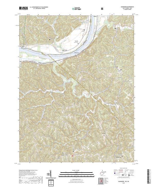 2023 Glenwood2023 Print · USGSModern West Virginia river life and hill country traditions meet along the banks of the Ohio River in the early 2020s. Genealogists and local historians can trace family ties through numerous upland sites like Moores Chapel Cemetery and the historic Swan Creek settlement.
 - 2023 Map of Mount Alto, 2023 Print
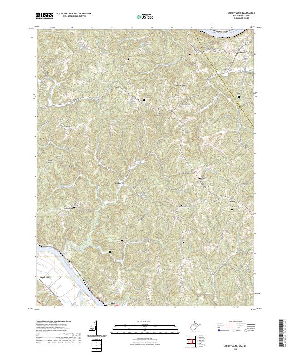 2023 Mount Alto2023 Print · USGSThe hill country of Jackson and Mason counties appears in extensive detail in this contemporary study of the Ohio River hinterlands. Researchers can trace family history through a high density of rural landmarks, including Mount Zion Cem, Jenkins Cem, and the settlement of Baden.
 - 2023 Map of Pomeroy, 2023 Print
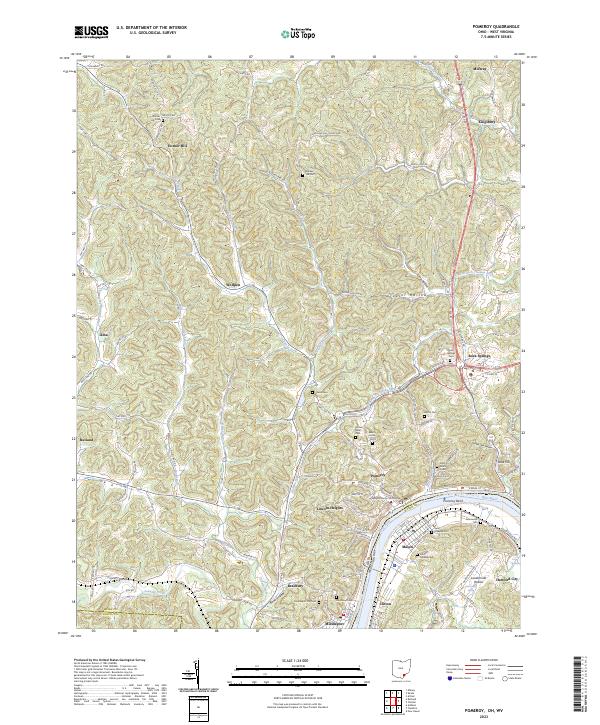 2023 Pomeroy2023 Print · USGSPomeroy and Middleport sit along the Ohio River in this recent survey of Meigs County. Genealogists can trace family burial sites at Saint Josephs Cem and Riverview Cem or locate the Meigs County Courthouse.
End of results
Showing maps 1-16 of 16
Top cities of Mason County
- Point Pleasant historical maps
- New Haven historical maps
- Mason historical maps
- Hartford City historical maps
- Henderson historical maps
- Leon historical maps
Frequently asked questions
- What are the different types of historical maps available for Mason County?
- What is the oldest map of Mason County?
- Where can I purchase historical maps of Mason County for my home or office?
- Where can I download high-res historical maps of Mason County?
- Are there historical topographic maps available for Mason County?
- Is there historical aerial imagery available for Mason County?
- Where are historical maps of Mason County sourced from?