1990s Maps of Nicholas County, West Virginia
Explore 12 historic maps of Nicholas County from the 1990s. These maps offer a rare glimpse into what life looked like during the 1990s — showing old roads, neighborhoods, homes, and landmarks that have changed or disappeared over time.
Whether you're researching your family's past, planning a metal detecting trip, or studying how Nicholas County's landscape evolved across the 1990s, these high-resolution maps are a powerful tool for exploring the history of this region.
- Focus on a specific era: All maps on this page are from the 1990s, giving you a focused view of this time period.
- See what’s changed: Compare century-old streets, trails, and buildings to today's modern landscape using overlays and satellite layers.
- Research with precision: Use these maps for genealogy, historical research, land use analysis, or educational projects.
- View, download, or print: Maps are fully viewable online in high resolution, and can be downloaded or printed for your own records.
Start exploring Nicholas County's history through authentic maps from the 1990s. This is your window into the past.
Nicholas County, WV maps
(12)- 1995 Map of Fork Mountain, 1998 Print
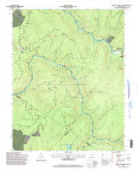
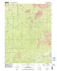
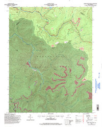 1995 Fork Mountain1998 Print · USGSThe West Virginia highlands in the 1990s show a landscape of intense resource extraction within the Monongahela National Forest. Trace the impact of several Strip Mines near landmarks like Cold Knob and Summit Lk.
 - 1995 Map of Nettie, 1998 Print
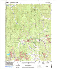
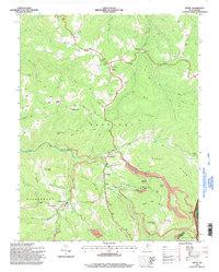 1995 Nettie1998 Print · USGSNicholas County in the mid-nineties shows a landscape defined by mountain settlements and coal operations along the edge of the national forest. Genealogists and historians can trace community roots at Downtain Chapel, Leivasy, and Fairview Cem while locating old Strip Mines.
 - 1995 Map of Camden on Gauley, 1998 Print
 1995 Camden on Gauley1998 Print · USGSThe Nicholas and Webster county border comes alive in the mid-nineties, showing a region defined by river gorges and timber tracks. Researchers can locate family landmarks like Half Acre Bethel Ch, Anderson Sch, and the Strip Mine Tipple near Holcomb.
 - 1995 Map of Quinwood, 1998 Print
 1995 Quinwood1998 Print · USGSMid-century mining settlements across the Greenbrier and Nicholas county line are documented here as coal production continued to shape the landscape. Local historians can trace family locations near Quinwood, Anjean, and rural landmarks like Hilltop Ch and Greenbrier West High Sch.
 - 1995 Map of Webster Springs SW, 1998 Print
 1995 Webster Springs SW1998 Print · USGSThe Monongahela National Forest highlands are captured here in the mid-nineties, showing a landscape of rugged mountain peaks and river headwaters. Researchers can trace the Mills Mtn Ch, local Cem, and the remote Three Forks of Williams River.
 - 1995 Map of Craigsville, 1998 Print
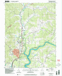
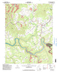 1995 Craigsville1998 Print · USGSNicholas County settlements and the winding Gauley River corridor are shown here in the mid-1990s as the local economy balanced industry and recreation. Genealogists and local historians can locate the Drive-in Theater at Craigsville, family cemeteries near Calvin, and the old Coal Siding along the river.
 - 1995 Map of Richwood, 1998 Print
 1995 Richwood1998 Print · USGSThe Cherry River valley in the 1990s reveals a landscape defined by mountain industry and forest conservation. Genealogists and historians can trace the foundations of local life through rural landmarks like New Hope Ch, Baber Cem, and the high-elevation settlement of Saxman.
 - 1996 Map of Bentree, 2002 Print
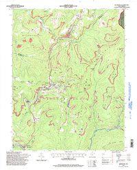
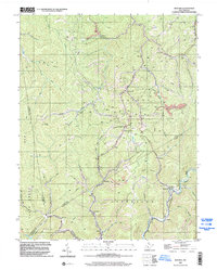 1996 Bentree2002 Print · USGSNear the intersection of four West Virginia counties in the 1990s, this area reflects a landscape shaped by coal production and creek-side settlements. Genealogists and historians can trace community roots through landmarks like Lilly No. 11 School, Lizemores Ch, and the strip mines near Bentree.
 - 1996 Map of Lockwood, 2002 Print
 1996 Lockwood2002 Print · USGSThe Nicholas and Clay county borderlands in the 1990s are defined by deep Appalachian valleys and an active extraction economy. Genealogists and historians can trace local landmarks like Lyonsville, the Otter Creek Sch, and the Twentymile Ch among the timbered hills.
 - 1996 Map of Gilboa, 2002 Print
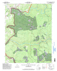
 1996 Gilboa2002 Print · USGSNicholas County in the mid-1990s reveals a landscape defined by industrial extraction and rural community hubs. Researchers can trace family history through local landmarks like Enon Ch, Pierson Chapel, and the Lone Star Lookout Tower near Gilboa.
 - 1996 Map of Summersville, 2003 Print
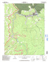
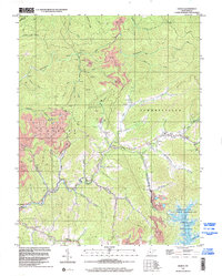
 1996 Summersville2003 Print · USGSSummersville and the Gauley River valley are captured in the late nineties as a mix of growing town centers and rural mountain communities. Trace family roots and local industry through the Glade Creek Sch, small mines, and numerous rural churches like St Martins Ch.
 - 1997 Map of Tioga, 2003 Print
 1997 Tioga2003 Print · USGSNicholas County’s coal and timber country is documented here in the late twentieth century, centered on the community of Tioga. Genealogists and local historians can locate family landmarks such as Radcliff Chapel, Boggs Cem, and the various mines that shaped the local economy.
End of results
Showing maps 1-12 of 12
Top cities of Nicholas County
- Summersville historical maps
- Richwood historical maps
- Craigsville historical maps
- Persinger Ford historical maps
- Groves Ford historical maps
Frequently asked questions
- What are the different types of historical maps available for Nicholas County?
- What is the oldest map of Nicholas County?
- Where can I purchase historical maps of Nicholas County for my home or office?
- Where can I download high-res historical maps of Nicholas County?
- Are there historical topographic maps available for Nicholas County?
- Is there historical aerial imagery available for Nicholas County?
- Where are historical maps of Nicholas County sourced from?