2000s (21st Century) Maps of Nicholas County, West Virginia
Explore 25 historic maps of Nicholas County from the 2000s (21st Century). These maps offer a rare glimpse into what life looked like during the 2000s — showing old roads, neighborhoods, homes, and landmarks that have changed or disappeared over time.
Whether you're researching your family's past, planning a metal detecting trip, or studying how Nicholas County's landscape evolved across the 2000s, these high-resolution maps are a powerful tool for exploring the history of this region.
- Focus on a specific era: All maps on this page are from the 2000s, giving you a focused view of this time period.
- See what’s changed: Compare century-old streets, trails, and buildings to today's modern landscape using overlays and satellite layers.
- Research with precision: Use these maps for genealogy, historical research, land use analysis, or educational projects.
- View, download, or print: Maps are fully viewable online in high resolution, and can be downloaded or printed for your own records.
Start exploring Nicholas County's history through authentic maps from the 2000s. This is your window into the past.
Nicholas County, WV maps
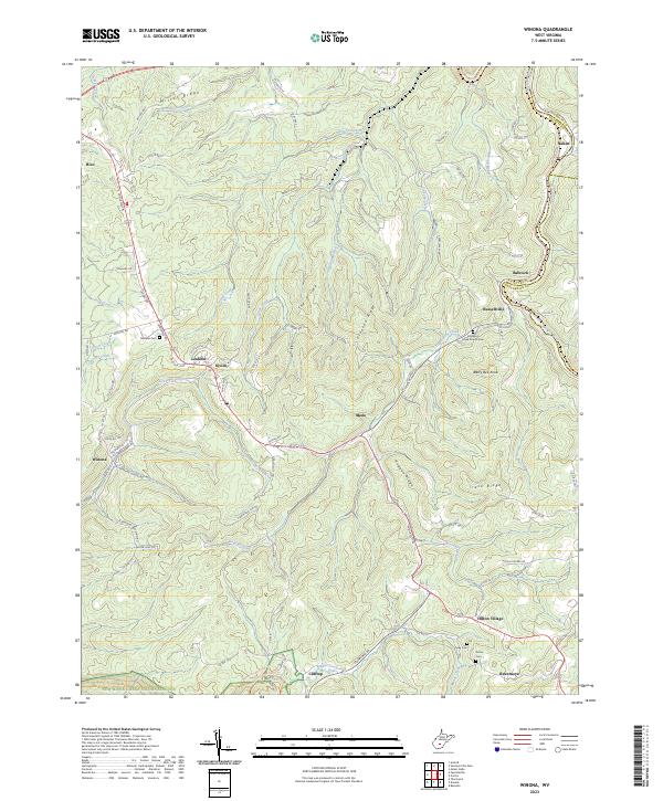
(25)- 2000 Map of Winona, 2001 Print
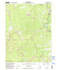 2000 Winona2001 Print · USGSThe coal and timber country of Fayette County is captured here at the start of the new millennium. Local historians and genealogists can trace the communities of Winona and Clifftop, locating landmarks like the Old Stone House, Brackens Creek Ch, and the Air Shaft Mine.
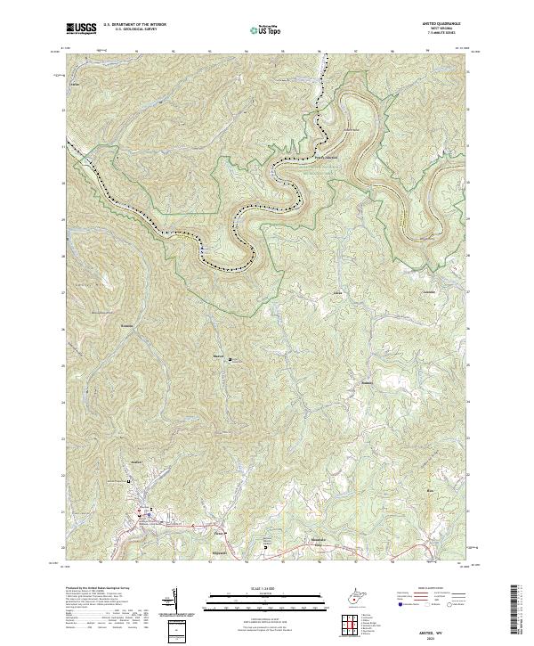
 - 2000 Map of Ansted, 2001 Print
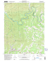 2000 Ansted2001 Print · USGSFayette and Nicholas counties at the start of the millennium show a landscape of deep river gorges and upland mining operations. Researchers can locate family landmarks such as Restlawn Memory Gardens, Mt Eary Ch, and the old settlement at Victor.
 - 2023 Map of Little Birch, 2023 Print
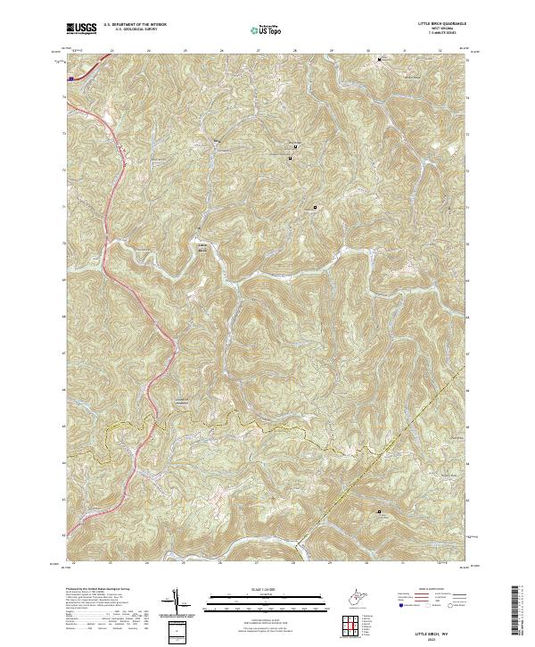 2023 Little Birch2023 Print · USGSThe rugged highlands of Braxton and Nicholas counties are documented here as they appeared in the early 21st century. Genealogists can trace ancestral sites at Hoover Cem, Hickory Flats Cem, and the old crossroads at Tesla and Hickory Flats.
 - 2023 Map of Strange Creek, 2023 Print
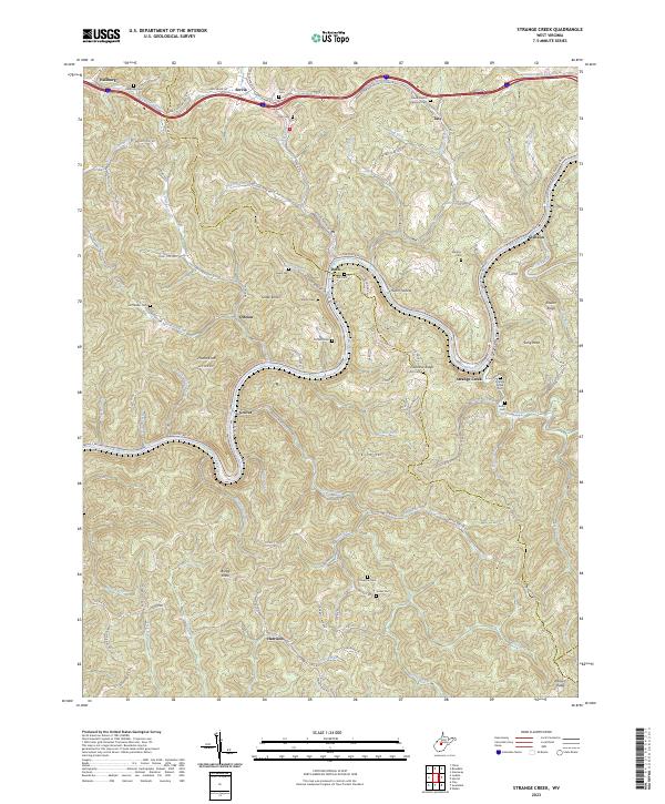 2023 Strange Creek2023 Print · USGSCentral West Virginia's river valleys and ridgelines are shown in detail here in the early twenty-first century. Family historians can locate dozens of burial sites like David Hamric Memorial Cem and trace old routes through Duck, Strange Creek, and Harrison.
 - 2023 Map of Bentree, 2023 Print
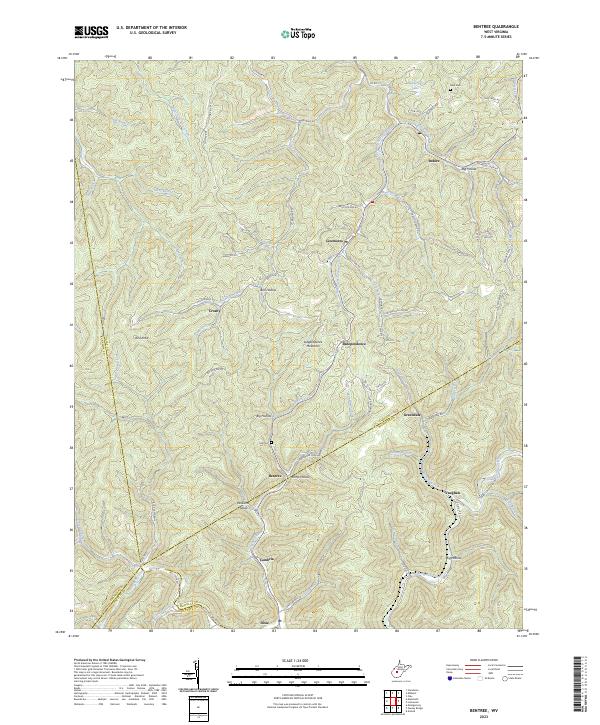 2023 Bentree2023 Print · USGSClay County and the surrounding highlands are depicted here at a moment when traditional hollow life and modern road networks intersect. Genealogists and hikers can trace family names and old paths through Ramp Hollow, Ida Cem, and the winding banks of Twentymile Creek.
 - 2023 Map of Lockwood, 2023 Print
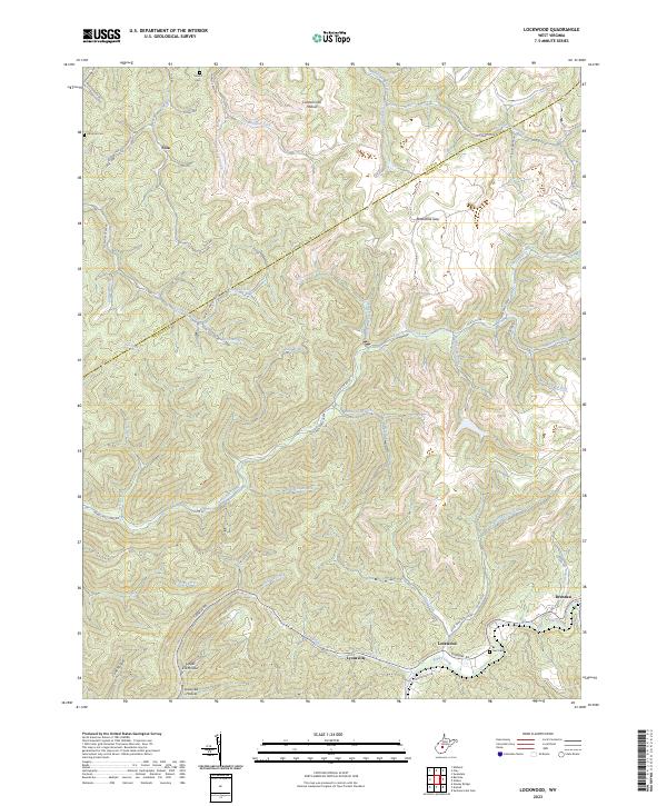 2023 Lockwood2023 Print · USGSThe Nicholas County highlands around the turn of the 21st century remain defined by deep hollows and isolated mountain settlements. Researchers can trace family roots through Sunset Cem or Neil Cem and follow the old Turnpike Rd past Lockwood and Drennen.
 - 2023 Map of Gauley Bridge, 2023 Print
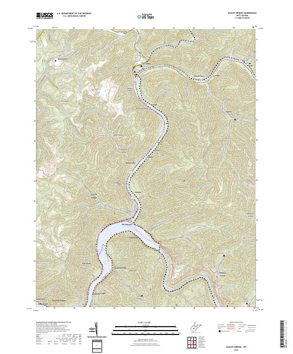 2023 Gauley Bridge2023 Print · USGSThe confluence of the New and Gauley Rivers comes alive in this contemporary look at Fayette County's river-bottom towns. Genealogists and local historians can trace legacy family sites like Abbott-Huddleston Cem or follow the rails through KM Junction and Gauley Bridge.
 - 2023 Map of Ansted, 2023 Print
 2023 Ansted2023 Print · USGSFayette and Nicholas Counties are documented here in the early twenty-first century, showing the rugged river gorge country of the New River region. Genealogists and historians can trace family locations near Ansted, Woods Ferry, and the Mount Chapel Cem.
 - 2023 Map of Gilboa, 2023 Print
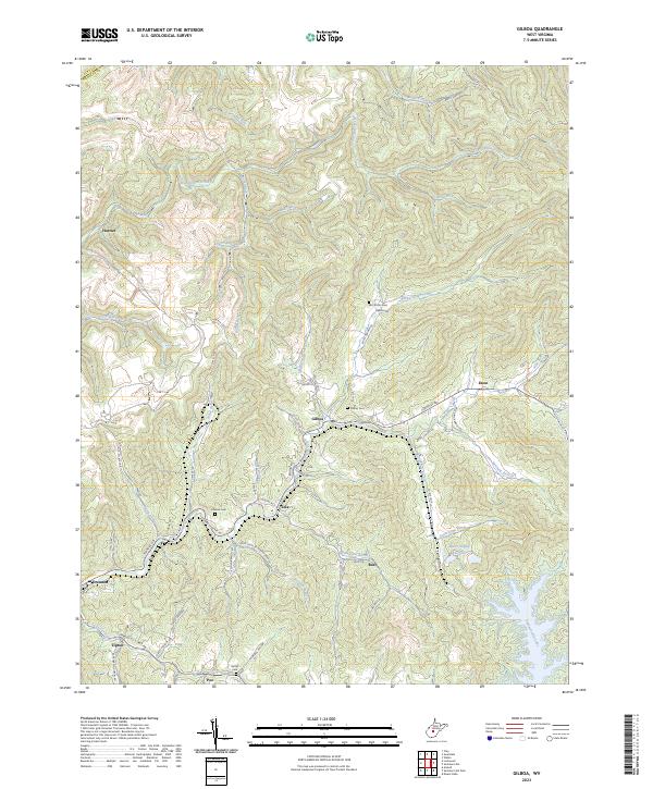 2023 Gilboa2023 Print · USGSNicholas County’s rugged plateau is shown here just as the modern road network weaves between established settlements and the waters of Summersville Lake. Local researchers can trace family roots at Keenan Cem or locate old homestead sites near Zela and Gilboa.
 - 2023 Map of Craigsville, 2023 Print
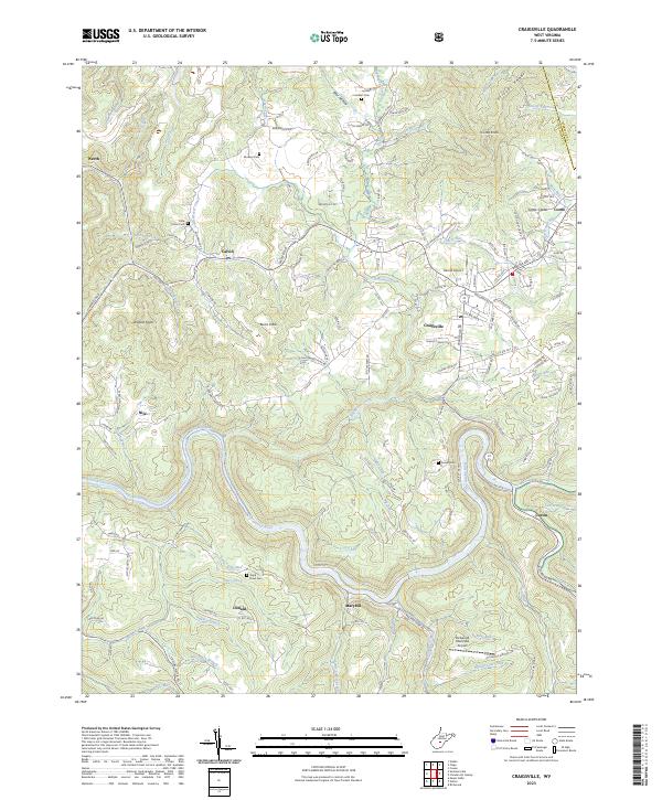 2023 Craigsville2023 Print · USGSThe highland valleys of Nicholas and Webster Counties are documented here in recent years, centered on the confluence of the Gauley River and Cherry River. Researchers can trace rural cemeteries such as Mullens Cem and Russell Cem or the localized growth of Craigsville.
 - 2023 Map of Corliss, 2023 Print
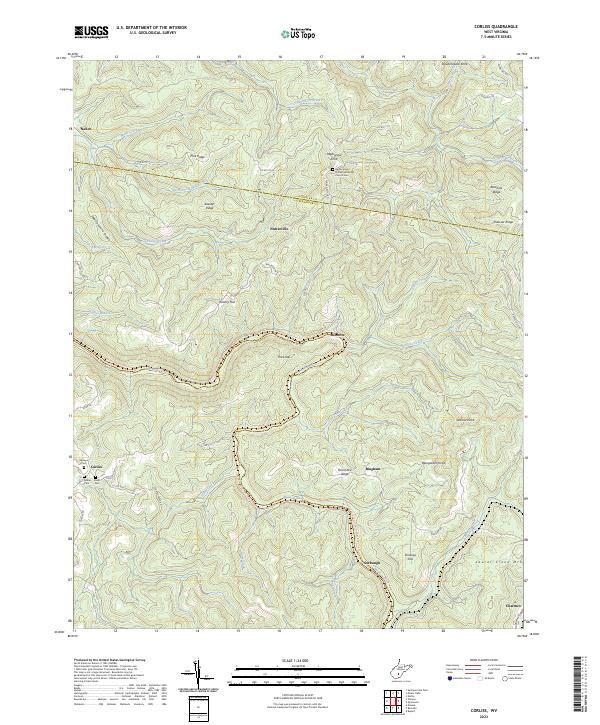 2023 Corliss2023 Print · USGSGreenbrier and Nicholas Counties are shown here during the early twenty-first century as the landscape transitions toward recreation. Researchers can trace the Meadow River Rail-Trail past high points like Beargarden Knob and family sites like Shawver Cem or Rider Cem.
 - 2023 Map of Camden On Gauley, 2023 Print
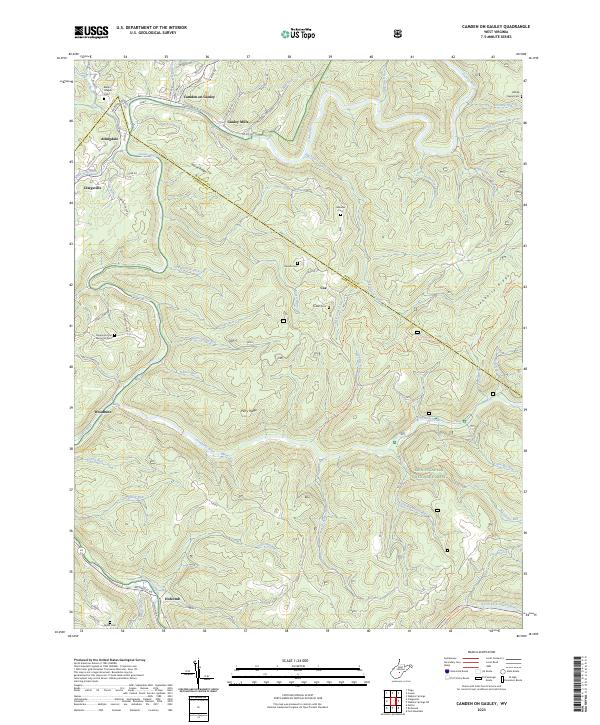 2023 Camden On Gauley2023 Print · USGSThe river valleys of Nicholas and Webster counties are captured here in the early 2020s, showing the enduring communities along the Gauley River. Local historians can trace old homesteads and landmarks like Blacks Chapel Cem, the settlement of Gauley Mills, and the Alderson Church.
 - 2023 Map of Herold, 2023 Print
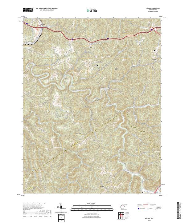 2023 Herold2023 Print · USGSBraxton and Nicholas Counties are shown in the 2020s, where river valleys dictate the layout of high-country settlements. Genealogists can locate several family burial sites like Tinnel-Mollohan Family Cem and the New Hope Church near Morris.
 - 2023 Map of Fork Mountain, 2023 Print
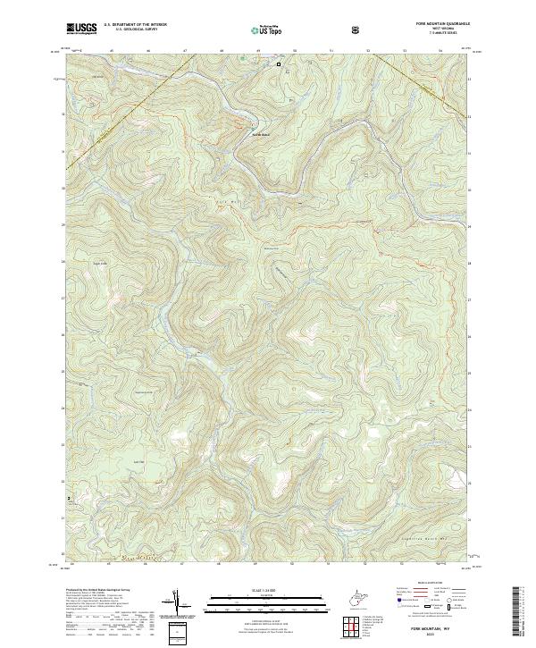 2023 Fork Mountain2023 Print · USGSGreenbrier County's high ridges and river forks are captured here in the early twenty-first century. Researchers can locate the Nancy Hart Cem and trace old mountain paths like the POCAHONTAS TRAIL or the Fork Mountain Tri through the dense forest.
 - 2023 Map of Quinwood, 2023 Print
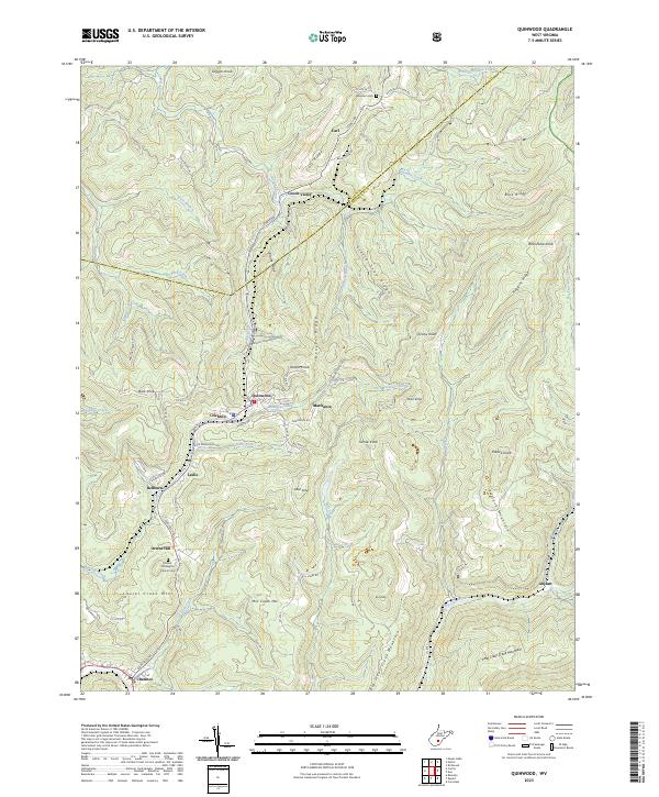 2023 Quinwood2023 Print · USGSIn the modern West Virginia coalfields, the rugged terrain of Greenbrier and Nicholas Counties continues to shape local life. Genealogists can trace family connections through sites like Orient Hill Baptist Church Cem and the small settlements of Quinwood and Anjean.
 - 2023 Map of Summersville, 2023 Print
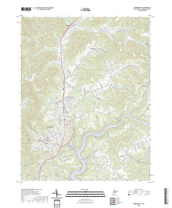 2023 Summersville2023 Print · USGSSummersville and the Gauley River valley are captured in this contemporary topographic record of Nicholas County. Researchers can trace the civic center around the Nicholas County Courthouse or locate family sites at Groves Cem and the historic Persinger Ford.
 - 2023 Map of Summersville Dam, 2023 Print
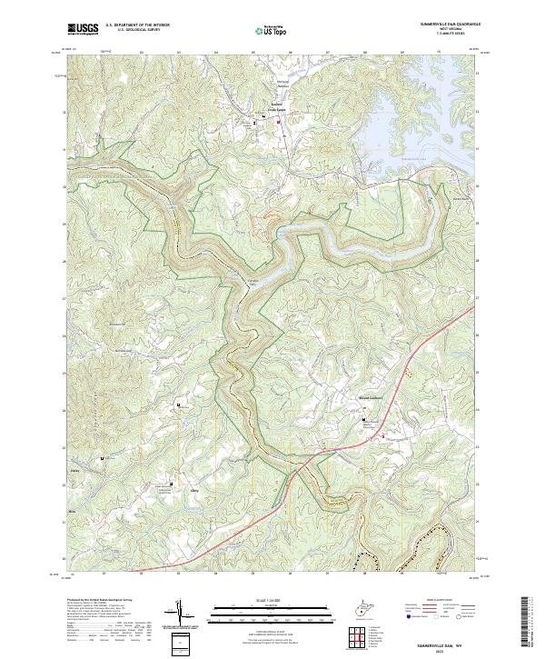 2023 Summersville Dam2023 Print · USGSThe West Virginia highlands and the Gauley River canyon come alive in this detailed look at Nicholas and Fayette Counties. Trace family roots at Kesler Memorial Presbyterian Church Cem or explore the historic crossing at Carnifex Ferry.
 - 2023 Map of Webster Springs SW, 2023 Print
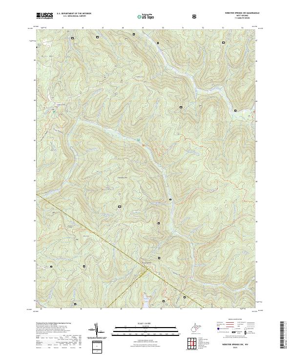 2023 Webster Springs SW2023 Print · USGSThe high ridges of Webster and Nicholas counties are detailed in this recent survey of West Virginia's interior. Researchers can trace the drainages of the Cranberry River and Williams River, locating landmarks like Blacks Chapel Cem and Hanging Rock.
 - 2023 Map of Nettie, 2023 Print
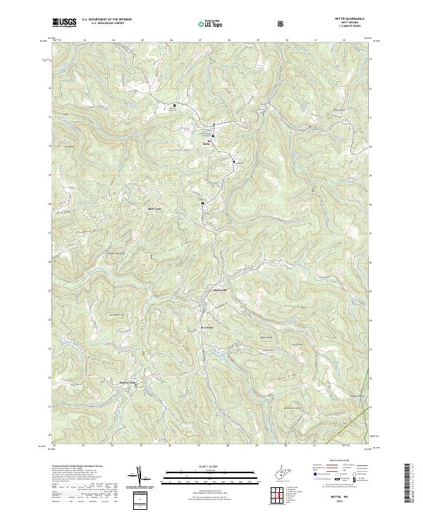 2023 Nettie2023 Print · USGSNicholas County settlements and high ridge country are mapped in detail during this modern era. Genealogists can trace family connections at Olive Branch Baptist Church Cem and Penile Cem or explore the drainage of Hominy Creek and Grassy Creek.
 - 2023 Map of Mount Nebo, 2023 Print
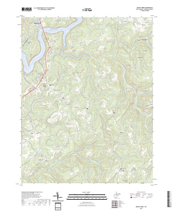 2023 Mount Nebo2023 Print · USGSNicholas County settlements and ridge-top communities are captured here in the early twenty-first century. Genealogists can locate family burial grounds like Gilgal Cem and Hickory Grove Cem or trace the rural routes connecting Runa, Bruce, and Pool.
 - 2023 Map of Widen, 2023 Print
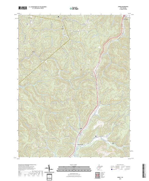 2023 Widen2023 Print · USGSThe Nicholas County highlands are mapped here in the early twenty-first century, showing the remote settlements of Widen and Hookersville. Genealogists can trace family landmarks like Butcher Cem, Spruce Run Cem, and the heights of Powell Mountain.
 - 2023 Map of Tioga, 2023 Print
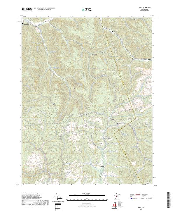 2023 Tioga2023 Print · USGSThis portion of the Nicholas and Webster county line shows the Appalachian landscape near the turn of the twenty-first century. Genealogists can locate family landmarks like the Barnett Family Cem and Armstrong Cem near the banks of the Birch River.
 - 2023 Map of Richwood, 2023 Print
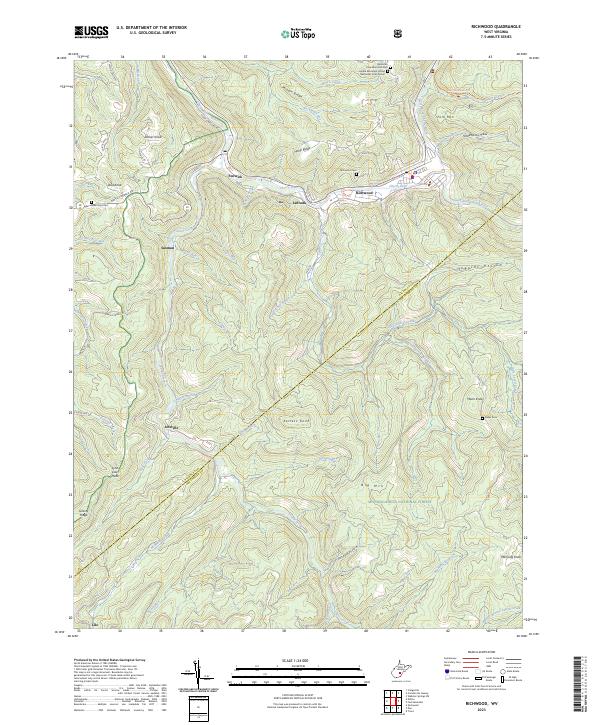 2023 Richwood2023 Print · USGSRichwood and the Cherry River forks are documented here in the early twenty-first century, showing the enduring mountain settlements of Nicholas County. Genealogists can trace family names through sites like Baber Cem, Tanner Knob, and Handle Factory Hollow.
 - 2023 Map of Winona, 2023 Print
 2023 Winona2023 Print · USGSFayette County ridge-top communities are documented here in the early twenty-first century as they overlook the dramatic West Virginia gorges. Researchers can locate family burial sites like Amick Cem and trace the conversion of the old Meadow River Rail-Trl.
 - 2023 Map of Swandale, 2023 Print
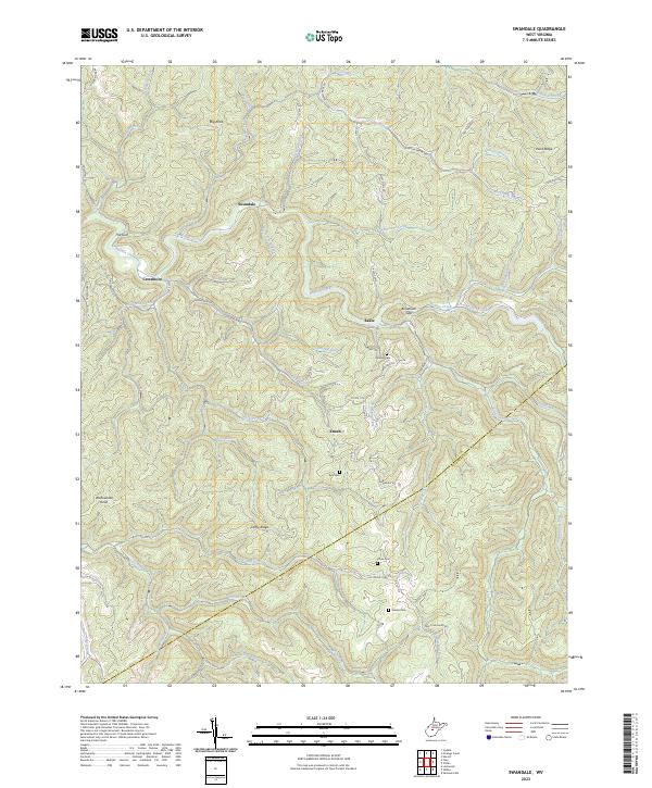 2023 Swandale2023 Print · USGSClay County's interior ridges and hollows are documented here during the early 2020s, showing the enduring layout of the West Virginia highlands. Genealogists can locate several local burial sites like Kyle Cem and Wilson Cem near the communities of Swandale and Enoch.
End of results
Showing maps 1-25 of 25
Top cities of Nicholas County
- Summersville historical maps
- Richwood historical maps
- Craigsville historical maps
- Persinger Ford historical maps
- Groves Ford historical maps
Frequently asked questions
- What are the different types of historical maps available for Nicholas County?
- What is the oldest map of Nicholas County?
- Where can I purchase historical maps of Nicholas County for my home or office?
- Where can I download high-res historical maps of Nicholas County?
- Are there historical topographic maps available for Nicholas County?
- Is there historical aerial imagery available for Nicholas County?
- Where are historical maps of Nicholas County sourced from?