1920s Maps of Nicholas County, West Virginia
Explore 5 historic maps of Nicholas County from the 1920s. These maps offer a rare glimpse into what life looked like during the 1920s — showing old roads, neighborhoods, homes, and landmarks that have changed or disappeared over time.
Whether you're researching your family's past, planning a metal detecting trip, or studying how Nicholas County's landscape evolved across the 1920s, these high-resolution maps are a powerful tool for exploring the history of this region.
- Focus on a specific era: All maps on this page are from the 1920s, giving you a focused view of this time period.
- See what’s changed: Compare century-old streets, trails, and buildings to today's modern landscape using overlays and satellite layers.
- Research with precision: Use these maps for genealogy, historical research, land use analysis, or educational projects.
- View, download, or print: Maps are fully viewable online in high resolution, and can be downloaded or printed for your own records.
Start exploring Nicholas County's history through authentic maps from the 1920s. This is your window into the past.
Nicholas County, WV maps
(5)- 1921 Map of Richwood
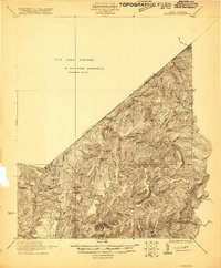 1921 Richwood1921 Print · USGSThe West Virginia mountain country of Greenbrier and Nicholas counties is captured here just after the Great War. Researchers can trace rural life through old schoolhouses like Fallbrook School and Big Stone School, or locate settlements at Jettsville and Quinnwood.2 unique versions available
 - 1923 Map of Lobelia
 1923 Lobelia1923 Print · USGSGreenbrier and Pocahontas Counties are shown in the early 1920s as mountain farming and timber harvesting shaped the landscape. Researchers can trace dozens of rural institutions, from Ellis Chapel and Band of Hope Church to remote schools like West Droop School.2 unique versions available
 - 1923 Map of Richwood
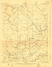
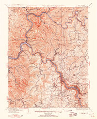
 1923 Richwood1923 Print · USGSThe Gauley River and its mountain forks in the early 1920s reveal a landscape of deep timber valleys and upland schoolhouses. Trace the path of the Baltimore and Ohio RR to Richwood and locate old sites like Hominy Mill or Namos Chapel.3 unique versions available
 - 1925 Map of Lobelia
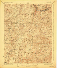
 1925 Lobelia1925 Print · USGSThe mountains and wetlands of Greenbrier County are captured here in the mid-1920s, showing a landscape of high ridges and rural valley settlements. Trace old family sites and mountain outposts like Lobelia, Trout Valley, and the Cranberry Glades.2 unique versions available
 - 1928 Map of Fayetteville, 1955 Print
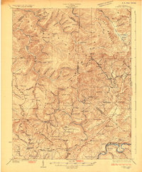
 1928 Fayetteville1955 Print · USGSFayette County was a hub of river-and-rail activity in the late twenties as the coal industry matured. Genealogists and historians can locate old landmarks like Kanawha Falls, the Blue Hole Tunnel, and rural centers such as Ansted and Gauley Bridge.4 unique versions available
End of results
Showing maps 1-5 of 5
Top cities of Nicholas County
- Summersville historical maps
- Richwood historical maps
- Craigsville historical maps
- Persinger Ford historical maps
- Groves Ford historical maps
Frequently asked questions
- What are the different types of historical maps available for Nicholas County?
- What is the oldest map of Nicholas County?
- Where can I purchase historical maps of Nicholas County for my home or office?
- Where can I download high-res historical maps of Nicholas County?
- Are there historical topographic maps available for Nicholas County?
- Is there historical aerial imagery available for Nicholas County?
- Where are historical maps of Nicholas County sourced from?