1990s Maps of Pendleton County, West Virginia
Explore 18 historic maps of Pendleton County from the 1990s. These maps offer a rare glimpse into what life looked like during the 1990s — showing old roads, neighborhoods, homes, and landmarks that have changed or disappeared over time.
Whether you're researching your family's past, planning a metal detecting trip, or studying how Pendleton County's landscape evolved across the 1990s, these high-resolution maps are a powerful tool for exploring the history of this region.
- Focus on a specific era: All maps on this page are from the 1990s, giving you a focused view of this time period.
- See what’s changed: Compare century-old streets, trails, and buildings to today's modern landscape using overlays and satellite layers.
- Research with precision: Use these maps for genealogy, historical research, land use analysis, or educational projects.
- View, download, or print: Maps are fully viewable online in high resolution, and can be downloaded or printed for your own records.
Start exploring Pendleton County's history through authentic maps from the 1990s. This is your window into the past.
Pendleton County, WV maps
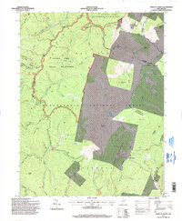
(18)- 1995 Map of Onego, 1998 Print
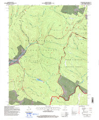
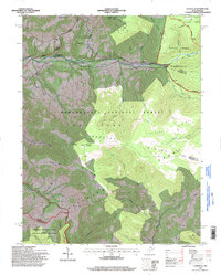
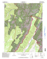 1995 Onego1998 Print · USGSPendleton County in the mid-1990s shows a landscape of deep river gaps and mountain ridges managed by the Forest Service. Researchers can trace historic family-named peaks like Ketterman Knob and settlements such as Onego and Macksville.
 - 1995 Map of Harman, 1998 Print
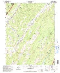
 1995 Harman1998 Print · USGSRandolph and Tucker counties in the mid-1990s show a region of high mountain ridges and river-bottom settlements. Genealogists and hikers can trace the winding Dry Fork, locate the Riverside Ch, and explore trails through the Otter Creek Wilderness.2 unique versions available
 - 1995 Map of Franklin, 1998 Print
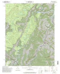
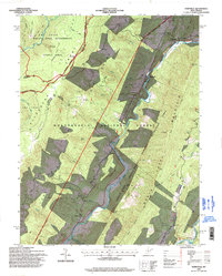
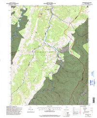
 1995 Franklin1998 Print · USGSIn the mid-nineties, the South Branch Potomac River valley in Pendleton County remains a landscape of river-bottom settlements and forest ridges. Researchers can locate family landmarks like Reeds Creek Ch, Ruddle Ch, and the streets of Franklin.
 - 1995 Map of Spruce Knob, 1998 Print
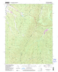
 1995 Spruce Knob1998 Print · USGSThe West Virginia highlands appear in the mid-nineties as a recreation hub centered around the state's highest peak. Genealogists and hikers can trace the paths near Cherry Grove and find landmarks like Big Run Chapel or the Spruce Knob lookout.
 - 1995 Map of Sinks of Gandy, 1998 Print
 1995 Sinks of Gandy1998 Print · USGSThe high Allegheny backcountry of Randolph and Pocahontas counties is captured here in the mid-nineties, before modern development reached these remote ridges. Researchers can locate the famous Sinks of Gandy cavern entrance, the settlement of Osceola, and high-altitude landmarks like Blister Swamp.
 - 1995 Map of Mozer, 1998 Print
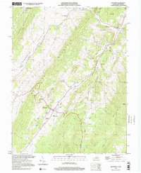
 1995 Mozer1998 Print · USGSPendleton and Grant counties are captured in the mid-1990s, showing a landscape of high ridges and narrow valley settlements. Genealogists and hikers can trace the rural homes and mountain gaps near Mozer, Mt Horeb Ch, and the rugged peaks of Cave Mtn.
 - 1995 Map of Hopeville, 1998 Print
 1995 Hopeville1998 Print · USGSThe West Virginia highlands in the mid-1990s reveal a landscape of deep river valleys and high wilderness plateaus. Researchers can trace remote mountain communities like Hopeville and Ketterman, as well as landmarks like Smoke Hole Caverns and Pleasant Valley Ch.
 - 1995 Map of Upper Tract, 1998 Print
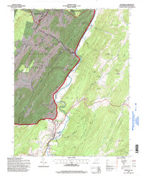
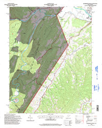
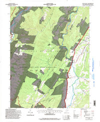 1995 Upper Tract1998 Print · USGSPendleton County's dramatic river gaps and high ridges are captured here during the mid-1990s as the national recreation area became a focal point for the region. Genealogists and local historians can locate remote churches like St Georges Smoke Hole Ch and trace the paths of Mill Run and Stony Creek.
 - 1995 Map of Thornwood, 1998 Print
 1995 Thornwood1998 Print · USGSThe West Virginia and Virginia borderlands come alive in the 1990s as the high ridges of the Allegheny Mountains meet. Genealogists and hikers can trace the remote reaches of the Greenbrier River near Thornwood, locate the cemetery, and find Locust Springs.
 - 1995 Map of Petersburg West, 1998 Print
 1995 Petersburg West1998 Print · USGSIn the mid-nineties, the South Branch Potomac River valley outside Petersburg supported a mix of mountain recreation and rural community life. Genealogists and hikers can trace historical landmarks like Marvin Chapel, the Petersburg Airport, and the peaks of Dayton Knob.
 - 1995 Map of Snowy Mountain, 1998 Print
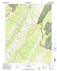
 1995 Snowy Mountain1998 Print · USGSThe West Virginia and Virginia borderlands near the South Branch Potomac River are captured here in the 1990s. Researchers can trace rural life through the locations of Dry Run Ch, Hardscrabble, and Elk Mtn Chapel tucked against Snowy Mountain.
 - 1995 Map of Circleville, 1998 Print
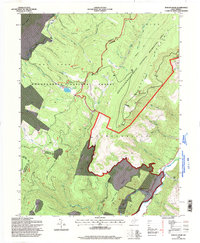
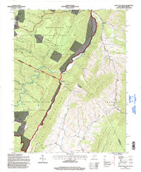
 1995 Circleville1998 Print · USGSPendleton County's high ridges and river valleys are captured here in the mid-1990s as the landscape transition between forest and farm. You can trace family sites and local history at Fairview Ch, Riverton, and the North Fork Memorial Cem.
 - 1995 Map of Laneville, 1998 Print
 1995 Laneville1998 Print · USGSHigh Allegheny plateaus and the headwaters of Red Creek define this West Virginia mountain landscape during the mid-1990s. Researchers can locate remote sites like Flanagan Memorial Cem, the Bethel Ch, and landmarks like Thunderstruck Rock.
 - 1995 Map of Whitmer, 1998 Print
 1995 Whitmer1998 Print · USGSThe Dry Fork valley in the mid-nineties shows the isolated settlements and mountain ridges of the West Virginia high country. Genealogists and hikers can trace family-named creeks and remote outposts like Whitmer, Little Italy, and the high-elevation Judy Springs.
 - 1999 Map of Reddish Knob, 2000 Print
 1999 Reddish Knob2000 Print · USGSThe mountain borderlands of Augusta and Rockingham counties are captured here in the late twentieth century. Researchers can trace historic access paths and high-country landmarks like Reddish Knob, the Hone Quarry Recreation Area, and scattered Mines.
 - 1999 Map of Palo Alto, 2000 Print
 1999 Palo Alto2000 Print · USGSThe borderlands of Augusta and Highland County meet West Virginia here in the late twentieth century, showing a landscape defined by ridges and narrow hollows. Genealogists can locate family landmarks such as Crummett Ch, Wilfong Ch, and the small settlement of Palo Alto.
 - 1999 Map of Brandywine, 2001 Print
 1999 Brandywine2001 Print · USGSThe West Virginia and Virginia borderlands meet along these high ridges as the new millennium approached. Researchers can trace family history at Pine Hill Cem or locate old landmarks like the Martin Luther Ch and High Knob Lookout Tower.
 - 1999 Map of Monterey, 2001 Print
 1999 Monterey2001 Print · USGSHighland County's high-mountain valleys are captured here at the close of the century, showing the rural settlement patterns of the Virginia-West Virginia border. Genealogists and local historians can trace family locations near Union Chapel, the community of New Hampden, and the landmark Trimble Knob.
End of results
Showing maps 1-18 of 18
Top cities of Pendleton County
Frequently asked questions
- What are the different types of historical maps available for Pendleton County?
- What is the oldest map of Pendleton County?
- Where can I purchase historical maps of Pendleton County for my home or office?
- Where can I download high-res historical maps of Pendleton County?
- Are there historical topographic maps available for Pendleton County?
- Is there historical aerial imagery available for Pendleton County?
- Where are historical maps of Pendleton County sourced from?