Old Maps of Pendleton County, West Virginia for Hiking & Exploration
Hike through history with 119 historic maps of Pendleton County. Explore old trails, ghost towns, and forgotten backroads — perfect for outdoor adventurers and local explorers.
- Rediscover forgotten places: Map out old mining camps, roads, and footpaths that no longer exist on modern maps.
- Layer with modern tools: Combine with LiDAR or satellite views to plan hikes through historical terrain.
- Made for exploration: Popular among hikers, overlanders, and local history lovers.
Use these maps to find adventure and explore the hidden past of Pendleton County.
Pendleton County, WV maps
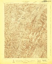
(119)- 1889 Map of Beverly
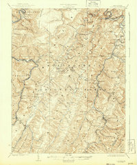
 1889 Beverly1889 Print · USGSThe high Allegheny ridges and river forks of West Virginia are mapped here in the late 1880s, highlighting the rugged settlement patterns of Randolph and Pocahontas counties. Researchers can trace early family-named locations such as Days Mills, locate the Boundary Line In Dispute, and find remote outposts like Traveller's Repose.
 - 1892 Map of Beverly
 1892 Beverly1892 Print · USGSCentral West Virginia's high-mountain settlements and disputed county lines are captured here in the late nineteenth century. Genealogists and historians can trace family locations and early industry near Beverly, Huttonsville, and the remote Days Mills.5 unique versions available
 - 1892 Map of Franklin
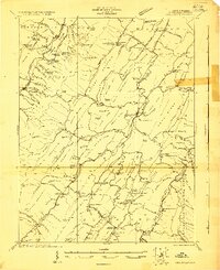
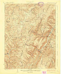
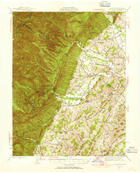
 1892 Franklin1892 Print · USGSPendleton County and the Potomac Highlands are shown here in the 1890s, organized by the dramatic ridges and river valleys of the Alleghanies. Researchers can trace historic homesteads and early post offices at Fort Seybert, Upper Tract, and the riverside crossroads of Kline Cross Roads.
 - 1894 Map of Staunton, 1897 Print
 1894 Staunton1897 Print · USGSThe Shenandoah Valley was a hub of rail commerce and mountain industry in the 1890s, centered on the growing city of Staunton. Genealogists and historians can trace defunct rail stops and early industry at Giant Mills, Milnesville, and Stribling Spgs.8 unique versions available
 - 1896 Map of Franklin, 1907 Print
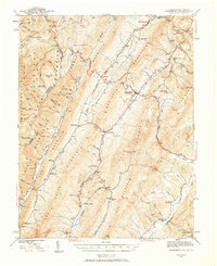
 1896 Franklin1907 Print · USGSThe Potomac River's headwaters and the high ridges of the Alleghenies are documented here in the final years of the nineteenth century. Genealogists and local historians can trace early valley communities like Fort Seybert, Sugar Grove, and the mills at Harper Mill.4 unique versions available
 - 1901 Map of Monterey, 1905 Print
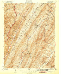
 1901 Monterey1905 Print · USGSThe high Allegheny ridges of Highland and Bath Counties are shown at the turn of the century when isolated valley settlements were linked by winding mountain gaps. Genealogists can trace early homesteads and commerce centers like Cleeks Mills, Mountaingrove, and New Hampden.8 unique versions available
 - 1920 Map of Petersburg
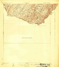
 1920 Petersburg1920 Print · USGSThe West Virginia and Virginia borderlands were a network of tight-knit mountain communities just after the Great War. Genealogists can locate family-named sites like Schmuckers School and Sites Chapel or trace the early Smoke Hole Settlement.3 unique versions available
 - 1920 Map of Onego, 1959 Print
 1920 Onego1959 Print · USGSPendleton and Grant counties in the early twentieth century are shown here as a landscape of isolated mountain communities and riverside hamlets. Researchers can trace family-named landmarks and long-standing institutions like the Germany Settlement, Mouth of Seneca, and the Evergreen Church.2 unique versions available
 - 1921 Map of Petersburg
 1921 Petersburg1921 Print · USGSEastern West Virginia at the start of the twenties shows a landscape of mountain hollows tied together by the Baltimore and Ohio at Petersburg. Genealogists can trace family names through landmarks like Hedrick Church, Crites School, and Ketterman.
 - 1921 Map of Onego
 1921 Onego1921 Print · USGSThe West Virginia highlands in the early 1920s reveal a network of isolated mountain schools and valley settlements. Genealogists can trace family roots through landmarks like Onego, High Rock Church, and the Boggs School near Seneca Rock.2 unique versions available
 - 1922 Map of Onego
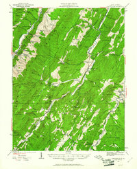
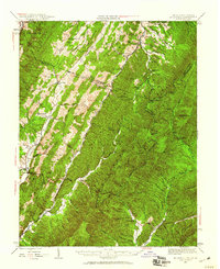
 1922 Onego1922 Print · USGSPendleton County's high ridges and river valleys are captured here in the early 1920s as the Monongahela National Forest was being established. Genealogists and hikers can locate old mountain homesteads, numerous remote schools like Keel Spring School, and the iconic Seneca Rock.2 unique versions available
 - 1922 Map of Fort Seybert
 1922 Fort Seybert1922 Print · USGSPendleton County's South Fork Valley is captured in the early 1920s, showing a landscape of remote mountain homesteads and small valley hamlets. Genealogists can locate family landmarks like Locust Grove School, New Bethel Church, and the high peaks of Shenandoah Mountain.2 unique versions available
 - 1922 Map of Horton
 1922 Horton1922 Print · USGSThe West Virginia highlands in the early twenties were a landscape of mountain timber towns and isolated valley schools. Genealogists can trace family names at Little Italy or Evenwood, and locate rural landmarks like Bethel Church and Mylius School.2 unique versions available
 - 1922 Map of Spruce Knob
 1922 Spruce Knob1922 Print · USGSThe Potomac Highlands are seen here in the early 1920s, a period defined by small mountain gaps and high-altitude settlements. Researchers can trace rural life through dozens of sites like Osceola Po, Winterburn Station, and the isolated Ridge Church.3 unique versions available
 - 1922 Map of Petersburg
 1922 Petersburg1922 Print · USGSThe West Virginia highlands in the early 1920s are centered here on the river valley at Petersburg. Researchers can locate dozens of rural schools and mountain churches, including Royal Glen Mill, Hedrick Church, and Mountaindale School.2 unique versions available
 - 1922 Map of Circleville, 1961 Print
 1922 Circleville1961 Print · USGSPendleton County in the early twenties is a landscape of high ridges and narrow valley settlements like Circleville and Riverton. Genealogists and historians can locate numerous rural schoolhouses, including Sinnet School, and small crossroads like Zigler and McCoys Mill.2 unique versions available
 - 1924 Map of Circleville
 1924 Circleville1924 Print · USGSThe Potomac headwaters in the 1920s reveal a high-mountain landscape of close-knit hollows and ridge-line schools. Genealogists can locate family landmarks like Johnstown, the Harper Mill, and rural centers such as Dolly School and Ruddle School.4 unique versions available
 - 1924 Map of Mc Dowell
 1924 Mc Dowell1924 Print · USGSHighland County and the Allegheny borderlands are shown in the early twenties, a time of isolated mountain communities and high-ridge forests. Genealogists can trace family footprints at St Paul Church, Mt Hull School, and the remote Crummet Church.5 unique versions available
 - 1924 Map of Fort Seybert
 1924 Fort Seybert1924 Print · USGSIn the early 1920s, the Pendleton County highlands were defined by remote mountain gaps and close-knit valley settlements. Genealogists can locate family-named landmarks and rural hubs like Fort Seybert, Brandywine, and the Cedar Grove School.3 unique versions available
 - 1924 Map of Horton
 1924 Horton1924 Print · USGSRandolph and Tucker Counties were at the height of their rail-and-timber era in the early twenties. Researchers can trace family sites like Little Italy, industrial hubs at Whitmer, and rural landmarks such as Bethel Church or the Mylius School.2 unique versions available
 - 1924 Map of Spruce Knob
 1924 Spruce Knob1924 Print · USGSThe Allegheny high country comes alive in the mid-twenties, centered on the heights of Spruce Knob and the North Fork River. Genealogists can trace family footprints at Osceola PO, Rexrode, and numerous mountain schools like Stark School.2 unique versions available
 - 1941 Map of Monterey, 1963 Print
 1941 Monterey1963 Print · USGSHighland County at the start of the 1940s reveals a network of high-valley settlements and strategic turnpikes. Trace the locations of early schools and churches like Strait Creek School and Union Chapel near the South Branch of the Potomac.2 unique versions available
 - 1944 Map of Monterey
 1944 Monterey1944 Print · USGSHighland County at the height of the Second World War remains a land of high ridges and isolated mountain valleys. Genealogists can trace family footprints across Bluegrass Valley and locate landmarks like Hamilton Chapel, Possum Trot, and the Strait Creek Sch.2 unique versions available
 - 1944 Map of Parnassus, 1955 Print
 1944 Parnassus1955 Print · USGSThe rural landscapes of Augusta County are shown here during the mid-1940s, where farming valleys meet the high ridges of the national forest. Researchers can locate family landmarks such as Fulton Sch, the towering Natural Chimneys, and small crossroads like Parnassus and Mt Solon.2 unique versions available
 - 1944 Map of Mc Dowell, 1960 Print
 1944 Mc Dowell1960 Print · USGSHighland and Augusta counties appear here during the mid-forties, capturing the remote mountain settlements and river gaps of the Alleghenies. Researchers can locate family landmarks like Siron's Mill and rural centers like Mc Dowell or Doe Hill.2 unique versions available
Showing maps 1-25 of 119
Top cities of Pendleton County
Frequently asked questions
- What are the different types of historical maps available for Pendleton County?
- What is the oldest map of Pendleton County?
- Where can I purchase historical maps of Pendleton County for my home or office?
- Where can I download high-res historical maps of Pendleton County?
- Are there historical topographic maps available for Pendleton County?
- Is there historical aerial imagery available for Pendleton County?
- Where are historical maps of Pendleton County sourced from?