1900s (20th Century) Maps of Roane County, West Virginia
Explore 37 historic maps of Roane County from the 1900s (20th Century). These maps offer a rare glimpse into what life looked like during the 1900s — showing old roads, neighborhoods, homes, and landmarks that have changed or disappeared over time.
Whether you're researching your family's past, planning a metal detecting trip, or studying how Roane County's landscape evolved across the 1900s, these high-resolution maps are a powerful tool for exploring the history of this region.
- Focus on a specific era: All maps on this page are from the 1900s, giving you a focused view of this time period.
- See what’s changed: Compare century-old streets, trails, and buildings to today's modern landscape using overlays and satellite layers.
- Research with precision: Use these maps for genealogy, historical research, land use analysis, or educational projects.
- View, download, or print: Maps are fully viewable online in high resolution, and can be downloaded or printed for your own records.
Start exploring Roane County's history through authentic maps from the 1900s. This is your window into the past.
Roane County, WV maps
(37)- 1906 Map of Kenna, 1959 Print
 1906 Kenna1959 Print · USGSThe West Virginia hills north of Charleston appear in this early century survey of the Jackson and Kanawha county border. Researchers can locate early homesteads and community hubs like Sissonville, the Emma Belle School, and Staats Mills.
 - 1906 Map of Otter, 1961 Print
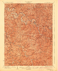
 1906 Otter1961 Print · USGSCentral West Virginia at the start of the twentieth century shows a landscape of deep hollows and high ridges before modern highways. Researchers can trace early settlements and family homesteads near Ivydale, Newton, and the remote Redhouse Siding along the Elk River.
 - 1906 Map of Walton, 1961 Print
 1906 Walton1961 Print · USGSRoane County at the dawn of the twentieth century shows a landscape of river-fed valleys and milling hamlets. Genealogists can trace family roots through historic settlements like Walton, Gandeeville, and Looneyville or locate long-standing landmarks like Mt Hermon Church.
 - 1907 Map of Kenna
 1907 Kenna1907 Print · USGSThe hill country of Jackson and Kanawha counties is captured here in the early twentieth century as a landscape of isolated valley farms and ridge-top communities. Genealogists can trace family footprints through rural centers like Sissonville, Staats Mills, and White Chapel.3 unique versions available
 - 1907 Map of Otter
 1907 Otter1907 Print · USGSCentral West Virginia at the turn of the century shows a landscape defined by its river valleys and new industrial rails. Genealogists can trace family homes near Newton, Linden, and Minnora, or follow the path of the Coal and Coke R R through Ivydale.3 unique versions available
 - 1907 Map of Arnoldsburg
 1907 Arnoldsburg1907 Print · USGSCalhoun County's rugged terrain and river life are preserved here in the first decade of the twentieth century. Researchers can trace ancestral home sites and rural post offices from Grantsville to Chestnut Grove Big Springs PO and Brooksville Big Bend PO.2 unique versions available
 - 1907 Map of Spencer
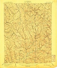
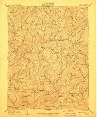
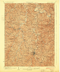
 1907 Spencer1907 Print · USGSRoane County at the turn of the century is captured here as a landscape of isolated hollows connected by the Ravenswood and Spencer Turnpike. Researchers can locate dozens of vanished rural centers and local landmarks like Burning Springs, the Morning Star Schoolhouse, and Buffalo Church.2 unique versions available
 - 1907 Map of Walton
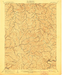
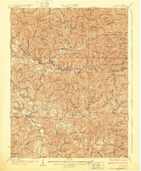
 1907 Walton1907 Print · USGSRoane County at the dawn of the twentieth century is a landscape of winding river valleys and isolated hilltop settlements. Genealogists and historians can trace family-named landmarks and early industry at Shamblings Mills, Osbornes Mills, and Mt Hermon Church.3 unique versions available
 - 1907 Map of Ripley, 1922 Print
 1907 Ripley1922 Print · USGSJackson County at the start of the twentieth century shows a landscape of ridge-top schools and creek-bottom settlements. Trace early routes like the Buffalo Turnpike or locate family sites at Lockhart PO and Klondike Schoolhouse.
 - 1925 Map of Arnoldsburg, 1964 Print
 1925 Arnoldsburg1964 Print · USGSCalhoun County in the mid-twenties shows a landscape of winding river bends and hundreds of named rural landmarks. Genealogists can trace family names through dozens of community sites like Jackson School, Mt Vernon Church, and Annamoriah Flats.
 - 1926 Map of Ripley, 1958 Print
 1926 Ripley1958 Print · USGSJackson County is shown during its mid-1920s development, centered on the rail-and-river hub of Ripley. Genealogists and historians can trace dozens of early rural schoolhouses and churches, including Klondike Sch, Batchel Chapel, and Parchment Valley Sch.
 - 1927 Map of Arnoldsburg
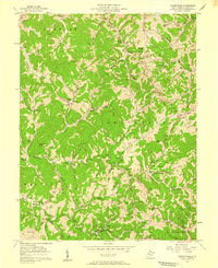
 1927 Arnoldsburg1927 Print · USGSCalhoun County's winding river valleys and high ridges are captured here during the late twenties, showing a rural landscape of scattered hill farms and tiny schools. Genealogists can trace family footprints near Grantsville, Rocksdale, and Mt Zion.3 unique versions available
 - 1928 Map of Spencer
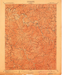
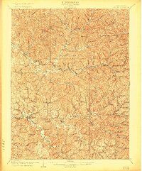
 1928 Spencer1928 Print · USGSRoane and Wirt counties come alive in the late 1920s, showing a landscape defined by the Baltimore and Ohio railroad and winding creek valleys. Genealogists can locate dozens of country schools like Lone Star Sch and churches such as Mt Zion Ch or Triumph Ch.2 unique versions available
 - 1928 Map of Ripley
 1928 Ripley1928 Print · USGSJackson County hill country in the late twenties is mapped here in detail, showing the rural communities surrounding Ripley and the Baltimore and Ohio Railroad. Genealogists can trace family footprints through numerous landmarks like Morning Star Sch, Kings Chapel, and Hargreave Knob.2 unique versions available
 - 1954 Map of Charleston
 1954 Charleston1954 Print · USGSWest Virginia’s industrial heart and mountain highlands are captured here during the mid-fifties, centered on the capital city. Researchers can trace historic river-and-rail corridors along the Kanawha River and locate remote peaks within the Monongahela National Forest.
 - 1957 Map of Burning Springs, 1959 Print
 1957 Burning Springs1959 Print · USGSWirt County in the late fifties was a landscape of deep river bends and active mineral extraction. Genealogists can trace family names through the Rector Cem, find rural school sites like Hill Grove Sch, and locate numerous historical Oil Wells.2 unique versions available
 - 1957 Map of Reedy, 1959 Print
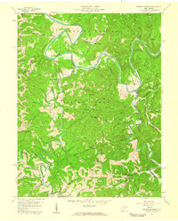
 1957 Reedy1959 Print · USGSThe Baltimore and Ohio railroad follows the creek beds of Roane and Wirt Counties during the late 1950s. Trace the rural footprint of gas extraction and small-town life near Zackville, McClung Cem, and Peewee Sch.2 unique versions available
 - 1957 Map of Romance, 1959 Print
 1957 Romance1959 Print · USGSThe Pocatalico River valley in the late fifties was a landscape of remote hollows and hilltop cemeteries at the borders of Jackson, Roane, and Kanawha counties. Researchers can trace rural lineages through family landmarks like Clendenin Cem and the Goff Sch near Romance.3 unique versions available
 - 1957 Map of Walton, 1959 Print
 1957 Walton1959 Print · USGSMid-century Roane County reveals a landscape of ridge-top schools and creek-bottom settlements before modern highway expansion. Genealogists and researchers can trace family landmarks like Gandee Cem, Looney Cem, and the community hub at Walton High Sch.3 unique versions available
 - 1957 Map of Looneyville, 1959 Print
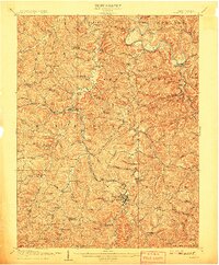
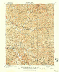
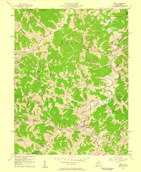
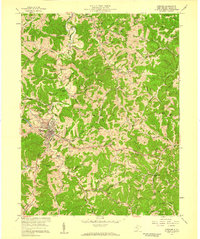
 1957 Looneyville1959 Print · USGSRoane County's steep ridges and hollows are captured here in the late fifties, showing a rural landscape transitioning into an active gas field. Genealogists can trace family names through numerous remote sites like Looney Cem, Rush Creek Ch, and Millstone Sch.2 unique versions available
 - 1957 Map of Spencer, 1959 Print
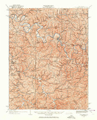
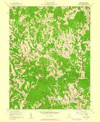
 1957 Spencer1959 Print · USGSMid-century Roane County is centered on the rail-and-river hub of Spencer during a period of steady industrial and civic expansion. Local historians can trace family landmarks and vanished schools like Vandale Sch, the State Hospital, and Alexander Ch.3 unique versions available
 - 1957 Map of Kentuck, 1959 Print
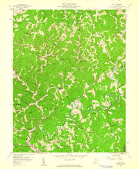
 1957 Kentuck1959 Print · USGSThe hills of Jackson and Roane Counties appear in the mid-fifties as a network of ridge-top schools and narrow valley farms. Genealogists can trace family names across dozens of sites like Skeen Cem, Sinaville Ch, and the community of Belgrove.3 unique versions available
 - 1957 Map of Clio, 1960 Print
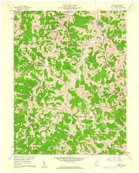
 1957 Clio1960 Print · USGSThe West Virginia hills at the Roane and Kanawha county line appear here in the mid-fifties, dominated by small creek-side settlements and oil fields. Researchers can locate family landmarks like Osbornes Mills, Rolling Hill Cem, and the Jackson Union Sch.3 unique versions available
 - 1957 Map of Peniel, 1961 Print
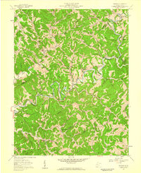
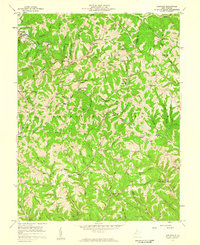
 1957 Peniel1961 Print · USGSRoane County, West Virginia, is shown in the late fifties as a landscape of remote ridges and valley settlements. Genealogists can trace family landmarks like Galahoe Cem, the Laurel Hill Sch, and the Baltimore and Ohio rail line.
 - 1957 Map of Charleston, 1966 Print
 1957 Charleston1966 Print · USGSMid-century West Virginia unfolds along the industrial Kanawha River valley and into the high Allegheny Mountains. Genealogists and historians can trace the vital rail lines of the Chesapeake and Ohio and locate riverside settlements from Saint Albans to Buckhannon.3 unique versions available
Showing maps 1-25 of 37
Top cities of Roane County
Frequently asked questions
- What are the different types of historical maps available for Roane County?
- What is the oldest map of Roane County?
- Where can I purchase historical maps of Roane County for my home or office?
- Where can I download high-res historical maps of Roane County?
- Are there historical topographic maps available for Roane County?
- Is there historical aerial imagery available for Roane County?
- Where are historical maps of Roane County sourced from?